Cloudcroft in Otero County, New Mexico — The American Mountains (Southwest)
Cloud Climbing Railroad
Photographed by James Hulse, July 24, 2024
1. Cloud Climbing Railroad Marker
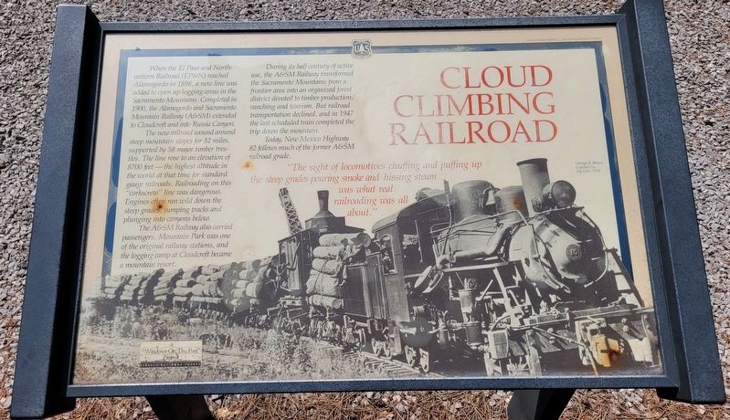
The new railroad wound around steep mountain slopes for 32 miles, supported by 58 major timber trestles. The line rose to an elevation of 8700 feet the highest altitude in the world at that time for standard gauge railroads. Railroading on this "corkscrew" line was dangerous. Engines often ran wild down the steep grades, jumping tracks and plunging into canyons below.
The A&SM Railway also carried passengers. Mountain Park was one of the original railway stations, and the logging camp at Cloudcroft became a mountain resort.
During its half century of active use, the A&SM Railway transformed the Sacramento Mountains from a frontier area into an organized forest district devoted to timber production, ranching and tourism. But railroad transportation declined, and in 1947 the last scheduled train completed the trip down the mountain.
Today, New
this page online
"The sight of locomotives chuffing and puffing up the steep grades pouring smoke and hissing steam was what real railroading was all about."
Captions
George E. Breece Lumber Co. log train, 1928.
Erected by A "Windows On The Past" Project, Lincoln National Forest and US Forest Service.
Topics. This historical marker is listed in these topic lists: Industry & Commerce • Railroads & Streetcars. A significant historical year for this entry is 1898.
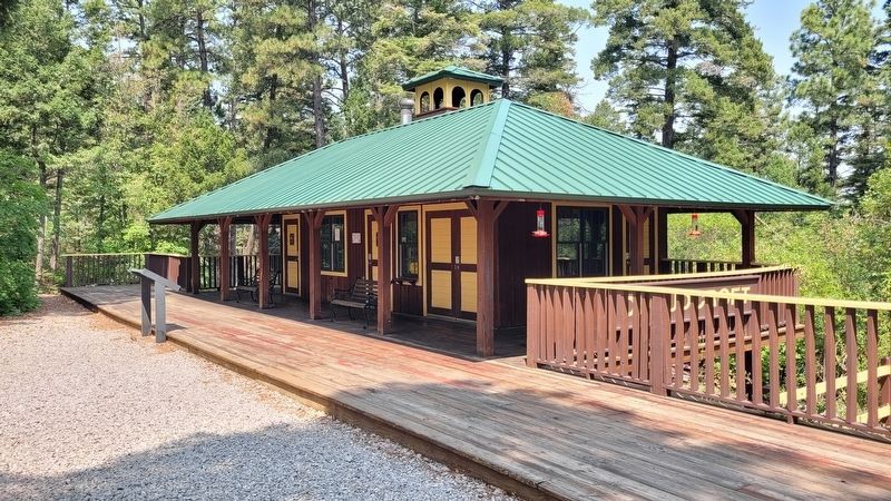
Location. 32° 57.44′ N, 105° 45.001′ W. Marker is in Cloudcroft, New Mexico, in Otero County. It is at the intersection of E Little Mexican Road and James Canyon Highway (U.S. 82) on E Little Mexican Road. The marker is located in front of the Trestle Depot at the recreation area. Touch for map. Marker is in this post office area: Cloudcroft NM 88317, United States of America. Touch for directions.

Regionally, this marker is in the Pecos Valley. It is also in the American Borderlands and in the Southwest. Globally, it is in North America, the Western Hemisphere, the Western World, and the Anglosphere. Historically,
Photographed by James Hulse, July 24, 2024
2. The Trestle Depot at the recreation area and Marker
Other nearby markers. At least 8 other markers are within walking distance of this marker: Cloudcroft Power House (approx. 0.2 miles away); Excursion Train (approx. ¼ mile away); Excursion Train at Depot ca. 1902 (approx. ¼ mile away); Cloudcroft Water Tank (approx. ¼ mile away); Cloudcroft Depot (approx. ¼ mile away); Casino & Land Office (approx. 0.3 miles away); The Pavilion - A Magical Place (approx. 0.3 miles away); Old Lodge (approx. 0.3 miles away). Touch for a list and map of all markers in Cloudcroft.
Also see . . . El Paso and Northeastern Railway. Wikipedia
The El Paso and Northeastern Railway (EP&NE) was a short line railroad that was built around the beginning of the twentieth century to help connect the industrial and commercial center at El Paso, Texas, with physical resources and the United States' national transportation hub in Chicago. Founded by Charles Eddy, the EP&NE was the primary railroad in a system organized under the New Mexico Railway and Coal Company (NMRy&CCo), a holding company which owned several other railroads and also owned mining and industrial properties served by the lines.(Submitted on August 11, 2024, by James Hulse of Medina, Texas.)
Credits. This page was last revised on August 11, 2024. It was originally submitted on August 11, 2024, by James Hulse of Medina, Texas. This page has been viewed 377 times since then and 62 times this year. Photos: 1, 2. submitted on August 11, 2024, by James Hulse of Medina, Texas.
