
Ipswich in Essex County, Massachusetts — The American Northeast (New England)
South Green
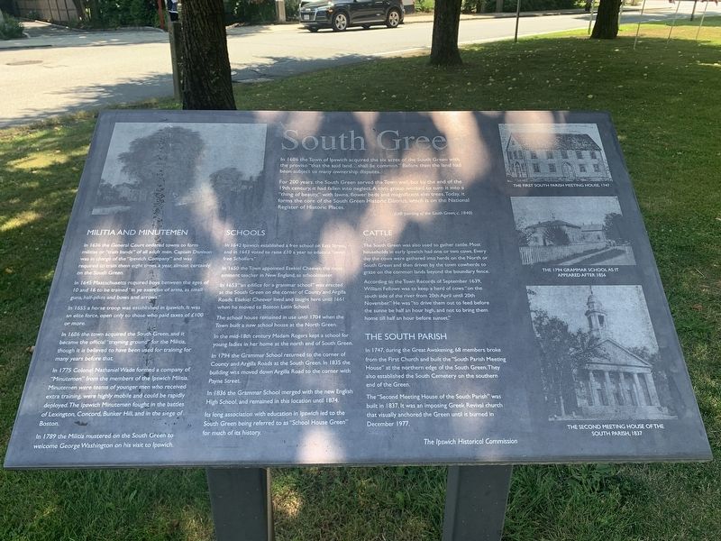
Photographed by Marc Posner, July 8, 2024
1. South Green Marker
In 1689 the Town of Ipswich acquired the six acres of the South Green with the proviso “that the said land…shall lie common.” Before then the land had been subject to many ownership disputes.
For 200 years, the South Green served the Town well, but by the end of the 19th century, it had fallen into neglect. A civic group worked to turn it into a “thing of beauty,” with lawns, flower beds and magnificent elm trees. Today, it forms the core of the South Green Historic District, which is on the National Register of Historic Places.
Militia and Minutemen
In 1636 the General Court ordered towns to form militias or “train bands” of all adult men. Captain Denison was in charge of the “Ipswich Company” and was required to train them eight times a year, almost certainly on the South Green.
In 1645 Massachusetts required boys between the ages of 10 and 16 to be trained “in ye exercise of arms, as small guns, half-pikes, and bows and arrows.”
In 1655 a horse troop was established in Ipswich. It was an elite force, open only to those who paid taxes of L100 or more.
In 1686 the town acquired the South Green, and it became
this page online
In 1775 Colonel Nathaniel Wade formed a company of “Minutemen” from the members of the Ipswich Militia. Minutemen were teams of younger men who received extra training, were highly mobile and could be rapidly deployed. The Ipswich Minutemen fought in the battles of Lexington, Concord, Bunker Hill, and in the siege of Boston.
In 1789 the Militia mustered on the South Green to welcome George Washington on his visit to Ipswich.
Schools
In 1642 Ipswich established a free school on East Street, and in 1643 voted to raise L10 a year to educate “seven free Schollars.”
In 1650 the Town appointed Ezekiel Cheever, the most eminent teacher in New England, as schoolmaster.
In 1653 “an edifice for a grammar school” was erected at the South Green on the corner of Country and Argilla Roads. Ezekiel Cheever lived and taught here until 1661 when he moved to Boston Latin School.
The school house remained in use until 1704 when the Town built a new school house at the North Green.
In the mid-18th century Madam
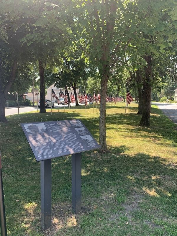
Photographed by Marc Posner, July 8, 2024
2. South Green Marker
In 1794 the Grammar School returned to the corner of County and Argilla Roads at the South Green. In 1855 the building was moved down Argilla Road to the corner with Payne Street.
In 1836 the Grammar School merged with the new English High School, and remained in this location until 1874.
Its long association with education in Ipswich led to the South Green being referred to as “School House Green” for much of its history.
Cattle
The South Green was also used to gather cattle. Most households in early Ipswich had one or two cows. Every day the cows were gathered into herds on the North or South Green and then driven by the town cowherds to graze on the common lands beyond the boundary fence.
According to the Town Records of September 1639, William Fellows was to keep a herd of cows “on the south side of the river from 20th April until 20th November.” He was “to drive them out to feed before the sunne be half an hour high, and not to bring them home till half an hour before sunset.”
The South Parish
In 1747, during the Great Awakening, 68
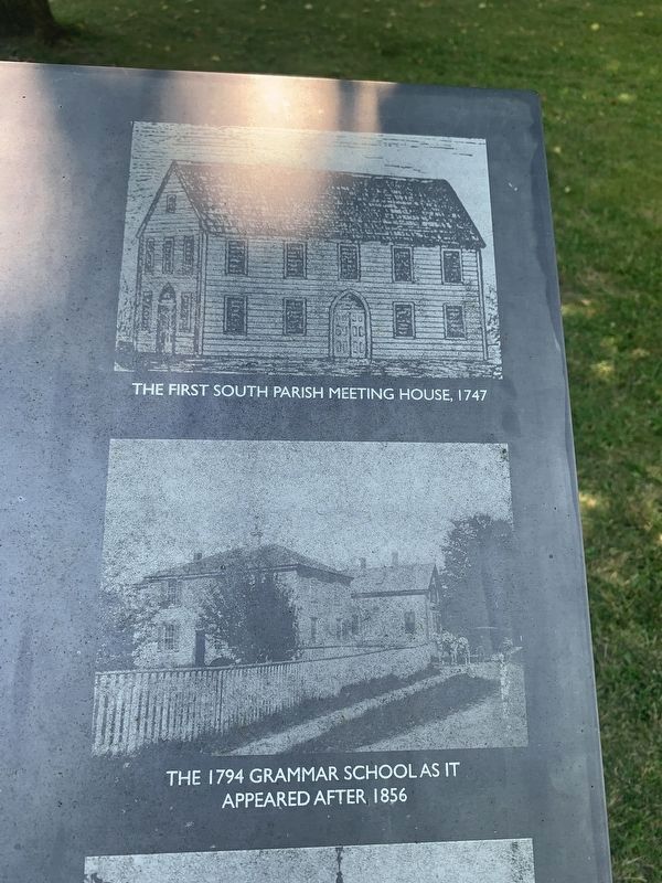
Photographed by Marc Posner, July 8, 2024
3. The First South Parish Meeting House 1747 & The 1794 Grammar School
The “Second Meeting House of the South Parish” was built in 1837. It was an imposing Greek Revival church that visually anchored the Green until it burned in December 1977.
The Ipswich Historical Commission
Erected by Ipswich Historical Commission.
Topics. This historical marker is listed in these topic lists: Education • Religion & Religious Structures • War, US Revolutionary. A significant historical month for this entry is September 1639.
Location. 42° 40.587′ N, 70° 50.139′ W. Marker is in Ipswich, Massachusetts, in Essex County. It is at the intersection of County Street and Argilla Road, on the left when traveling north on County Street. Located on South Village Green. Touch for map. Marker is in this post office area: Ipswich MA 01938, United States of America. Touch for directions.

Regionally, this marker is on Massachusetts’ North Shore, in Greater Boston, and in the Merrimack Valley. It is also in the American
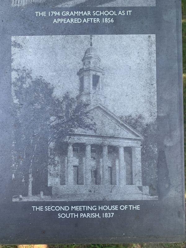
Photographed by Marc Posner, July 8, 2024
4. Second Meeting House 1837
Other nearby markers. At least 8 other markers are within walking distance of this marker: Ipswich Massachusetts Village Green Memorial (within shouting distance of this marker); Alexander Knight House (about 300 feet away, measured in a direct line); Ipswich House (about 500 feet away); Ipswich Veterans Memorial (about 600 feet away); Sawmill Point (about 600 feet away); Along The Ipswich River (about 700 feet away); Agawam - Ipswich (about 800 feet away); The District (approx. 0.2 miles away). Touch for a list and map of all markers in Ipswich.
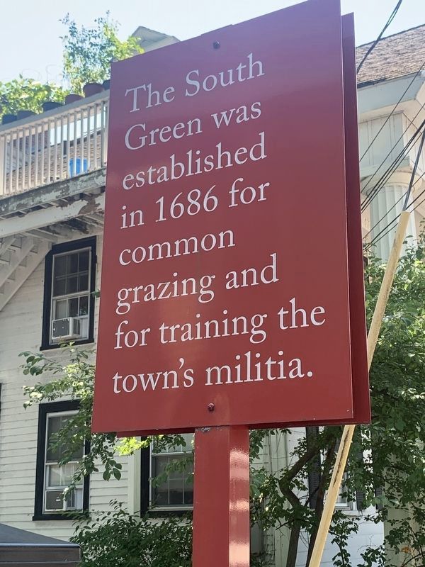
Photographed by Marc Posner, July 8, 2024
5. Nearby South Green marker

Photographed by Marc Posner, July 8, 2024
6. James Appleton Memorial on South Green
Credits. This page was last revised on August 19, 2024. It was originally submitted on August 11, 2024, by Marc Posner of Somerville, Massachusetts. This page has been viewed 196 times since then and 31 times this year. Photos: 1, 2, 3, 4, 5, 6. submitted on August 11, 2024, by Marc Posner of Somerville, Massachusetts. • Michael Herrick was the editor who published this page.
