Negaunee Township in Marquette County, Michigan — The American Midwest (Great Lakes)
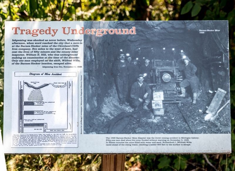
Tragedy Underground
Barnes-Hecker Mine Tragedy
| — | Nov 3, 1926 | — |
Photographed by J. J. Prats, August 3, 2024
1. Tragedy Underground Marker
Click on image to zoom in to examine the diagram and photograph. the photograph was taken underground two months prior to the disaster. All shown here died. Identified are the captain, William Tippett, kneeling at the left; and Peter Mongiat, the pumpman, standing at the far left. The photograph is in the collection of the Marquette County Historical Society.
The 1928 Barnes-Hecker Mine disaster was the worst mining accident in Michigan history. Fifty-one men died when the mine flooded without warning on November 3, 1826. In fifteen minutes the mine filled with water and sand. Rutherford J. (Wilfred) Wills raced ahead of the rising water, climbing a ladder 800 feet to the surface to escape.
Ishpeming was shocked as never before, Wednesday afternoon, when word reached the city that a cave-in at the Barnes-Hecker mine of the Cleveland-Cliffs Iron company, five miles to the west of here, had cost the lives of fifty miners and the county mine inspector, William E. Hill, who was underground making an examination at the time of the disaster. Only one man employed on the shift, Wilfred Wills, of the Barnes-Hecker location, escaped alive.—Ishpeming Iron Ore, November 6, 1926
The above diagram of the Barnes-Hecker mine shows how the cave-in resulted in the deaths of 51 men, 50 of them employes of the Cleveland Cliffs Iron company and one the county mine inspector. The mud, water and sand that poured in from the cave swept down through the three levels and choked the shaft to—Daily Mining Journalwithin 180 feet of the surface.
Click or scan to see
this page online
Seven bodies were washed to the bottom of the raise leading to the sixth level of the Morris mine and were recovered there. This level has now been blocked off to prevent any flooding of the Morris mine. The cave-in depression is about 60 feet deep.
It was impossible to draw the diagram to scale. The cave-in occurred 1,600 feet from the Barnes-Hecker shaft, instead of next to the shaft, as the diagram indicates. The distance between the Barnes-Hecker and Morris Lloyd mines is two miles and the old lake bottom, included in the diagram, is about midway between the mines.
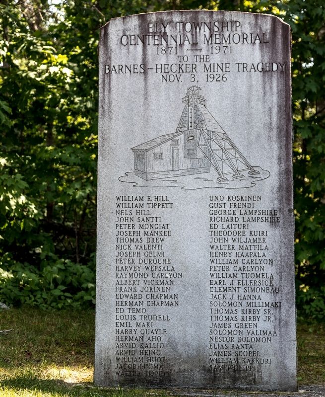
Ely Township Centennial Memorial
1871—1971
to the
Barnes-Hecker Mine Tragedy
Nov 3, 1929
William E. Hill • William Tippett • Nels Hill • John Santti • Peter Mongiat • Joseph Mankee • Thomas Drew • Nick Valenti • Joseph Gelmi • Peter Duroche • Harvey Wepsala • Raymond Carlyon. • Albert Vickman • Frank Jokinen • Edward Chapman • Herman Chapman • Ed Temo • Louis Trudell • Emil Maki • Harry Quayle • Herman Aho • Arvid Kallio • Arvid Heino • William Huot • Jacob Luoma • Walter Tippett
Uno
Photographed by J. J. Prats, August 3, 2024
2. Ely Township Centennial Memorial to the 1926 Barnes-Hecker Mine Tragedy
Topics. This historical marker is listed in these topic lists: Disasters • Industry & Commerce • Natural Resources. A significant historical date for this entry is November 3, 1926.
Location. 46° 31.27′ N, 87° 33.524′ W. Marker is near Negaunee, Michigan, in Marquette County. It is in Negaunee Township. It can be reached from Jackson Trace Parkway just north of Forge Road. It is at the eastern side of the lower parking lot of the Michigan Iron Industry Museum grounds. Touch for map. Marker is at or near this postal address: 73 Forge Road, Negaunee MI 49866, United States of America. Touch for directions.

Regionally, this marker is on the Upper Peninsula. It is also in the American Midwest and on Lake
Photographed by J. J. Prats, August 3, 2024
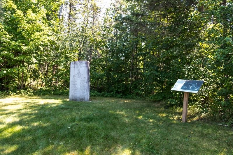
3. Centennial Memorial Monument and Tragedy Underground Marker
Other nearby markers. At least 8 other markers are within 6 miles of this marker, measured as the crow flies: Laughing Whitefish (approx. ¼ mile away); Jackson Mine (approx. 2.1 miles away); Marquette Iron Range (approx. 2.2 miles away); 1921 CR 510 Bridge (approx. 2.6 miles away); 2010 CR 510 Bridge (approx. 2.6 miles away); Ishpeming: Historic Ski Center (approx. 5.2 miles away); Swedes on the Iron Range (approx. 5.9 miles away); Italians on the Marquette Iron Range (approx. 5.9 miles away). Touch for a list and map of all markers in Negaunee.
Also see . . . Nov. 3, 1926: Hour-by-hour look at Michigan's worst mining disaster. 2016 article by Brandon Champion on Mlive.com News, Grand Rapids. Excerpt:
At 11:25 a.m. on Nov. 3, 1926, an avalanche of mud and water flooded the mine.(Submitted on August 12, 2024.)
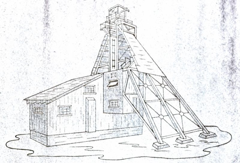
One of the men working in the mine wasin the process of routine dynamiting when an explosion broke into a large void, which ran up through the rock into the soft "overburden" area above.Photographed by J. J. Prats, August 3, 20244. Barnes-Hecker Mine EntranceThis is a close-up of the line drawing etched into the memorial.
The blast resulted in a cave-in which drained a nearby lake. The water flooded the mine, trapping almost everyone within minutes.
Credits. This page was last revised on November 27, 2024. It was originally submitted on August 12, 2024, by J. J. Prats of Powell, Ohio. This page has been viewed 1,246 times since then and 217 times this year. Photos: 1, 2, 3, 4. submitted on August 12, 2024, by J. J. Prats of Powell, Ohio.
