Taylor in Williamson County, Texas — The American South (West South Central)
The Tenth Street United Methodist Church
Photographed by Keith Peterson, June 28, 2007
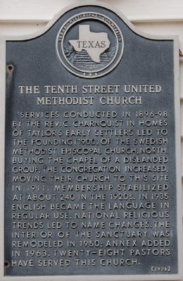
1. The Tenth Street United Methodist Church Marker
Services conducted in 1896-98 by the Rev. C. Charnquist in homes of Taylor’s early settlers led to the founding (1900) of the Swedish Methodist Episcopal Church, North. Buying the chapel of a disbanded group, the congregation increased, moving their church to this site in 1911. Membership stabilized at about 240 in the 1920s. In 1935 English became the language in regular use. National religious trends led to name changes. The interior of the sanctuary was remodeled in 1950; annex added in 1963. Twenty-eight pastors have served this church.
Erected 1976 by Texas Historical Commission. (Marker Number 9361.)
Topics and series. This historical marker is listed in this topic list: Religion & Religious Structures. In addition, it is included in the United Methodist Church Historic Sites series list. A significant historical year for this entry is 1911.
Location. 30° 34.552′ N, 97° 24.868′ W. Marker is in Taylor, Texas, in Williamson County. It is on West 10th Street, on the right when traveling west. Touch for map. Marker is at or near this postal address: 410 W 10th St, Taylor TX 76574, United States of America. Touch for directions.

Regionally, this marker is in Central Texas and in the Austin Metropolitan Area. It is also in the American South. Globally, it is in North America, a Gulf of Mexico state, the Western Hemisphere, the Western World, and the Anglosphere. Historically, it finds itself in what was once New Spain, the Republic of Texas, one of the Confederate States of America, and the Antebellum South.
Other nearby markers. At least 8 other markers are within walking distance of this marker: The Taylor Public Schools (about 700 feet away, measured in a direct line); Daniel James (Dan'l) Moody (approx. 0.2 miles away); Birthplace of Governor Dan Moody (approx. 0.2 miles away); St. James Church
this page online
Photographed by Keith Peterson, June 28, 2007
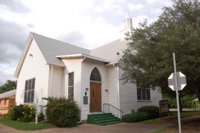
2. The Tenth Street United Methodist Church
Credits. This page was last revised on November 29, 2020. It was originally submitted on December 13, 2009, by Keith Peterson of Cedar Park, Texas. This page has been viewed 1,217 times since then and 33 times this year. Photos: 1, 2. submitted on December 13, 2009, by Keith Peterson of Cedar Park, Texas. • Bill Pfingsten was the editor who published this page.
