
St. Charles in St. Charles County, Missouri — The American Midwest (Upper Plains)
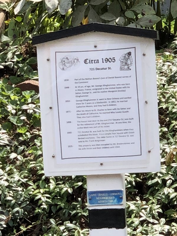
Circa 1905
721 Decatur St.
Photographed by Duane and Tracy Marsteller, July 20, 2024
1. Circa 1905 Marker
1848 –At 19 yrs. of age, Mr. George Klinghammer, who was born in Alsace, France, emigrated to the United States with his father, George Sr., and his mother Margaret (Anstap) Klinghammer.
1850 – George Klinghammer Jr. went to New Orleans and worked there for 3 years as a blacksmith. In 1852, he married Catherine Moore, and they had 6 children.
1871 – After his return to St. Charles to farm with his father and the death of Catherine, he married Miss Louise Quade. They also had 6 children.
1898 – The house next door to the east (717 Decatur St) was built for the retirement of Mr. Klinghammer. At one time, the entire block was part of his estate.
1905 – 721 Decatur St. was built for the Klinghammers when they subdivided the block. It is a simple Four Square with Greek Revival overtones. The older home at 717 Decatur St. was sold to Mc Frank Borgmeyer.
1925 – This property was then occupied by Mr. Bredensteiner and his wife Anne and their children until 1944.
Erected by Saint Charles Commons Neighborhood Association.
Topics and series.
this page online
Location. 38° 47.372′ N, 90° 29.256′ W. Marker is in St. Charles, Missouri, in St. Charles County. It is on Decatur Street east of Kingshighway, on the right when traveling east. Touch for map. Marker is at or near this postal address: 721 Decatur St, Saint Charles MO 63301, United States of America. Touch for directions.

Regionally, this marker is in the Missouri River Corridor and in Greater St. Louis. It is also in the American Midwest, in the Lewis & Clark Corridor, in the Corn Belt, and in the Great River Road Region. Globally, it is in North America, the Western Hemisphere, the Western World, and the Anglosphere. Historically, it finds itself in what was once the territory of the Mississippian Culture, the Louisiana Purchase, and the Antebellum South.
Other nearby markers. At least 8 other markers are within walking distance of this marker: Circa 1903 (about 300 feet away, measured in a direct line); Circa 1904

Photographed by Duane and Tracy Marsteller, July 20, 2024
2. Circa 1905 Marker
Also see . . . Commons Neighborhood Historic District. National Register of Historic Places Registration Form (Submitted on August 16, 2024, by Duane and Tracy Marsteller of Murfreesboro, Tennessee.)
Credits. This page was last revised on January 1, 2026. It was originally submitted on August 16, 2024, by Duane and Tracy Marsteller of Murfreesboro, Tennessee. This page has been viewed 142 times since then and 8 times this year. Photos: 1, 2. submitted on August 16, 2024, by Duane and Tracy Marsteller of Murfreesboro, Tennessee.
