Folsom in Sacramento County, California — The American West (Pacific Coastal)
Prairie City
courtesy California Landmark Foundation
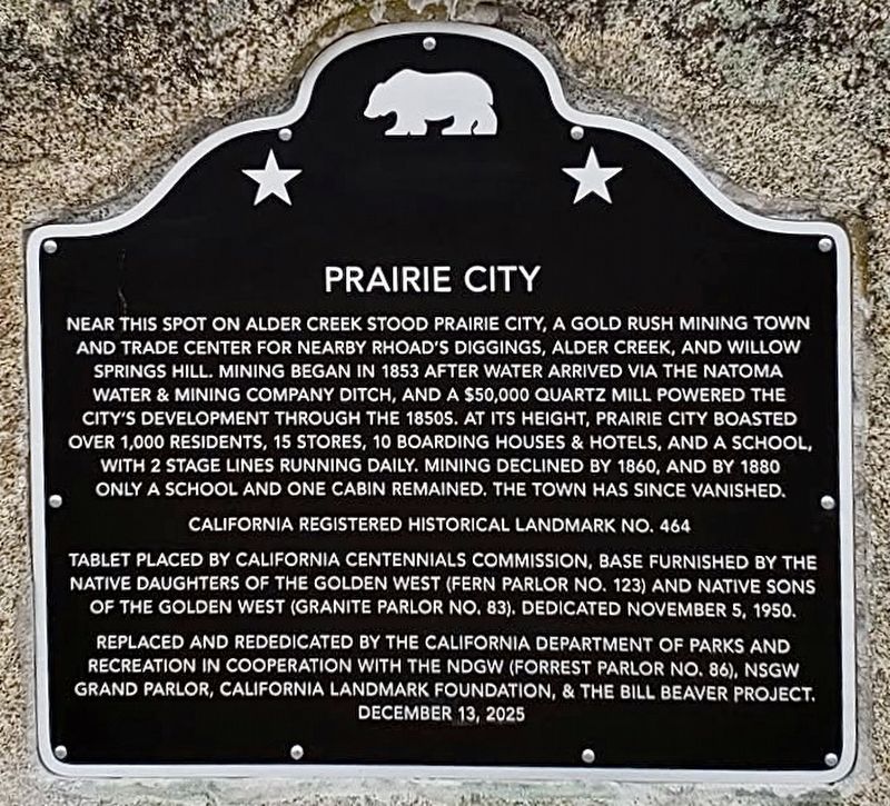
1. Prairie City Marker
Near this spot on Alder Creek stood Prairie City, a gold rush mining town and trade center for nearby Rhoad’s Diggings, Alder Creek, and Willow Springs Hill. Mining began in 1853 after water arrived via The Natoma Water & Mining Company ditch, and a $50,000 quartz mill powered the city’s development through the 1850s. At its height, Prairie City boasted over 1,000 residents, 15 Stores, 10 boarding houses & hotels, and a school, with 2 stage lines running daily. Mining declined by 1860, and by 1880 only a school and one cabin remained. The town has since vanished.
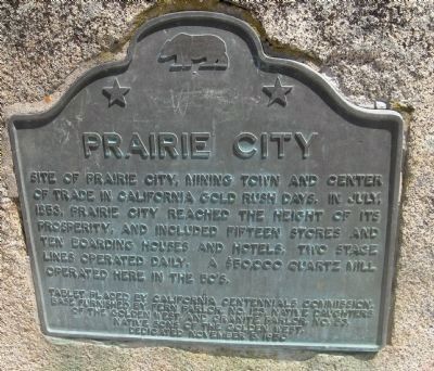
original marker:
Site of Prairie City, mining town and center of trade in California Gold Rush days. In July, 1853, Prairie City reached the height of its prosperity, and included fifteen stores and ten boarding houses and hotels. Two stage lines operated daily. A $50,000 quartz mill operated here in the 50’s.
Erected 1950 by California Centennials Commission, Fern Parlor No. 123 Native Daughters of the Golden West, and Granite Parlor No. 83 Native Sons of the Golden West. And 2025 by California Department of Parks and Recreation, NDGW (Forrest
this page online
Topics and series. This historical marker is listed in this topic list: Notable Places. In addition, it is included in the California Historical Landmarks, and the Native Sons/Daughters of the Golden West series lists. A significant historical year for this entry is 1853.
Location. 38° 38.669′ N, 121° 9.454′ W. Marker is in Folsom, California, in Sacramento County. It is on Prairie City Road 0.1 miles north of U.S. 50, on the right when traveling north. Touch for map. Marker is in this post office area: Folsom CA 95630, United States of America. Touch for directions.

Regionally, this marker is in Sacramento Metro, in the Sacramento Valley, and specifically in the Central Valley. It is also on the American Pacific Coast. Globally, it is in North America, on the Ring of Fire, on the Pacific Rim, in the Western Hemisphere, in the Western World, and in the Anglosphere. Historically, it finds itself in what was once New Spain and also Mexico’s Alta California.
Other nearby markers. At least 8 other markers are
Photographed by Syd Whittle, August 22, 2008
2. Original Prairie City Marker
Another marker is no longer nearby. Prairie City Cemetery (was a few steps from this marker but has been confirmed missing).
More about this marker. Unveiling of the new plaque was on December 13, 2025. This plaque replaces the original plaque, which went missing several years ago.
Regarding Prairie City. On November 5, 1950, a bronze plaque was dedicated on the side of Prairie City Road commemorating Prairie City as California Historical Landmark #464. Sometime in 2022, the plaque went missing.
The California Landmark Foundation, Native Daughters
Photographed by Syd Whittle, August 22, 2008
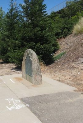
3. Prairie City Marker
Prairie City sprung up for the reason most towns in the early 1850’s did, Gold. Once gold was found in the nearby rivers, the town boomed. The community once sat on the American River near present-day Folsom, California in Sacramento County.
A July 1853 article, in the Sacramento Daily Union, mentioned the city had about 1500 inhabitants at that time. But by 1960, the gold vanished and so did the residents. Prairie City is believed to have been located where the current subdivision of Prairie Oaks now stands.
In 1997, when the Prairie City Road off-ramp was being built, 12 bodies were unearthed; they were believed to be Prairie City residents. Their remains were relocated to the Mormon Island relocation cemetery, located south of Folsom Lake.
There is a lot of history at Mormon Island Cemetery. When the Folsom Dam was built in 1955, Mormon Island Cemetery was created as a replacement for several cemeteries that were submerged under Folsom Lake. The cemetery was built in 1954 by the Army Corps of Engineers and is one of the largest cemeteries in El Dorado County at approximately 5 acres. About half of the area is undeveloped and is being saved by the county for future relocations.
It’s quite possible that other Prairie City artifacts have yet to be discovered. Much of the land to the south of highway 50 is undeveloped.
Also see . . . California Landmarks Foundation.
The foundation is raising money to replace missing California Historical Landmark plaques. (Submitted on December 2, 2024.)
Additional keywords. Mining, Gold Rush

courtesy Folsom Historical Society, November 1950
4. Original Marker Unveiling
Credits. This page was last revised on April 28, 2026. It was originally submitted on August 29, 2008, by Syd Whittle of Mesa, Arizona. This page has been viewed 2,117 times since then and 88 times this year. Last updated on August 17, 2024, by James King of San Miguel, California. Photos: 1. submitted on December 3, 2025, by Craig Baker of Sylmar, California. 2, 3. submitted on August 29, 2008, by Syd Whittle of Mesa, Arizona. 4. submitted on December 4, 2024, by Craig Baker of Sylmar, California. • Devry Becker Jones was the editor who published this page.
