Near Boulder City in Clark County, Nevada — The American Mountains (Southwest)
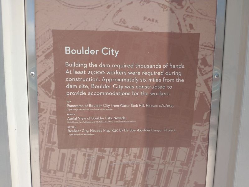
Boulder City
Photographed by Tom Bosse, July 20, 2024
1. Boulder City Marker
Top
Panorama of Boulder City, from Water Tank Hill. Hoover. 11/17/1933 Digital Image C45-301-2184 from Bureau of Reclamation.
Middle
Aerial View of Boulder City, Nevada. Digital Image from Wikipedia and U.S. National Archives and Records Administration
Bottom
Boulder City, Nevada Map 1930 by De Boer-Boulder Canyon Project. Digital Image from Wikimedia.org.
Topics. This historical marker is listed in this topic list: Notable Places. A significant historical year for this entry is 1930.
Location. 35° 59.668′ N, 114° 47.954′ W. Marker is near Boulder City, Nevada, in Clark County. It is on Interstate 11, on the right when traveling north. Marker is located at the Robert L. Mendenhall Scenic Overlook. Touch for map. Marker is in this post office area: Boulder City NV 89005, United States of America. Touch for directions.

Regionally, this marker is in the Colorado River Valley, in the Mojave Desert,
this page online
Other nearby markers. At least 8 other markers are within walking distance of this marker: Origin of the Dam (here, next to this marker); Tunnel Construction (here, next to this marker); Boulder Dam! No! (here, next to this marker); Lake Mead National Recreation Area (here, next to this marker); The Colorado River (here, next to this marker); Dam Completion (here, next to this marker); Robert L. Mendenhall Scenic Overlook Obelisk (a few steps from this marker); Interstate 11 Project Team (a few steps from this marker). Touch for a list and map of all markers in Boulder City.

Photographed by Tom Bosse, July 20, 2024
2. Boulder City Marker

Photographed by Tom Bosse, July 20, 2024
3. Boulder City Marker

Photographed by Tom Bosse, July 20, 2024
4. Hoover Dam

Photographed by Tom Bosse, July 20, 2024
5. Mike O'Callaghan–Pat Tillman Memorial Bridge as seen from Hoover Dam.
Credits. This page was last revised on October 4, 2024. It was originally submitted on August 18, 2024, by Tom Bosse of Jefferson City, Tennessee. This page has been viewed 193 times since then and 25 times this year. Photos: 1, 2, 3, 4, 5. submitted on August 18, 2024, by Tom Bosse of Jefferson City, Tennessee. • Bill Pfingsten was the editor who published this page.
