Brownwood in Brown County, Texas — The American South (West South Central)
Gulf War
Photographed by James Hulse, May 30, 2024
1. Gulf War Marker
Inscription.
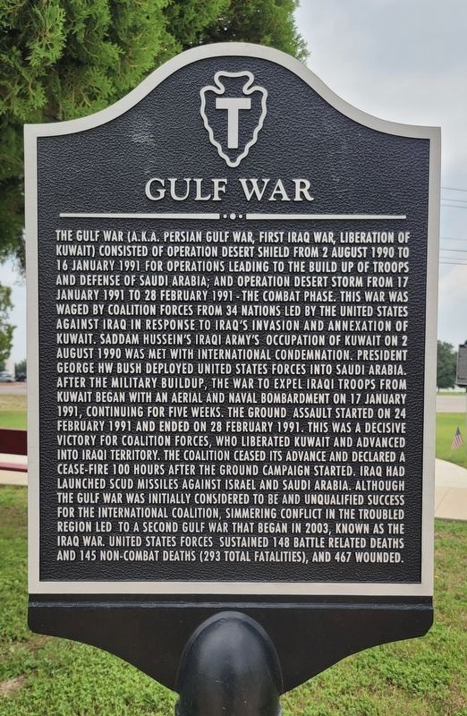
The Gulf War (A.K.A. Persian Gulf War, first Iraq War, Liberation of Kuwait) consisted of Operation Desert Shield from 2 August 1990 to 16 January 1991 for operations leading to the build up of troops and defense of Saudi Arabia; and Operation Desert Storm from 17 January 1991 to 28 February 1991 - the combat phase. This war was waged by coalition forces from 34 nations led by the United States against Iraq in response to Iraq's invasion and annexation of Kuwait. Saddam Hussein Iraqi Army's occupation of Kuwait on 2 August 1990 was met with international condemnation. President George HW Bush deployed United States forces into Saudi Arabia. After the military buildup, the war to expel Iraqi troops from Kuwait began with an aerial and naval bombardment on 17 January 1991, continuing for five weeks. The ground assault started on 24 February 1991 and ended on 28 February 1991. This was a decisive victory for coalition forces, who liberated Kuwait and advanced into Iraqi territory. The coalition ceased its advance and declared a cease-fire 100 hours after the ground campaign started. Iraq had launched Scud missiles against Israel and Saudi Arabia. Although the Gulf War was initially considered to be and unqualified success for the international coalition, simmering conflict in the troubled region led to a second Gulf War that began in 2003, known as the Iraq War. United States Forces sustained 148 battle related deaths and 145 non-combat deaths (293 total fatalities), and 467 wounded.
Topics. This historical marker is listed in these topic lists: War, 1st Iraq & Desert Storm • War, 2nd Iraq. A significant historical date for this entry is January 16, 1991.
Location. 31° 40.672′ N, 98° 59.505′ W. Marker is in Brownwood, Texas, in Brown County. It is at the intersection of Crockett Drive and Memorial Park Drive, on the right
Click or scan to see this page online
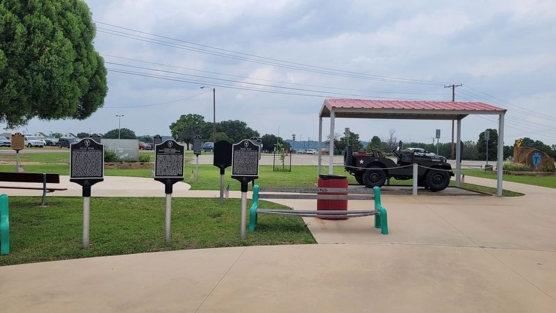
when traveling north on Crockett Drive. The marker is located at the northwest section of the Camp Bowie Memorial Park. Touch for map. Marker is at or near this postal address: 2710 Crockett Dr, Brownwood TX 76801, United States of America. Touch for directions.
Regionally, this marker is in Big Country. Globally, it is in North America, a Gulf of Mexico state, the Western Hemisphere, the Western World, and the Anglosphere. Historically, it finds itself in what was once New Spain, the Comanchería, the Republic of Texas, and one of the Confederate States of America.
Credits. This page was last revised on August 18, 2024. It was originally submitted on August 18, 2024, by James Hulse of Medina, Texas. This page has been viewed 178 times since then and 21 times this year. Photos:1, 2. submitted on August 18, 2024, by James Hulse of Medina, Texas.