Palmer in Matanuska-Susitna Borough, Alaska — Northwest (North America)
a little town with BIG PLANS
Matanuska Colony Historic District
Photographed by William Fischer, Jr., August 12, 2024
1. a little town with BIG PLANS Marker
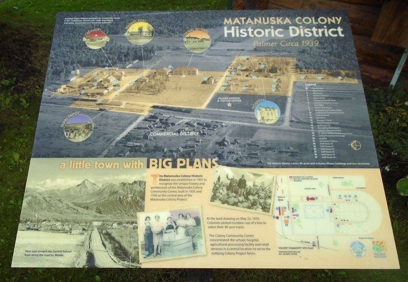
The Matanuska Colony Historic District was established in 1991 to recognize the unique history and architecture of the Matanuska Colony Community Center, built in 1935 and 1936 as the central area of the Matanuska Colony Project.
At the land drawing on May 23, 1935, Colonists picked numbers out of a box to select their 40-acre tracts.
The Colony Community Center concentrated the school, hospital, agricultural processing facility and retail services in a central location to serve the outlying Colony Project farms.
[Top aerial photo captioning] Palmer Circa 1939
Architect David Williams designed the Community Center in the "indigenous architecture" style that reflects a sensible, economical and functional approach.
Legend [highlights notable locations on photo]
The Historic District covers 80 acres and includes fifteen buildings and two structures.
[Lower left photo caption reads]
View east toward the Central School from along the road to Wasilla.
[Bottom right] Colony Community Site Plan
Erected by Palmer Museum and Matanuska Susitna Borough.
Topics. This historical marker is listed in these topic
this page online
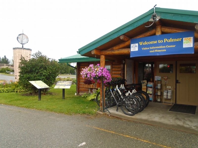
Location. 61° 35.915′ N, 149° 6.793′ W. Marker is in Palmer, Alaska, in Matanuska-Susitna Borough. It is at the intersection of South Valley Way and Elmwood Avenue, on the left when traveling south on South Valley Way. Marker is near the Palmer Visitor Information Center entrance. Touch for map. Marker is at or near this postal address: 723-799 South Valley Way, Palmer AK 99645, United States of America. Touch for directions.

Regionally, this marker is in the Alaska Railroad Corridor, in the Athabascan Region, in the Mat-Su Valley, and in Southcentral Alaska. It is also on the American Pacific Coast. Globally, it is in North America, on the Pacific Rim, in the Western Hemisphere, in the Western World, and in the Anglosphere. Historically, it finds itself in what was once the Russian Empire.
Other nearby markers. At least 8 other markers are within walking distance of this marker: Balto (a few steps from this marker); Land of Giants (a few steps from this marker); a Great Place to Call Home (a few steps from this marker);
Photographed by William Fischer, Jr., August 12, 2024
2. a little town with BIG PLANS Marker
Also see . . . Matanuska Colony Community Center (Living New Deal entry). (Submitted on August 19, 2024, by William Fischer, Jr. of Reynoldsburg, Ohio.)
Credits. This page was last revised on August 31, 2024. It was originally submitted on August 19, 2024, by William Fischer, Jr. of Reynoldsburg, Ohio. This page has been viewed 173 times since then and 14 times this year. Photos: 1, 2. submitted on August 19, 2024, by William Fischer, Jr. of Reynoldsburg, Ohio.
