Near New Market in Page County, Virginia — The American South (Mid-Atlantic)
Page County
⎯⎯⎯
Shenandoah County
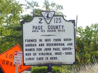
Photographed by J. J. Prats, September 29, 2006
1. Page County Face Faces Shenandoah County
Page County. Area 322 square miles. Formed in 1831 from Shenandoah and Rockingham, and named for John Page, Governor of Virginia, 1802–1805. Luray cave is here.
Shenandoah County. Area 510 square miles. Formed in 1772 from Frederick, and first named Dunmore for Lord Dunmore, governor of Virginia, 1771–1775. In 1778 the county was renamed for the Shenandoah River.
Erected 1929 by the Conservation and Development Commission. (Marker Number Z-125.)
Topics and series. This historical marker is listed in this topic list: Political Subdivisions. In addition, it is included in the Virginia Department of Historic Resources (DHR) series list. A significant historical year for this entry is 1831.
Location. 38° 38.574′ N, 78° 36.714′ W. Marker is near New Market, Virginia, in Page County. It is on Lee Highway (U.S. 211) just east of Crisman Hollow Road, on the right when traveling east. The marker stands at the crest of Massanutten mountain, at New Market Gap. Touch for map. Marker is at or near this postal address: 3210 Lee Hwy, New Market VA 22844, United States of America. Touch for directions.

Regionally, this marker
this page online
Other nearby markers. At least 8 other markers are within walking distance of this marker: Jackson’s 2nd Corps Established (within shouting distance of this marker); Massanutten Wildflower Trail (about 300 feet away, measured in a direct line); History Marches Forward (about 500 feet away); You Are Invited (about 500 feet away); Downy Serviceberry (about 600 feet away); Flowering Dogwood (about 600 feet away); Pignut Hickory (about 700 feet away); The Tea Tree (approx. 0.2 miles away).
Also see . . .
1. Page County. Wikipedia entry (Submitted on August 19, 2022, by Larry Gertner of New York, New York.)
2. Shenandoah County, Virgnia. Wikipedia entry (Submitted on December 24, 2006.)
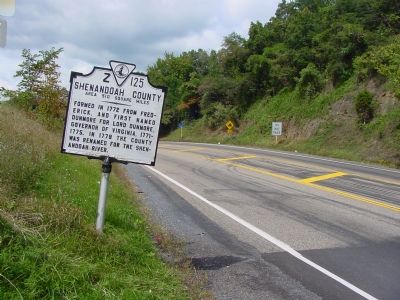
Photographed by J. J. Prats, September 29, 2006
2. Shenandoah County Face Faces Page County
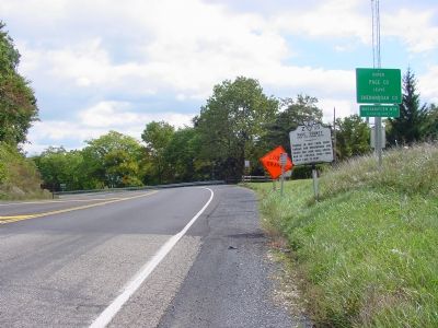
Photographed by J. J. Prats, September 29, 2006
3. Page County / Shenandoah County Marker
Credits. This page was last revised on August 20, 2024. It was originally submitted on December 24, 2006, by J. J. Prats of Powell, Ohio. This page has been viewed 1,766 times since then and 35 times this year. Last updated on August 20, 2024, by Carl Gordon Moore Jr. of North East, Maryland. Photos: 1, 2, 3. submitted on December 24, 2006, by J. J. Prats of Powell, Ohio. • Devry Becker Jones was the editor who published this page.
