
Grottoes in Rockingham County, Virginia — The American South (Mid-Atlantic)
Appalachian Trail
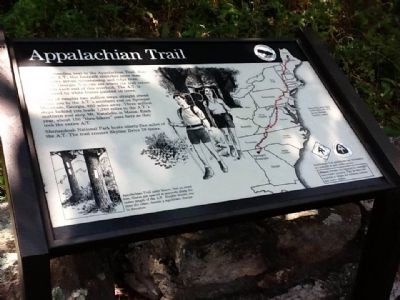
Photographed by Charles T. Harrell, August 9, 2011
1. Appalachian Trail Marker
A hike of roughly two million steps straight ahead brings you to the A.T.’s southern end on Springer Mountain, Georgia, 860 miles away. Three million steps behind you leads 1,280 miles to the A.T.’s northern end atop Mt. Katahdin in Maine. Each year, about 150 “Thru-hikers” pass here as they trek the entire A.T.
Shenandoah national park hosts ninety-five miles of the A.T. The trail crosses Skyline Drive 28 times. (caption: Appalachian Trail uses blazes. Not on every tree, blazes are spaced at intervals along the entire length of the A.T. Double blazes, one over the other, describe a significant change in direction.)
Topics. This historical marker is listed in this topic list: Notable Places.
Location. 38° 14.79′ N, 78° 41.66′ W. Marker is in Grottoes, Virginia, in Rockingham
this page online

Regionally, this marker is in Virginia’s Shenandoah Valley. It is also in the American South and specifically in the Upper South. Globally, it is in North America, the Western Hemisphere, the Western World, and the Anglosphere. Historically, it finds itself in what was once the territory of the Mississippian Culture, one of the original Thirteen Colonies, one of the Confederate States of America, and the Antebellum South.
Other nearby markers. At least 8 other markers are within 3 miles of this marker, measured as the crow flies: Big Run Watershed (about 300 feet away, measured in a direct line); Nature Without Us, For Us (approx. ¾ mile away); Civilian Conservation Corps (approx. 1½ miles away); Jackson's Valley Campaign (approx. 1.7 miles away); What's Special about Shenandoah? (approx. 2.1 miles away); Skyline Drive (approx. 2.1 miles away); Shenandoah’s Deer (approx. 2.1 miles away); Rekindling Nature
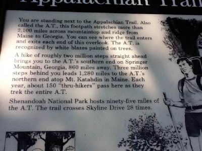
Photographed by Charles T. Harrell, August 9, 2011
2. Appalachian Trail Marker
Credits. This page was last revised on August 21, 2024. It was originally submitted on August 11, 2011, by Charles T. Harrell of Woodford, Virginia. This page has been viewed 778 times since then and 20 times this year. Last updated on August 21, 2024, by Carl Gordon Moore Jr. of North East, Maryland. Photos: 1, 2. submitted on August 11, 2011, by Charles T. Harrell of Woodford, Virginia. • Bernard Fisher was the editor who published this page.
