Mackinaw Township in Mackinaw City in Cheboygan County, Michigan — The American Midwest (Great Lakes)
The Lumbering Era
| — | Mackinaw City Historical Pathway | — |
Photographed by J. J. Prats, August 2, 2024
1. The Lumbering Era Marker
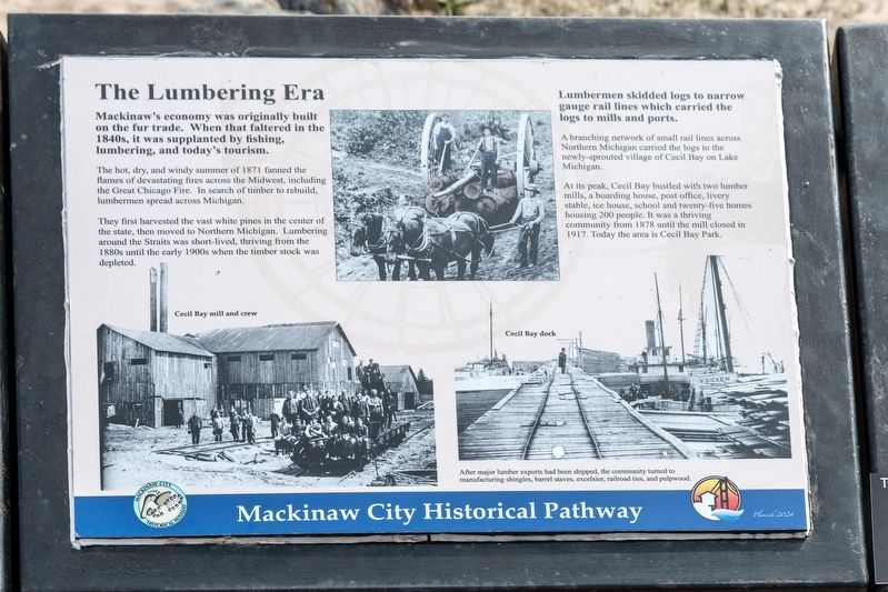
The hot, dry, and windy summer of 1871 fanned the flames of devastating fires across the Midwest, including the Great Chicago Fire. In search of timber to rebuild, lumbermen spread across Michigan.
They first harvested the vast white pines in the center of the state, then moved to Northern Michigan. Lumbering around the Straits was short-lived, thriving from the 1880s until the early 1900s when the timber stock was depleted.
Lumbermen skidded logs to narrow gauge rail lines which carried the logs to mills and ports.
A branching network of small rail lines across Northern Michigan carried the logs to the newly-sprouted village of Cecil Bay on Lake Michigan. At its peak, Cecil Bay bustled with two lumber mills, a boarding house, post office, livery stable, ice house, school and twenty-five homes housing 200 people. It was a thriving community from 1878 until the mill closed in 1917. Today the area is Cecil Bay Park.
After major lumber exports
this page online
Erected 2024.
Topics. This historical marker is listed in these topic lists: Industry & Commerce • Natural Resources. A significant historical year for this entry is 1871.
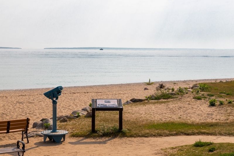
Location. 45° 47.086′ N, 84° 43.491′ W. Marker is in Mackinaw City, Michigan, in Cheboygan County. It is in Mackinaw Township. It is at the intersection of North Huron Avenue and Langlade Street, on the right when traveling north on North Huron Avenue. It is in the Gary R Williams Memorial Park. Touch for map. Marker is at or near this postal address: 312 N Huron Ave, Mackinaw City MI 49701, United States of America. Touch for directions.

Regionally, this marker is in Northern Michigan Lower Peninsula, on the Straits of Mackinac, and in one of the Lake Huron Shore counties. It is also in the American Midwest. Globally, it is in North America, in the Great North Woods, on the Great Lakes, in the Western Hemisphere, in the Western World, and in the Anglosphere. Historically, it finds itself in what was once the Northwest Territory.
Photographed by J. J. Prats, August 2, 2024
2. The Lumbering Era Marker
Other nearby markers. At least 8 other markers are within walking distance of this marker: “Merizon Barn” (about 400 feet away, measured in a direct line); Anchor (about 500 feet away); Chief Wawatam (about 500 feet away); a different marker also named Chief Wawatam (about 500 feet away); Marine and Weather Reporter (about 500 feet away); A Bridge for Mackinac (about 600 feet away); Where are the Clouds? The Snow? (about 600 feet away); Geology of the Straits (about 600 feet away). Touch for a list and map of all markers in Mackinaw City.
Other markers no longer nearby. The Lumbering Era (has been replaced with this marker); Anchors and their retrieval (was about 500 feet away but has been replaced with another marker now near it); Marine & Weather Reporter (was about 500 feet away but has been replaced with another marker now near it); Island-Hopping the Straits (was about 600 feet away but has been replaced with another marker now near it).
More about this marker. This interpretive panel is illustrated with three photographs. The center photograph at the top shows logs being skidded to the rail line. The one on the lower left is captioned “Cecil Bay mill and crew.” The one on the lower right is captioned “Cecil Bay dock.”
Regarding The Lumbering Era. Cecil Bay is seven miles west of Mackinaw City, on Lake Michigan.
Credits. This page was last revised on August 24, 2024. It was originally submitted on August 24, 2024, by J. J. Prats of Powell, Ohio. This page has been viewed 154 times since then and 33 times this year. Photos: 1, 2. submitted on August 24, 2024, by J. J. Prats of Powell, Ohio.
