Chico in Wise County, Texas — The American South (West South Central)
The Methodist Church in Chico
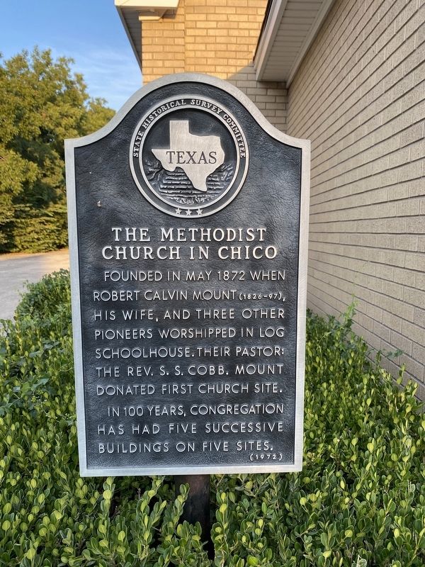
Photographed by Morgan Petermann, August 24, 2024
1. The Methodist Church in Chico Marker
Erected 1972 by State Historical Survey Committee. (Marker Number 5378.)
Topics. This historical marker is listed in this topic list: Religion & Religious Structures. A significant historical month for this entry is May 1872.
Location. 33° 17.556′ N, 97° 47.852′ W. Marker is in Chico, Texas, in Wise County. It is on South Weatherford Street near East Maginnis Street, on the right when traveling south. Touch for map. Marker is at or near this postal address: 302 S Weatherford St, Chico TX 76431, United States of America. Touch for directions.

Regionally, this marker is in the Prairies & Lakes Region and in the Dallas-Fort Worth Metropolitan Area. Globally, it is in North America, a Gulf of Mexico state, the Western Hemisphere, the Western World, and the Anglosphere. Historically, it finds itself in what was once New Spain, the Republic of Texas, and
this page online
Other nearby markers. At least 8 other markers are within 6 miles of this marker, measured as the crow flies: Siddons-Barnes Log Cabin (about 600 feet away, measured in a direct line); Brown Hotel (about 600 feet away); First Baptist Church of Chico (about 700 feet away); Hanna-Robinson-Richey Drugstore (approx. 0.2 miles away); R. C. Mount House (approx. 1½ miles away); Indian Captives Dot and Bianca Babb (approx. 2.2 miles away); Lake Bridgeport (approx. 3 miles away); First Presbyterian Church of Bridgeport (approx. 5.7 miles away). Touch for a list and map of all markers in Chico.

Photographed by Morgan Petermann, August 24, 2024
2. The Methodist Church in Chico Marker
Credits. This page was last revised on August 26, 2024. It was originally submitted on August 24, 2024, by Morgan Petermann of Hurst, Texas. This page has been viewed 303 times since then and 47 times this year. Photos: 1, 2. submitted on August 24, 2024, by Morgan Petermann of Hurst, Texas. • James Hulse was the editor who published this page.
