David City in Butler County, Nebraska — The American Midwest (Upper Plains)
T. B. Myers Building
Photographed by Mark Parker, October 13, 2023
1. T. B. Myers Building Marker
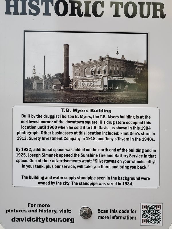
Built by the druggist Thorton B. Myers, the T.B. Myers building is at the northwest corner of the downtown square. His drug store occupied this location until 1900 when he sold it to J.B. Davis, as shown in this 1904 photograph. Other businesses at this location included: Flint Dee's store in 1913, Surety Investment Company in 1918, and Tony's Tavern in the 1940s.
By 1922, additional space was added on the north end of the building and in 1925, Joseph Simanek opened the Sunshine Tire and Battery Service in that space. One of their advertisements went: "Silvertowns on your wheels, ethyl in your tank, plus our service, will take you there and bring you back."
The building and water supply standpipe seen in the background were owned by the city. The standpipe was razed in 1934.
Topics. This historical marker is listed in these topic lists: Architecture • Industry & Commerce. A significant historical year for this entry is 1904.
Location. 41° 15.25′ N, 97° 7.818′ W. Marker is in David City, Nebraska, in Butler County. It can be reached from the intersection of North 4th Street (Nebraska Route 15) and E Street, on the right
this page online

Regionally, this marker is in the American Midwest, in the Corn Belt, and on the prairies. Globally, it is in North America, the Western Hemisphere, the Western World, and the Anglosphere. Historically, it finds itself in what was once the Louisiana Purchase.
Other nearby markers. At least 8 other markers are within walking distance of this marker: Wolfe Building (here, next to this marker); Built in 1900 as The Boston Studio (within shouting distance of this marker); North Side of the Square (within shouting distance of this marker); To the Pioneers of Butler County (about 400 feet away, measured in a direct line); Schweser's (about 500 feet away); Thorpe Opera House (about 600 feet away); Replica of the Statue of Liberty (approx. 0.6 miles away); Memorial Field (approx. 0.6 miles away). Touch for a list and map of all markers

Photographed by Mark Parker, October 13, 2023
2. T.B. Myers Building and Marker
The T.B. Myers building is to the left facing E Street at the northeast corner of North 4th Street. Other blocks include the Lierle and J.T. Myers Buildings.
Credits. This page was last revised on September 11, 2024. It was originally submitted on August 24, 2024, by Mark Parker of Hickory, North Carolina. This page has been viewed 163 times since then and 15 times this year. Photos: 1, 2. submitted on August 24, 2024, by Mark Parker of Hickory, North Carolina. • J. Makali Bruton was the editor who published this page.
