Mackinaw Township in Mackinaw City in Cheboygan County, Michigan — The American Midwest (Great Lakes)
Building the Mighty Mac
| — | Mackinaw City Historical Pathway | — |

Photographed by J. J. Prats, August 2, 2024
1. Building the Mighty Mac Marker
Long, strong and within budget. When built the Mackinac Bridge was the longest suspension bridge in the world if you count all three segments, but today the longest is in Japan. Mighty Mac was designed to withstand crushing ice and at least 632 mph winds. It was a construction triumph, built for $99.8 million between 1954 and 1957, on time and within budget. The 4.5 million vehicles which safely cross each year pay tribute to those who built and maintain the bridge, especially during the harsh winters and the strong winds of the Straits.
How the suspension part of the bridge works. The Mackinac Bridge is constructed of segments: a truss bridge approach on each end and a center suspension portion of three parts. Over a deep shipping channel, suspension bridges can have long spans, greater height, cheaper cost, and are easier to construct that truss bridges.
Two massive anchor blocks, the big wide concrete pads shown above in red, are at each edge of the deep water, the point of transition between truss and suspension. Cables are stretched between these two blocks across the chasm. The cables are propped
this page online
The bridge designers determined the required height of the towers by calculating the bridge span and the desired height of the roadbed above the water. The roadbed is 148 feet minimum above the water to allow for the passage of freighters and tall sailing vessels.
As you can see in the photo at left, the cables are not hooked to the towers, they merely drape over the towers through saddles. The cables and towers move with the weight load on the bridge and temperature changes.
The two people standing on top of a tower give a sense of scale. The large red lights on the tips of the tower are aviation beacons.
Erected 2022.
Topics. This historical marker is listed in this topic list: Bridges & Viaducts. A significant historical year for this entry is 1954.
Location. 45° 47.234′ N, 84° 43.664′ W. Marker is in Mackinaw City, Michigan, in Cheboygan County. It is in Mackinaw Township. It can be reached from the intersection of North Huron Avenue and Henry Street, on the right when traveling west. It is in Alexander
Photographed by J. J. Prats, August 2, 2024
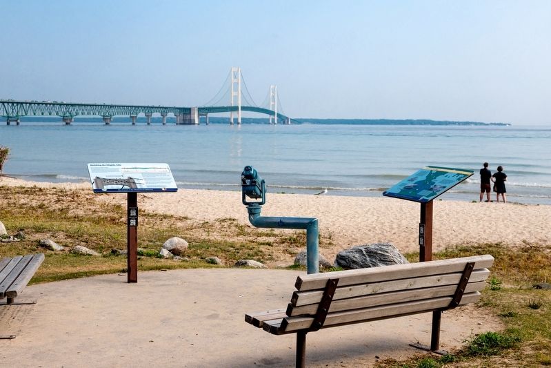
2. The Mighty Mac and Marker

Regionally, this marker is in Northern Michigan Lower Peninsula, on the Straits of Mackinac, and in one of the Lake Huron Shore counties. It is also in the American Midwest. Globally, it is in North America, in the Great North Woods, on the Great Lakes, in the Western Hemisphere, in the Western World, and in the Anglosphere. Historically, it finds itself in what was once the Northwest Territory.
Other nearby markers. At least 8 other markers are within walking distance of this marker: Graveyard of the Deep (here, next to this marker); Crossroads of the Great Lakes (within shouting distance of this marker); Shipwrecks in the Straits (within shouting distance of this marker); Alexander Henry Park Kiosk (within shouting distance of this marker); Michilimackinac State Park (within shouting distance of this marker); Alexander Henry 1739 - 1834 (within shouting distance of this marker); Radio Beacon 1937/1938 (about 400 feet away, measured in a direct line);
Photographed by J. J. Prats, August 2, 2024
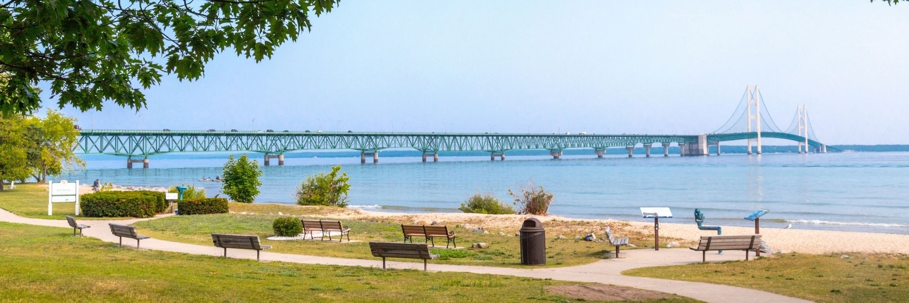
3. The Mackinac Bridge Crosses the Straits of Mackinac
This view is from Mackinaw City. Lake Michigan is to the left and Lake Huron is to the right. The Straits are five miles wide here.
Other markers no longer nearby. Building Mighty Mac (was here, next to this marker but has been replaced with another marker now near it); a different marker also named Graveyard of the Deep (was here, next to this marker but has been replaced with another marker now near it); a different marker also named Crossroads of the Great Lakes (was within shouting distance of this marker but has been replaced with another marker now near it).
More about this marker. This interpretive panel is illustrated with a cross-section drawing of the bridge and a photograph of the top of one of its towers.
Regarding Building the Mighty Mac. The Mackinac Bridge is five miles long and crosses the Straits of Mackinac, connecting the upper and lower peninsulas of Michigan. It is the longest suspension bridge in North America. The building of the Mackinac Bridge began in May 1954 and opened to traffic November 1, 1957. A dedication was held in June 1958, with Governor G. Mennen Williams attending.
Also see . . .
1. Building the Mackinac Bridge. It begins,
After more than 70 years of dreams, with many different plans for bridging the Straits of Mackinac, ground breaking to build the Mackinac Bridge took place in St. Ignace on May 7, 1954 and Mackinaw City on May 8. The photos on this page are from slides taken by my father, Lester Stokes, who lived less than a block from the foot of the Mackinac Bridge in Mackinaw City, and worked on the State Dock which served the automobile ferries until November 1, 1957, when the Mackinac Bridge opened and ferry service was discontinued.(Submitted on August 24, 2024.)
2. History of the Bridge. Mackinac Bridge Authority website. Excerpt:
The dedication of the Brooklyn Bridge in 1883 gave Mackinac Bridge backers encouragement. A St. Ignace store owner in 1884 reprinted an artist’s conception of the famous New York structure in his advertising and captioned it “Proposed bridge across the Straits of Mackinac.”(Submitted on August 24, 2024.)
Credits. This page was last revised on August 24, 2024. It was originally submitted on August 24, 2024, by J. J. Prats of Powell, Ohio. This page has been viewed 775 times since then and 47 times this year. Photos: 1, 2, 3. submitted on August 24, 2024, by J. J. Prats of Powell, Ohio.
