Aylmer in Elgin County, Ontario — Central Canada (North America)
The Founding of Aylmer

Photographed by Tim Boyd, August 23, 2024
1. The Founding of Aylmer Marker
Erected by the Archaeological and Historic Sites Board, Department of Public Records and Archives of Ontario
Erected by Ontario Archaeological and Historic Sites Board.
Topics and series. This historical marker is listed in these topic lists: Industry & Commerce • Settlements & Settlers. In addition, it is included in the Canada, Ontario Heritage Trust series list. A significant historical month for this entry is October 1817.
Location. 42° 46.375′ N,
this page online

Regionally, this marker is in the Southwest Ontario Area and in Southwestern Ontario. It is also in Central Canada. Globally, it is in North America, on the Great Lakes, in the Western Hemisphere, in the Western World, and in the Anglosphere. Historically, it finds itself in what was once a British colony, the Viceroyalty of New France, the Haudenosaunee (Iroquois) Confederacy, and Rupert’s Land.
Other nearby markers. At least 8 other markers are within 11 kilometers of this marker, measured as the crow flies: Aylmer Cenotaph (within shouting distance of this marker); Springfield Cenotaph (approx. 7.4 kilometers away); The Founding of Springfield (approx. 7.4 kilometers away); The Founding of Sparta, 1813 (approx. 10.6 kilometers away); The Eakins Store (approx. 11 kilometers away); The Sparta House
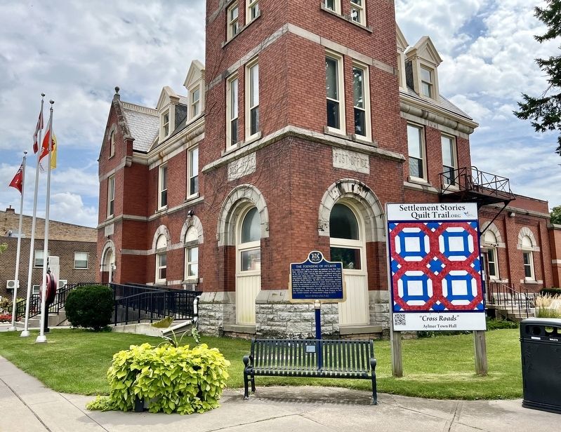
Photographed by Tim Boyd, August 23, 2024
2. The Founding of Aylmer Marker
Also see . . . Aylmer the History of a Town.
By 1886, the village had exceeded a population of 2,000 residents and therefore had qualified to be incorporated as a town. The Act of Incorporation was put into effect on January 1st, 1887. Increasing numbers of businesses began to open in Aylmer, although some industries, such as canning and tobacco grew and then declined. The town's ever-increasing population resulted in the creation of local schools and churches. The Second World War saw the coming of The Royal Canadian Air Force to Aylmer as they established a training centre within the town, which later became the site of the Ontario Police College.(Submitted on August 26, 2024, by Tim Boyd of Hamilton, Ontario.)
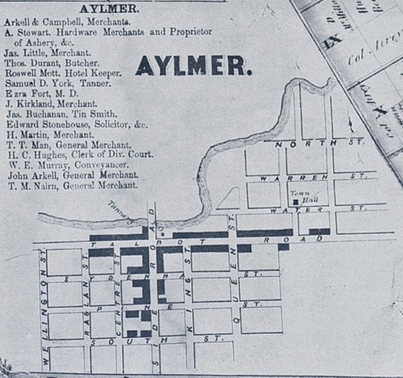
3. The Village of Aylmer, 1864
Source: Tremaine’s Map of the County of Elgin
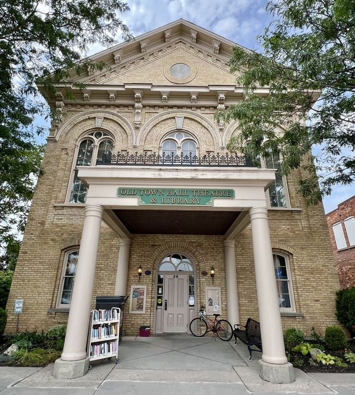
Photographed by Tim Boyd, August 23, 2024
4. Aylmer Old Town Hall, 2024
Credits. This page was last revised on August 28, 2024. It was originally submitted on August 26, 2024, by Tim Boyd of Hamilton, Ontario. This page has been viewed 367 times since then and 71 times this year. Photos: 1, 2, 3, 4. submitted on August 26, 2024, by Tim Boyd of Hamilton, Ontario. • Andrew Ruppenstein was the editor who published this page.
