Ansonia in Naugatuck Valley Region, Connecticut — The American Northeast (New England)
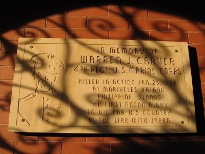
In Memory of Warren J. Carver
Photographed by Michael Herrick, December 8, 2009
1. In Memory of Warren J. Carver Marker
Warren J. Carver
4th Regt. U.S. Marine Corps
Killed in action Jan. 25, 1942
at Mariveles Bataan
Philippine Islands
The first Ansonia boy
to die for his Country
in the War with Japan
Topics. This historical marker is listed in this topic list: War, World II. A significant historical date for this entry is January 25, 1942.
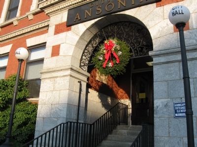
Location. 41° 20.573′ N, 73° 4.705′ W. Marker is in Ansonia in Naugatuck Valley Region, Connecticut. It can be reached from the intersection of Main Street and Water Street, on the right when traveling north. Located in the entrance way of Ansonia City Hall. The marker is visible from the sidewalk. Touch for map. Marker is at or near this postal address: 253 Main St, Ansonia CT 06401, United States of America. Touch for directions.

Regionally, this marker is in the Connecticut River Valley, on the Connecticut Shoreline, and in Greater New Haven. It is also in the American Northeast and in New England. Globally, it is in North America, the Western Hemisphere, the Western World, and the Anglosphere. Historically, it finds itself in what was once New Haven County and also one of the
this page online
Other nearby markers. At least 8 other markers are within walking distance of this marker: Ansonia Veterans Memorial (here, next to this marker); Ansonia Volunteer Firemen’s Monument (a few steps from this marker); Charter Oak Seedling (within shouting distance of this marker); Ansonia Veterans Monument (within shouting distance of this marker); Anna Sewell Memorial Fountain (approx. 0.2 miles away); Soldiers Monument (approx. 0.4 miles away); Pork Hollow (approx. 0.7 miles away); Ansonia (approx. ¾ mile away). Touch for a list and map of all markers in Ansonia.
Photographed by Michael Herrick, December 8, 2009
2. The Entrance of Ansonia City Hall
The marker is visible below the wreath.
Credits. This page was last revised on May 19, 2026. It was originally submitted on December 14, 2009, by Michael Herrick of Southbury, Connecticut. This page has been viewed 1,179 times since then and 22 times this year. Photos: 1, 2. submitted on December 14, 2009, by Michael Herrick of Southbury, Connecticut. • Kevin W. was the editor who published this page.
