Near West Lorne in Elgin County, Ontario — Central Canada (North America)
Brock’s Creek
Photographed by Tim Boyd, August 23, 2024
1. Brock’s Creek Marker
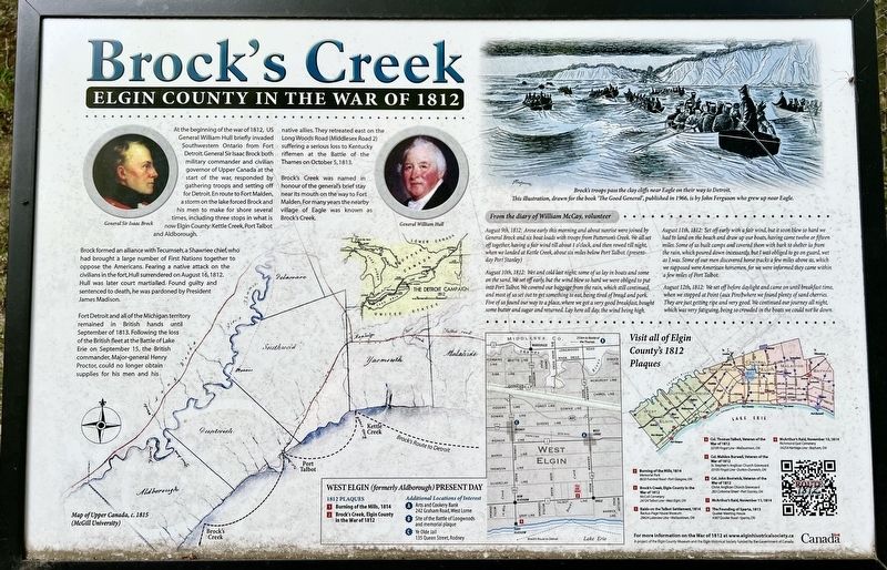
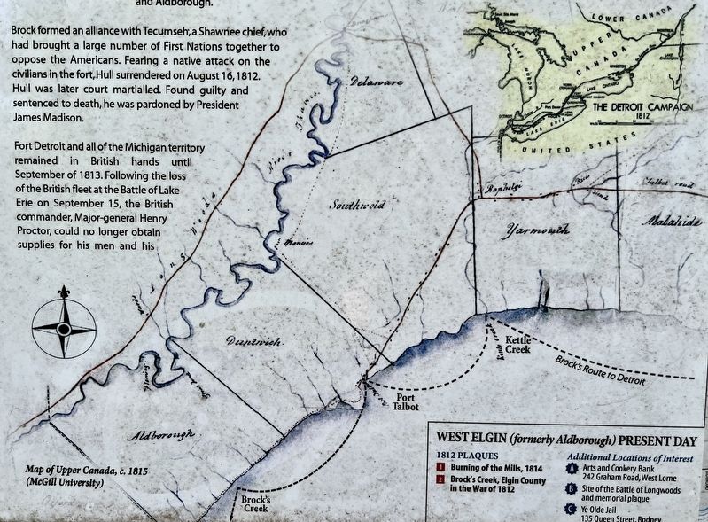
Brock formed an alliance with Tecumseh, a Shawnee chief, who had brought a large number of First Nations together to oppose the Americans. Fearing a native attack on the civilians in the fort, Hull surrendered on August 16, 1812. Hull was later court martialled. Found guilty and sentenced to death, he was pardoned by President James Madison.
Fort Detroit and all of the Michigan territory remained in British hands until September of 1813. Following the loss of the British fleet at the Battle of Lake Erie on September 15, the British commander, Major-general Henry Proctor, could no longer obtain supplies for his men and his native allies. They
this page online
Brock's Creek was named in honour of the general's brief stay near its mouth on the way to Fort Malden. For many years the nearby village of Eagle was known as Brock's Creek.
Erected by Elgin County Museum.
Topics. This historical marker is listed in this topic list: War of 1812. A significant historical date for this entry is August 16, 1812.
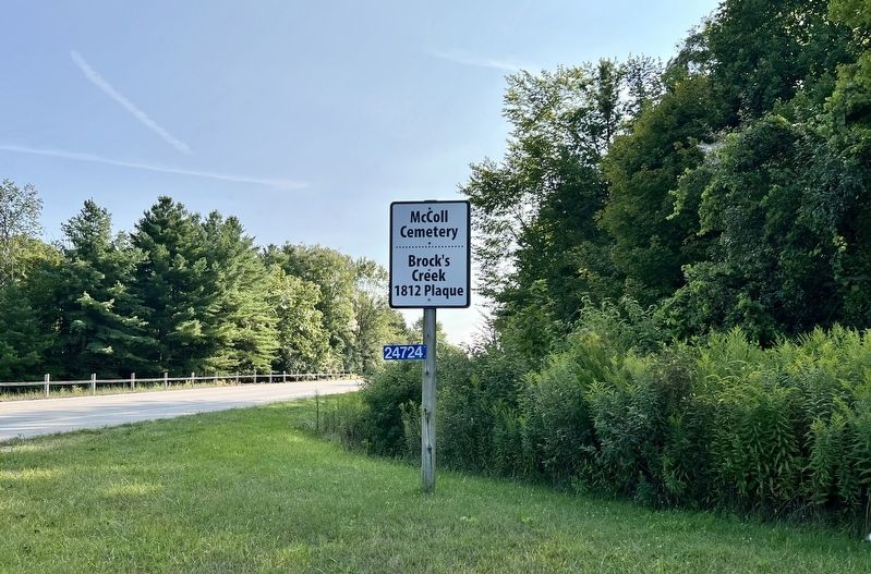
Location. 42° 33.471′ N, 81° 34.732′ W. Marker is near West Lorne, Ontario, in Elgin County. It is on Talbot Line (County Road 3) 1.7 kilometers west of Graham Road (County Road 76). The marker is on the grounds of the McColl Cemetery, approx. 100 metres from the entrance on Talbot Line. Touch for map. Marker is at or near this postal address: 24724 Talbot Line, West Lorne ON N0L 2P0, Canada. Touch for directions.

Regionally, this marker is in the Southwest Ontario Area and in Southwestern Ontario. It is also in Central Canada. Globally, it is in North America, on the Great Lakes, in the Western Hemisphere, in the Western World, and in

Photographed by Tim Boyd, August 23, 2029
2. Brock’s Creek Marker
Other nearby markers. At least 8 other markers are within 13 kilometers of this marker, measured as the crow flies: Port Glasgow Summer Dance Pavilion (approx. 5.9 kilometers away); Aldborough Pioneers/ Pioneer Parliamentarian (approx. 5.9 kilometers away); Aldborough Pioneers’ and Soldiers’ Memorial Park “Historic Stone” (approx. 5.9 kilometers away); Burning of the Mills, 1814 (approx. 5.9 kilometers away); Tyrconnell (approx. 10.6 kilometers away); Raids on the Talbot Settlement, 1814 (approx. 12.2 kilometers away); St. Peter’s Church 1827 (approx. 12.6 kilometers away); Ellis Wellwood Sifton, V.C. (approx. 12.6 kilometers away).
Also see . . . Brock at Detroit (uppercanadahistory.ca).
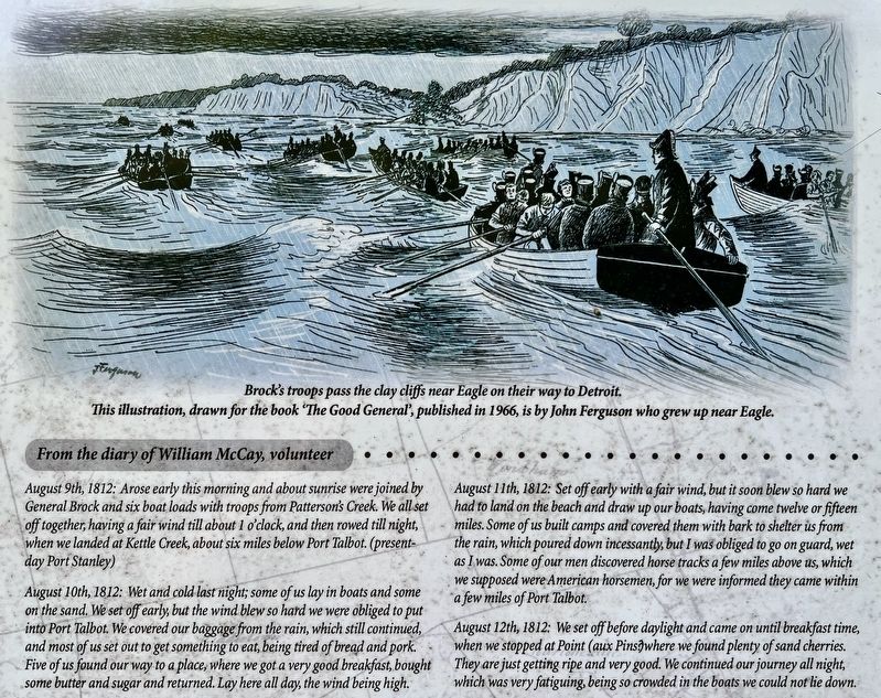
Brock proceeded to Long Point on Lake Erie where on August 8th he embarked his "mass of manoeuvre" comprising 50 regulars and 260 militia chosen for the boating skills and knowledge of the Erie shoreline. In ten small, dilapidated vessels they sailed along the(Submitted on August 29, 2024, by Tim Boyd of Hamilton, Ontario.)Lake Erie shoreline, hugging the treacherous coast as they proceeded with all the speed the heavy weather permitted. They carried with them two 'grasshoppers' cannons. After five days of slow progess and incessant exertion in the ramshackle fleet, they covered the 300 kilometres and reached Amherstburg at midnight on Thursday, August 13th.Photographed by Tim Boyd, August 23, 20243. Brock’s Creek marker detail
Brock was pleased with the soldiers' stamina during the rough and rugged voyage. "In no instance have I seen troops who have endured the fatigue of a long journey in boats during extremely bad weather with greater cheerfulness and constance and it is but justice to this little band to add that their conduct excited my admiration."
Photographed by Tim Boyd, August 23, 2024
4. Brock’s Creek marker detail
Photographed by Tim Boyd, August 23, 2024
5. Entrance on Talbot Line to the McColl Cemetery and Brock’s Creek marker
Credits. This page was last revised on August 30, 2024. It was originally submitted on August 29, 2024, by Tim Boyd of Hamilton, Ontario. This page has been viewed 517 times since then and 63 times this year. Photos: 1, 2, 3, 4, 5. submitted on August 29, 2024, by Tim Boyd of Hamilton, Ontario. • Andrew Ruppenstein was the editor who published this page.
