Barren Island in Brooklyn in Kings County, New York — The American Northeast (Mid-Atlantic)
Gateway to Flight
Gateway National Recreation Area
| — | National Park Service, U.S. Department of the Interior | — |
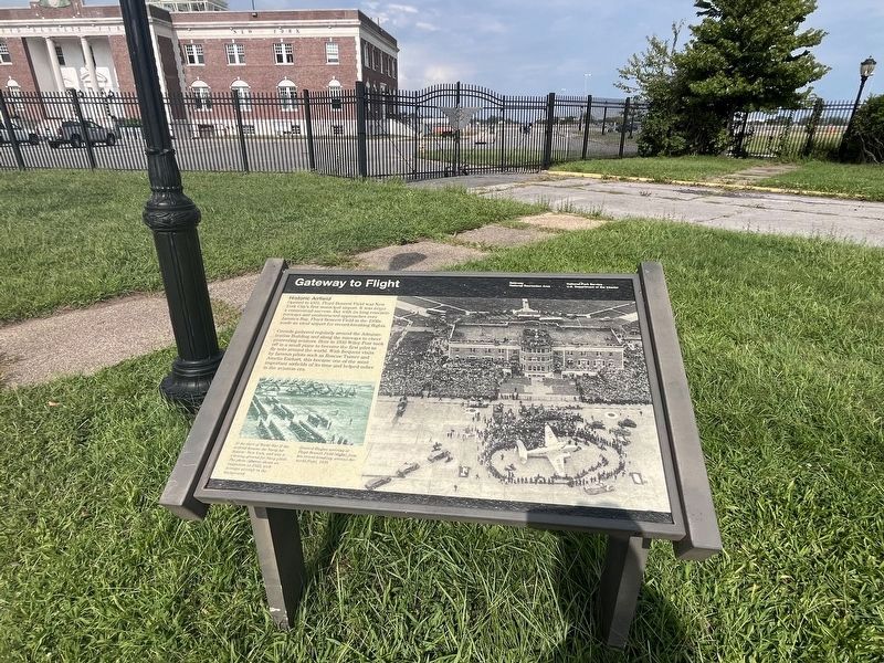
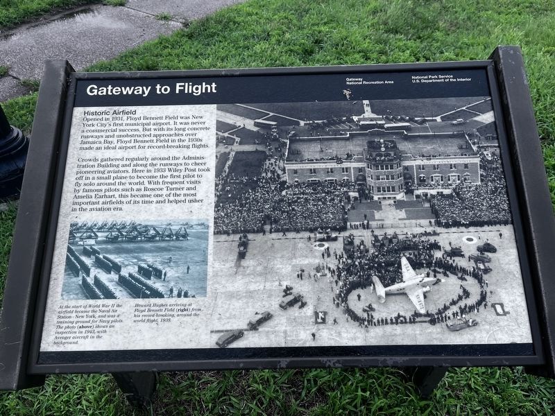
Historic Airfield
Opened in 1931, Floyd Bennett Field was New York City's first municipal airport. It was never a commercial success. But with its long concrete runways and unobstructed approaches over Jamaica Bay, Floyd Bennett Field in the 1930s made an ideal airport for record-breaking flights.
Crowds gathered regularly around the Administration Building and along with the runways to cheer pioneering aviators. Here in 1933 Wiley Post took off in a small plane to become the first pilot to fly solo around the world. With frequent visits by famous pilots such as Roscoe Turner and Amelia Earhart, this became one of the most important airfields in of its time and helped usher in the aviation era.
[Captions:]
At the start of World War II the airfield became the Naval Air Station - New York, and was a training ground for Navy pilots. The photo (above) shows an inspection in 1943, with Avenger aircraft in the background.
Howard Hughes arriving at Floyd Bennett Field (right) from his record-breaking, around-the-world flight, 1938.
Erected by National Park Service, U.S. Department of the Interior.
Topics.
this page online
Location. 40° 35.252′ N, 73° 53.83′ W. Marker is in Brooklyn, New York, in Kings County. It is on Barren Island. It is on Flatbush Avenue north of Aviation Road, on the right when traveling north. Touch for map. Marker is at or near this postal address: 5031 Flatbush Ave, Brooklyn NY 11234, United States of America. Touch for directions.

Regionally, this marker is in New York City and on Long Island. It is also in the American Northeast, in the Mid-Atlantic, and on the Eastern Seaboard. Globally, it is in the North Atlantic Region, North America, the Western Hemisphere, the Western World, and the Anglosphere. Historically, it finds itself in what was once New Netherland and also one of the original Thirteen Colonies.
Other nearby markers. At least 8 other markers are within 3 miles of this marker, measured as the crow flies: Floyd Bennett Field / Jamaica Bay Greenway (within shouting distance of this marker); a different marker also named Gateway to Flight (about 300 feet away, measured

Another marker is no longer nearby. Lituanica (was approx. half a mile away but has been confirmed missing).
Photographed by Steve Stoessel, July 15, 2026
3. Gateway to Flight Marker
Credits. This page was last revised on July 16, 2026. It was originally submitted on September 2, 2024, by Devry Becker Jones of Washington, District of Columbia. This page has been viewed 208 times since then and 29 times this year. Photos: 1, 2. submitted on September 2, 2024, by Devry Becker Jones of Washington, District of Columbia. 3. submitted on July 16, 2026, by Steve Stoessel of Niskayuna, New York.
