
Belmar Park in Lakewood in Jefferson County, Colorado — The American Mountains (Southwest)
The Interurban Line
Wide Acres Trolley Stop
Photographed by Craig Baker, August 23, 2024
1. The Interurban Line Marker
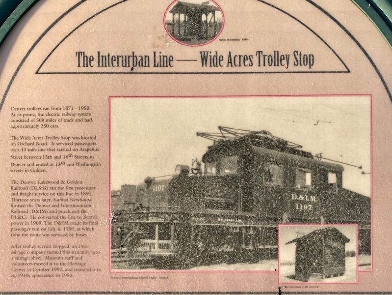
Denver trolleys ran from 1871-1950. At its prime, the electric railway system consisted of 300 miles of track and had approximately 250 cars.
The Wide Acres Trolley Stop was located on Orchard Road. It serviced passengers on a 13-mile line that started on Arapahoe Street between 15th and 16th Streets in Denver and ended at 13th and Washington streets in Golden.
The Denver, Lakewood & Golden Railroad (DL&G) ran the first passenger and freight service on this line in 1891. Thirteen years later, Saanuci Newhouse formed the Denver and Intermountain Railroad (D&IM) and purchased the DL&G. He converted the line to electric power in 1909. The D&IM made its final passenger run on July 4, 1950, at which time the route was serviced by buses.
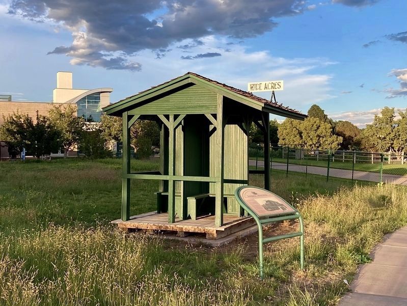
After trolley service stopped, an auto salvage company turned this structure into a storage shed. Museum staff and volunteers moved it to the Heritage Center in October 1992, and restored it to its 1940s appearance in 1996.
Topics. This historical marker is listed in this topic list: Railroads & Streetcars. A significant historical date for this entry is July 4, 1950.
Location. 39° 42.167′ N,
this page online

Regionally, this marker is in Colorado’s Front Range. It is also in the American Mountain West. Globally, it is in North America, the Rocky Mountains, the Western Hemisphere, the Western World, and the Anglosphere. Historically, it finds itself in what was once the Louisiana Purchase.
Other nearby markers. At least 8 other markers are within walking distance of this marker: Estes Motel (within shouting distance of this marker); Gil and Ethel’s (within shouting distance of this marker); The 1920s and 1930s Family Farms (within shouting distance of this marker); Glen Creighton Pump House and Matthews Water Tower (within shouting distance of this marker); Country School (within shouting distance of this marker); 1930s Farm House (about 300 feet away, measured in a direct line); Streer-Peterson House (about 300 feet
Photographed by Craig Baker, August 23, 2024
2. The Interurban Line Marker
At the Wide Acres Trolley Stop.
Credits. This page was last revised on September 3, 2024. It was originally submitted on September 3, 2024, by Craig Baker of Sylmar, California. This page has been viewed 257 times since then and 31 times this year. Photos: 1, 2. submitted on September 3, 2024, by Craig Baker of Sylmar, California.
