Near Grand Saline in Van Zandt County, Texas — The American South (West South Central)
Sand Flat Community
Photographed by Jeff Leichsenring, September 1, 2024
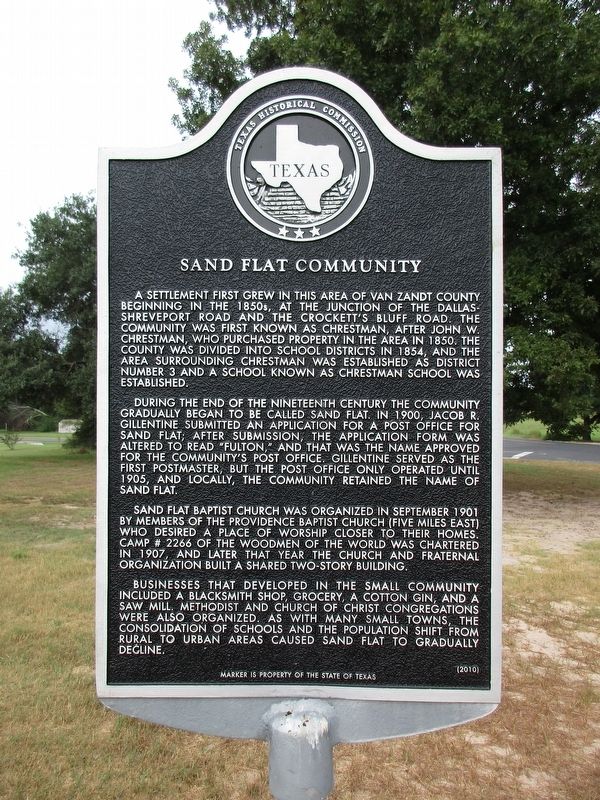
1. Sand Flat Community Marker
During the end of the nineteenth century the community gradually began to be called Sand Flat. In 1900, Jacob R. Gillentine submitted an application for a post office for Sand Flat; after submission, the application form was altered to read “Fulton,” and that was the name approved for the community’s post office. Gillentine served as the first postmaster, but the post office only operated until 1905, and locally, the community retained the name of Sand Flat.
Sand Flat Baptist Church was organized in September 1901 by members of the Providence Baptist Church (five miles east) who desired a place of worship closer to their homes. Camp # 2266 of the Woodmen of the World
this page online
Businesses that developed in the small community included a blacksmith shop, grocery, a cotton gin, and a saw mill. Methodist and Church of Christ congregations were also organized. As with many small towns, the consolidation of schools and the population shift from rural to urban areas caused Sand Flat to gradually decline.
Erected 2010 by Texas Historical Commission. (Marker Number 16555.)
Topics. This historical marker is listed in this topic list: Settlements & Settlers.
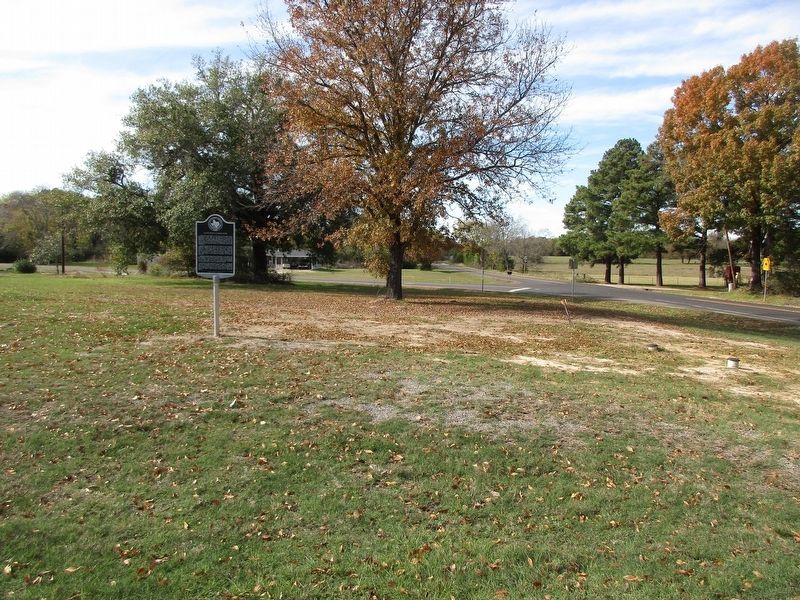
Location. 32° 37.63′ N, 95° 39.121′ W. Marker is near Grand Saline, Texas, in Van Zandt County. It is at the intersection of Farm to Market Road 857 and Farm to Market Road 1255 on Road 857. Touch for map. Marker is at or near this postal address: 4515 Farm To Market 857, Grand Saline TX 75140, United States of America. Touch for directions.

Regionally, this marker is in the American South and in the Piney Woods. Globally, it is in North America, a Gulf of Mexico state, the Western
Photographed by Jeff Leichsenring, November 27, 2023
2. Sand Flat Community Marker
Other nearby markers. At least 8 other markers are within 5 miles of this marker, measured as the crow flies: Providence Community (approx. 3 miles away); Jordans Saline (approx. 3.3 miles away); Pruitt Baptist Church and Pruitt Community (approx. 4.1 miles away); Grand Saline, C.S.A. (approx. 4.3 miles away); Wiley Hardeman Post (approx. 4.7 miles away); First Methodist Church of Grand Saline (approx. 4.8 miles away); Corinth Cemetery (approx. 4.9 miles away); Corinth Baptist Church and School (approx. 4.9 miles away). Touch for a list and map of all markers in Grand Saline.
Credits. This page was last revised on September 5, 2024. It was originally submitted on September 3, 2024, by Jeff Leichsenring of Garland, Texas. This page has been viewed 331 times since then and 54 times this year. Photos: 1, 2. submitted on September 3, 2024, by Jeff Leichsenring of Garland, Texas. • James Hulse was the editor who published this page.
