Grand Saline in Van Zandt County, Texas — The American South (West South Central)
Poletown and Rhodesburg
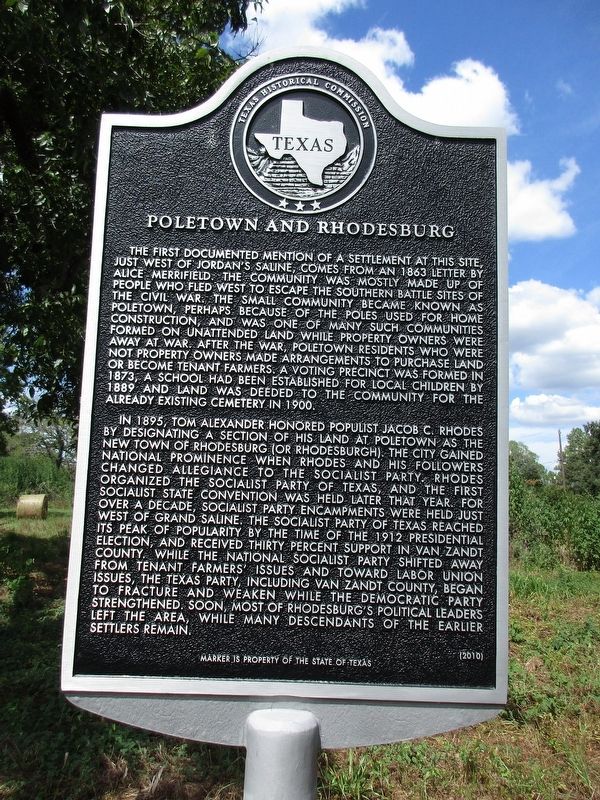
Photographed by Jeff Leichsenring, September 2, 2024
1. Poletown and Rhodesburg Marker
In 1895, Tom Alexander honored populist Jacob C. Rhodes by deisgnating a section of his land at Poletown as the new town of Rhodesburg (or Rhodesburgh). The city gained national prominence when Rhodes and his followers changed allegiance to the Socialist Party. Rhodes organized the Socialist Party of Texas, and the first Socialist state convention was held later that year. For over
this page online
Erected 2010 by Texas Historical Commission. (Marker Number 16471.)
Topics. This historical marker is listed in these topic lists: Fraternal or Sororal Organizations • Settlements & Settlers.
Location. 32° 40.202′ N, 95° 43.924′ W. Marker is in Grand Saline, Texas, in Van Zandt County. It is at the intersection of County Road 1820 and County Road 1824 on County Road 1820. Touch for map. Marker is at or near this postal address: 1550 Co Rd 1820, Grand Saline TX 75140, United States of America. Touch for directions.

Regionally,

Photographed by Jeff Leichsenring, September 2, 2024
2. Poletown and Rhodesburg Marker
Other nearby markers. At least 8 other markers are within 6 miles of this marker, measured as the crow flies: Creagleville (approx. 1.3 miles away); Wiley Hardeman Post (approx. 1.3 miles away); First Methodist Church of Grand Saline (approx. 1.4 miles away); Benjamin Franklin Wheeler (approx. 1½ miles away); Mercer's Colony Eastern Boundary (approx. 1.6 miles away); Grand Saline, C.S.A. (approx. 1.9 miles away); Jordans Saline (approx. 2½ miles away); Sand Flat Community (approx. 5½ miles away). Touch for a list and map of all markers in Grand Saline.
Additional commentary.
1. Pole Town; Spelling
Perhaps the spelling of Poletown as it were should be Poll Town. It having to do with where voting occurred during the Depression. That would be a definite help to avoid any mistaken presumptions. Grand Saline has endured enough. Note To Editor only visible by Contributor and editor
— Submitted April 2, 2025, by Jimmy Freeman of Dallas, Texas.
Credits. This page was last revised on April 8, 2025. It was originally submitted on September 3, 2024, by Jeff Leichsenring of Garland, Texas. This page has been viewed 664 times since then and 171 times this year. Photos: 1, 2. submitted on September 3, 2024, by Jeff Leichsenring of Garland, Texas. • James Hulse was the editor who published this page.
