Creagleville near Grand Saline in Van Zandt County, Texas — The American South (West South Central)
Creagleville
Photographed by Jeff Leichsenring, September 2, 2024
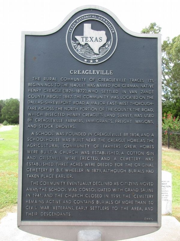
1. Creagleville Marker
A school was founded in Creagleville by 1854, and a schoolhouse was built near the Creagle home. As the agricultural community of farmers grew, homes were built, a church was established, a cotton gin and gristmill were erected, and a cemetery was established. Three acres were deeded for the original cemetery by B.F. Wheeler in 1879, although burials had taken place earlier.
The community eventually declined as citizens moved away; the school was consolidated with Grand Saline in 1941, and the church closed in 1991. The cemetery remains active and contains burials of more than 50 Civil War veterans, early settlers to the area, and their descendants.
Erected 1997 by Texas Historical
this page online
Topics. This historical marker is listed in this topic list: Settlements & Settlers.
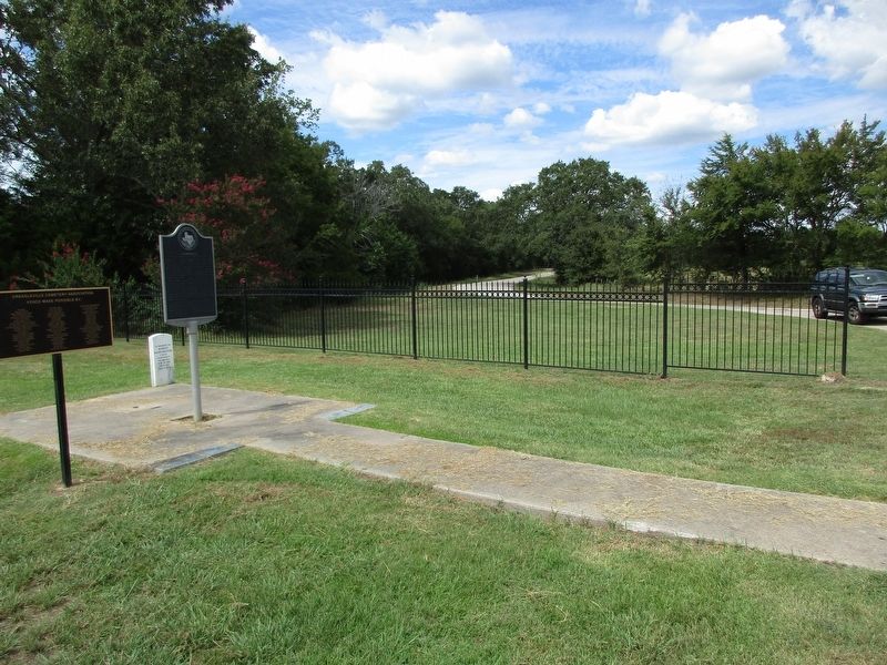
Location. 32° 40.104′ N, 95° 45.276′ W. Marker is near Grand Saline, Texas, in Van Zandt County. It is in Creagleville. It is on County Road 1818 near County Road 1820. 1 mi. W of Grand Saline on US 80 to CR 1818; inside the cemetery entrance. Touch for map. Marker is at or near this postal address: 701 Co Rd 1818, Grand Saline TX 75140, United States of America. Touch for directions.

Regionally, this marker is in the American South and in the Piney Woods. Globally, it is in North America, a Gulf of Mexico state, the Western Hemisphere, the Western World, and the Anglosphere. Historically, it finds itself in what was once New Spain, the Republic of Texas, one of the Confederate States of America, and the Antebellum South.
Other nearby markers. At least 8 other markers are within 5 miles of this marker, measured as the crow flies: Benjamin Franklin Wheeler (approx. ¼ mile away); Mercer's Colony Eastern Boundary (approx. 0.3 miles away); Poletown and Rhodesburg
Photographed by Jeff Leichsenring, September 2, 2024
2. Creagleville Marker
Credits. This page was last revised on September 5, 2024. It was originally submitted on September 3, 2024, by Jeff Leichsenring of Garland, Texas. This page has been viewed 358 times since then and 54 times this year. Photos: 1, 2. submitted on September 3, 2024, by Jeff Leichsenring of Garland, Texas. • James Hulse was the editor who published this page.
