Enoch in Iron County, Utah — The American Mountains (Southwest)
Johnson's Spring
| — | Enoch Trails | — |

Photographed by Jeremy Snow, September 3, 2024
1. Johnson's Spring Marker
This general area was the initial home of the first Anglo to live in Enoch. In November 1851, Joel Hills Johnson built a rough residence of two dugout shelters and moved part of his family here in December. He was a prolific writer of poems and hymns, including the popular LDS hymn "High on the Mountain Top." Later, he abandoned this crude home and directed the building of Johnson's Fort (Marker #5).
ENOCH TRAILS
Historical Marker # 3 GPS: 37.778104 N 113.021480 W Elevation: 5,566 feet
Marker #4 is about 22 feet south on Enoch Road.
Erected by Enoch City - Enoch Trails. (Marker Number 3.)
Topics and series. This historical marker is listed in these topic lists: Arts, Letters, Music • Settlements & Settlers. In addition, it is included in the Enoch Trails series list. A significant historical month for this entry is November 1851.
Location. 37° 46.689′ N, 113° 1.287′ W. Marker is in Enoch, Utah, in Iron County. It is on North Enoch Road, on the right when traveling south. Touch for map. Marker is at or near this postal address: 5565 N Enoch Road, Cedar City UT 84721, United States of America. Touch for directions.

Regionally,
this page online
Other nearby markers. At least 8 other markers are within walking distance of this marker: Enoch City Logo (a few steps from this marker); Old Log Schoolhouse (within shouting distance of this marker); Johnson's Fort (within shouting distance of this marker); Jones Iron Works Park (about 500 feet away, measured in a direct line); Samuel Bell Home (about 700 feet away); The Jones Family (approx. 0.2 miles away); Enoch Ward Chapel (approx. 0.4 miles away); Mercantile Building (approx. 0.4 miles away). Touch for a list and map of all markers in Enoch.
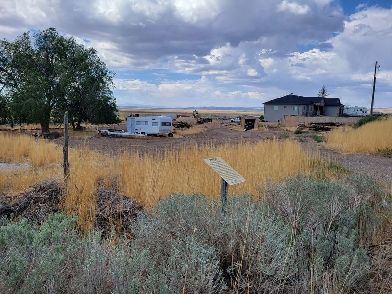
Photographed by Jeremy Snow, September 3, 2024
2. Johnson's Spring Marker
Credits. This page was last revised on September 4, 2024. It was originally submitted on September 3, 2024, by Jeremy Snow of Cedar City, Utah. This page has been viewed 211 times since then and 45 times this year. Photos: 1, 2. submitted on September 3, 2024, by Jeremy Snow of Cedar City, Utah. • Andrew Ruppenstein was the editor who published this page.
