Ballantyne in Charlotte in Mecklenburg County, North Carolina — The American South (South Atlantic)
Technology
Photographed by Mark Parker, September 3, 2024
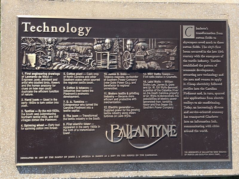
1. Technology Marker
(Main panel with the key to the mural on the plaque and accompanying sculpture)
1. First engineering drawings of Leonardo da Vinci - Engineer, poet, architect and artist who studied birds, flowers and the human anatomy for clues on how man could duplicate the efficient function of nature.
2. Hand loom - Used in the early 1800s to turn cotton into cloth.
3. Textiles - By the mid-1920s, the South was outproducing Northern textile mills, and mill villages dotted the Piedmont.
4. Spinning wheel - Early tool for spinning cotton into thread.
5. Cotton plant - Cash crop of North Carolina and other Southern states which spurred the regional textile boom.
6. Cotton & tobacco - Industries that fueled the Piedmont's economic development.
7. D. A. Tomkins - Entrepreneur who turned the Carolina Piedmont into a textile capital.
8. The loom - Transformed the textile industry in the South.
9. First electric tower - Appeared in the early 1900s in the form of a transmission tower.
10. James B. Duke - Tobacco magnate, cofounder of Southern Power Company (now Duke Power Co.), and benefactor to regional universities.
11.
this page online
12. Electric generator - Supplied power for the growing textile industry using steam turbines on Lake Wylie.
13. WBT Radio Towers - First radio station in Charlotte.
14. Lake Wylie - William States Lee, James B. Duke and Dr. W. Gill Wylie dammed a portion of the Catawba River on the South Carolina property of Dr. Wylle to demonstrate the possibilities of electric power generated from, tumbling water and thus began the Southern Power Company.
(right panel)
Charlotte's transformation from cotton fields to skyscrapers owed much to those cotton fields. The city's first boom occurred in the late 19th century with the emergence of the textile industry. Textiles established the pattern of economic development, attracting new technology and the men and women to apply it. Cheap electricity followed textiles into the Carolina Piedmont and, in turn, spurred new applications from electric trolleys to air conditioning. Today, an increasingly diverse and service-oriented economy has transported Charlotte into an information hub, communicating
Photographed by Mark Parker, September 3, 2024
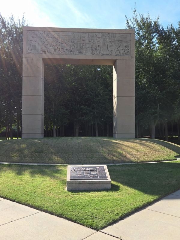
2. Technology Marker and archway
Available parking is at Ballantyne Commons East shopping complex beyond the trees.
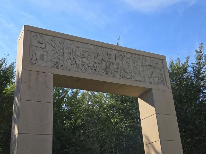
The monuments at Ballantyne were created by painter and sculptor Boris Tomic.
Erected 1995 by The family of James J. & Angela M. Harris.
Topics. This historical marker is listed in these topic lists: Communications • Industry & Commerce • Settlements & Settlers.
Location. 35° 3.263′ N, 80° 50.991′ W. Marker is in Charlotte, North Carolina, in Mecklenburg County. It is in Ballantyne. It can be reached from the intersection of Johnston Road (U.S. 521) and Ballantyne Commons Parkway, on the right when traveling north. The marker is at ground level. Parking is available at the Ballantyne Commons East shopping complex. Touch for map. Marker is at or near this postal address: 14025 Johnston Rd, Charlotte NC 28277, United States of America. Touch for directions.

Regionally, this marker is in North Carolina’s Piedmont. It is also in the American South and specifically in the Upper South. Globally, it is in North America, the Western Hemisphere, the Western World, and the Anglosphere. Historically, it finds itself in what was
Photographed by Mark Parker, September 3, 2024
3. Technology sculpture
Other nearby markers. At least 8 other markers are within 3 miles of this marker, measured as the crow flies: Human Spirit (within shouting distance of this marker); Transportation (within shouting distance of this marker); Finance (about 300 feet away, measured in a direct line); The Revolution in the Back Country / Sumpter's Camp at Clems Branch (approx. 1.9 miles away in South Carolina); The Revolution in the Backcountry / Sumter's Camp at Clems Branch (approx. 2.3 miles away in South Carolina); Trading Path (approx. 2.4 miles away); Polk Family Cemetery (approx. 2.4 miles away); President James K. Polk S.H.S. (approx. 2.4 miles away). Touch for a list and map of all markers in Charlotte.
Credits. This page was last revised on September 4, 2024. It was originally submitted on September 4, 2024, by Mark Parker of Hickory, North Carolina. This page has been viewed 269 times since then and 30 times this year. Photos: 1, 2, 3. submitted on September 4, 2024, by Mark Parker of Hickory, North Carolina. • Bernard Fisher was the editor who published this page.
