Newfane in Niagara County, New York — The American Northeast (Mid-Atlantic)
Site of Stone Marking the Northernmost Point of the Transit Surveyed by Joseph Ellicott

Photographed by Anton Schwarzmueller, June 2, 2025
1. Site of Stone Marking the Northernmost Point of the Transit Surveyed by Joseph Ellicott Marker
Repainted; reinstalled.
Erected 1985 by Town of Newfane Historical Society.
Topics. This historical marker is listed in this topic list: Exploration. A significant historical year for this entry is 1800.
Location. 43° 20.427′ N, 78° 41.807′ W. Marker is in Newfane, New York, in Niagara County. It is at the intersection of East Lake Road (New York State Route 18) and Transit Road, on the right when traveling west on East Lake Road. Marker is just east of the community of Olcott Beach. Touch for map. Marker is at or near this postal address: 6201 East Lake Road, Burt NY 14028, United States of America. Touch for directions.

Regionally, this marker is in Upstate New York, specifically in Western New York, and in the Buffalo Metropolitan Area. It is also in the American Northeast and in the Mid-Atlantic. Globally, it is in North America, on the Great Lakes, in the Western Hemisphere, in the Western World, and in the Anglosphere. Historically, it finds itself in what was once the Viceroyalty of New France,
this page online
Other nearby markers. At least 8 other markers are within walking distance of this marker: Broad Axe Jim (approx. 0.7 miles away); Olcott Beach Hotel (approx. 0.8 miles away); In Memory of Those Who for Their Splendid Spirit of Duty (approx. 0.8 miles away); Mike Rann (approx. 0.8 miles away); Olcott Beach (approx. 0.8 miles away); Tom Kelly Rustic Theatre (approx. 0.8 miles away); Kiddie Whistle Pig Ferris Wheel (approx. 0.9 miles away); Olcott Amusement Park (approx. 0.9 miles away). Touch for a list and map of all markers in Newfane.
More about this marker. This is the nothernmost point of the transit due to Lake Ontario.
Regarding Site of Stone Marking the Northernmost Point of the Transit Surveyed by Joseph Ellicott. The Holland Land Company purchased western New York State. The company office is itself a historic site in Batavia, NY.
Related markers. Click here for a list of markers that are related to this marker. Markers for the Holland Land Company Office and Joseph Ellicott in Batavia, NY.
Also see . . .
1. The Holland Land Company - Wikipedia.
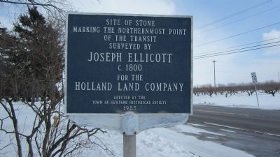
Photographed by Anton Schwarzmueller, March 3, 2014
2. Northern Endpoint of Transit Surveyed by Joseph Ellicott Marker
2. Joseph Ellicott (surveyor) - Wikipedia. (Submitted on March 4, 2014, by Anton Schwarzmueller of Wilson, New York.)
3. Holland Land Office Museum. (Submitted on March 4, 2014, by Anton Schwarzmueller of Wilson, New York.)

Photographed by Anton Schwarzmueller, June 2, 2025
3. Site of Stone Marking the Northernmost Point of the Transit Surveyed by Joseph Ellicott Marker
Repainted, reinstalled.
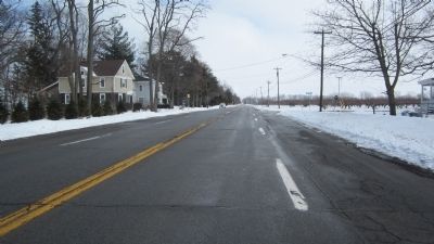
Photographed by Anton Schwarzmueller, March 3, 2014
4. Eastward View of the Marker
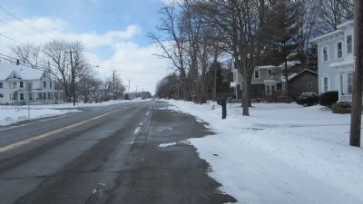
Photographed by Anton Schwarzmueller, March 3, 2014
5. Wesward View of the Marker
This side of the marker may be obscured during foliage. Transit Road is across from the marker. The marker is on the Lake Ontario side of NY Route 18.
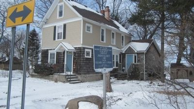
Photographed by Anton Schwarzmueller, March 3, 2014
6. Stone and Marker

Photographed by Bruce InCharlotte, July 3, 2024
7. Site of Stone Marking the Northernmost Point of the Transit Surveyed by Joseph Ellicott Marker
Credits. This page was last revised on June 5, 2025. It was originally submitted on March 4, 2014, by Anton Schwarzmueller of Wilson, New York. This page has been viewed 1,128 times since then and 46 times this year. Last updated on September 8, 2024, by Marguerite Newton of Olcott, New York. Photos: 1. submitted on June 2, 2025, by Anton Schwarzmueller of Wilson, New York. 2. submitted on March 4, 2014, by Anton Schwarzmueller of Wilson, New York. 3. submitted on June 2, 2025, by Anton Schwarzmueller of Wilson, New York. 4, 5, 6. submitted on March 4, 2014, by Anton Schwarzmueller of Wilson, New York. 7. submitted on July 27, 2024, by Bruce InCharlotte of Charlotte, North Carolina. • Devry Becker Jones was the editor who published this page.
