Tom Bean in Grayson County, Texas — The American South (West South Central)
City of Tom Bean
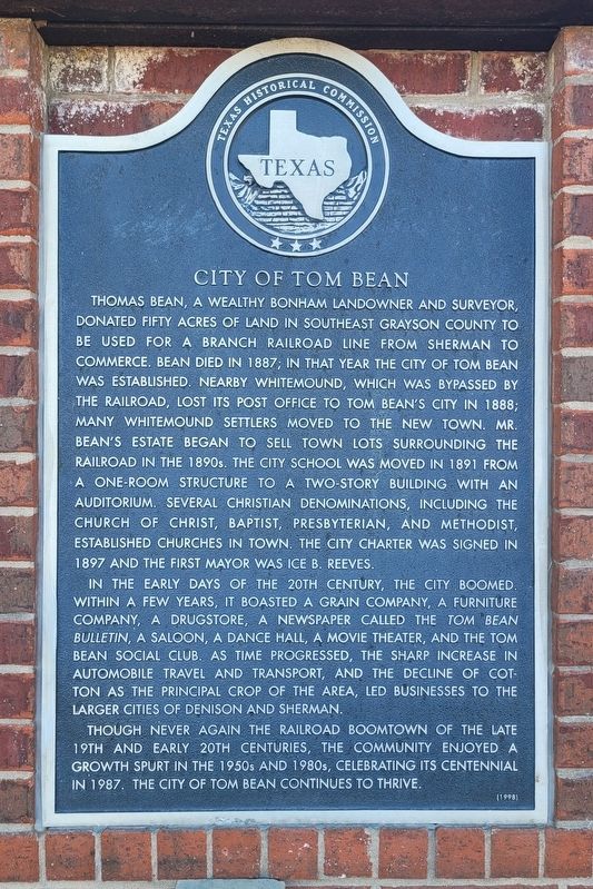
Photographed by James Hulse, September 10, 2024
1. City of Tom Bean Marker
In the early days of the 20th century, the city boomed. Within a few years, it boasted a grain company, a furniture company, a drugstore, a newspaper called the Tom Bean Bulletin, a saloon, a dance hall, a movie theater, and the Tom Bean Social Club. As time progressed, the sharp increase in automobile travel and transport, and the decline of cotton as the principal crop of the area, led businesses to the larger cities of Denison and Sherman.
Though never again the railroad boomtown of the late 19th and early 20th centuries, the community enjoyed a growth spurt in the 1950s and 1980s, celebrating its centennial in 1987. The city of Tom Bean continues to thrive.
Erected 1998 by Texas Historical Commission. (Marker Number 11913.)
Topics. This historical marker is listed in these topic lists: Industry & Commerce • Railroads & Streetcars • Settlements & Settlers. A significant historical year for this entry is 1887.
Location. 33° 31.174′ N, 96° 29.071′ W. Marker is in Tom Bean, Texas, in Grayson County. It is at the intersection
this page online

Regionally, this marker is in the Prairies & Lakes Region. It is also in the American South. Globally, it is in North America, a Gulf of Mexico state, the Western Hemisphere, the Western World, and the Anglosphere. Historically, it finds itself in what was once New Spain, the Republic of Texas, one of the Confederate States of America, and the Antebellum South.
Other nearby markers. At least 8 other markers are within 5 miles of this marker, measured as the crow flies: In Honor of Tom Bean Area Veterans (here, next to this marker); First United Methodist Church (approx. one mile away); Site of Early Grayson County Settlement Whitemound (approx. 1.4 miles away); Kentucky Town (approx. 2.7 miles away); Vittitoe Cemetery (approx. 2.8 miles away); Old Cedar Community (approx. 3.2 miles away); Whitewright (approx. 4.8 miles away);

Photographed by James Hulse, September 10, 2024
2. City of Tom Bean Marker (left marker)
Also see . . . Tom Bean, TX. Texas State Historical Association (TSHA) (Submitted on September 11, 2024, by James Hulse of Medina, Texas.)
Credits. This page was last revised on September 11, 2024. It was originally submitted on September 10, 2024, by James Hulse of Medina, Texas. This page has been viewed 442 times since then and 19 times this year. Photos: 1, 2. submitted on September 11, 2024, by James Hulse of Medina, Texas.
