Buxton in Dare County, North Carolina — The American South (South Atlantic)
Welcome to Buxton…
Outer Banks National Scenic Byway

Photographed by Tom Bosse, September 7, 2024
1. Welcome to Buxton… Marker
Since the 1950s, surfers have been playing in Buxton’s waves and have come from all over the world to ride the legendary waves in the shade of the Cape Hatteras Lighthouse.
It took a group of island kids to harness the waves that sunk ships and stranded mariners on the fabled “Graveyard of the Atlantic”. The early core of Hatteras Island surfers were teenagers John Ochs and Buddy Hooper. They were eventually joined in the water by brothers Stewart and John Couch, Ray Gray, Elvin Hooper, Shelley Rollinson, and Asa Gray.
In the 1970s, Buxton’s johnny Conner started renting surfboards from an abandoned mobile home that eventually became J.C.’s Surf Shop. Soon after, surf shops opened in an old post office and a burger joint and board manufacturing took place in garages and a tanning salon. Drawn to the island’s consistent waves, some surfers decided to relocate to Hatteras Island. To survive, surfers became commercial fishermen, photographers, a screen repairer, real estate agents, servers, restaurant owners, a writer, carpenters and contractors.
The great surf drew accomplished
this page online
Eventually traditional surfing led to the invention of other dynamic watersports such as wind surfing, kite boarding and stand-up paddle boarding.
Watch all these watersports in action along both sides of the North Carolina’s Outer Banks National Scenic Byway, NC 12.
A Taste of Buxton...
Hatteras-Style Clam Chowder
2 cups of chucked clams, chopped, and juiced (about 12 chowder clams)
1 cup diced potatoes
½ cup diced onions
1 cup of cold water
¼ pound salt pork, fried and grease rendered
Black pepper and sea salt to taste
Drain juice from clams and reserve. Chop clams and set aside. Combine water, clam juice, potatoes, onions and salt pork grease in a medium-size pot. Bring to a boil and then simmer until potatoes are tender. Add chopped clams and simmer for about 10 more minutes. Add a pinch of sea salt and a few good grinds of black pepper.
Traditional
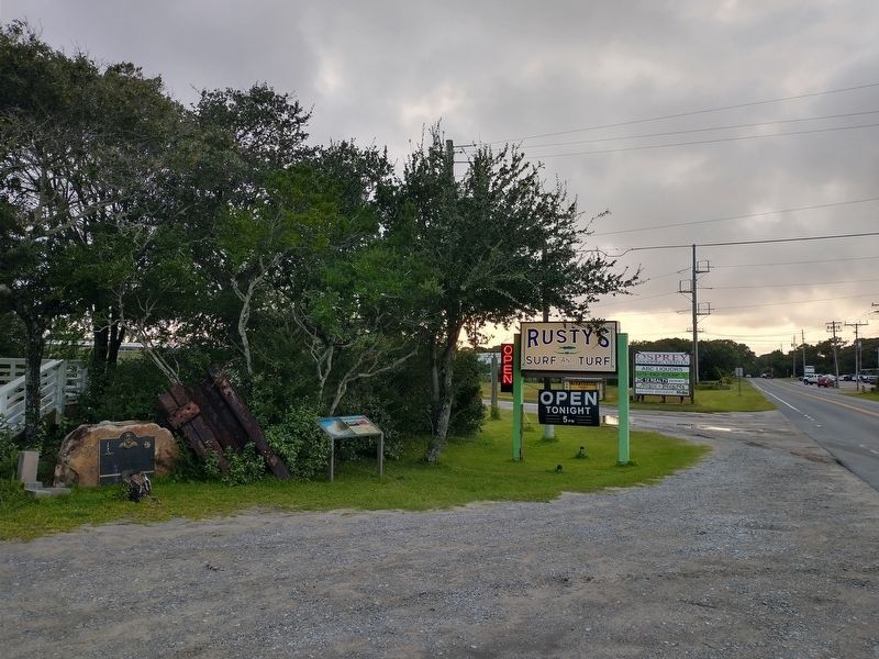
Photographed by Tom Bosse, September 7, 2024
2. Welcome to Buxton… Marker
(sidebar)
Outer Banks National Scenic Byway
The Outer Banks National Scenic Byway traverses one of the nation’s great coastal landscapes. Tidal marshes, wind-swept dunes, lonesome beaches and beautiful sounds line the 138-mile route. Two national seashores are home to four lighthouses. Two national wildlife refuges highlight the region’s rich biological diversity. You are invited to experience the maritime heritage of 21 traditional villages and communities.
(captions)
Surfer in a barrel Daniel Pullen
Original Hatteras Island Surf Shop (an old post office) Michael Halminski
Original Natural Arts Surf Shop (previously a burger joint) Natural Arts Collection
J.C. Conner’s Surf Shop Logo Conner Collection
Erected by Federal Highway Administration National Scenic Byways Program; Dare, Hyde, and Carteret Counties; Dare County Tourism Board.
Topics and series. This historical marker is listed in this topic list: Settlements & Settlers. In addition, it is included in the Lighthouses, and the Outer Banks National Scenic Byway series lists.
Location. 35° 15.995′ N, 75° 31.867′ W. Marker is in Buxton, North Carolina, in Dare County. It is on North Carolina Route 12 0.2 miles west of Buxton Road, on the left when traveling west. Touch for map. Marker is at or near this postal address: 47355 NC-12, Buxton NC 27920, United States of America. Touch for directions.

Regionally, this marker is in North Carolina’s Coastal Plain and on the Outer Banks. It is also in the American South, specifically in the Upper South, in the Tidewater, and on the Eastern Seaboard. Globally, it is in the North Atlantic Region, North America, the Western Hemisphere, the Western World, and the Anglosphere. Historically, it finds itself in what was once the territory of the Mississippian Culture, one of the original Thirteen Colonies, one of the Confederate States of America, and the Antebellum South.
Other nearby markers. At least 8 other markers are within one mile of this marker, measured as the crow flies: Cape Hatteras Lighthouse (approx. 0.4 miles away); Diamond Shoals (approx. 0.6 miles away); Radio Milestone (approx. 0.7 miles away); A Shifting Shoreline, An Imperiled Lighthouse (approx. one mile away); Lighthouse Move Path (approx. one mile away); a different marker also named Lighthouse Move Path (approx. one mile away); a different marker also named Lighthouse Move Path (approx. one mile away); Inching Inland (approx. 1.1 miles away). Touch for a list and map of all markers in Buxton.
Credits. This page was last revised on September 11, 2024. It was originally submitted on September 11, 2024, by Tom Bosse of Jefferson City, Tennessee. This page has been viewed 349 times since then and 46 times this year. Photos: 1, 2. submitted on September 11, 2024, by Tom Bosse of Jefferson City, Tennessee. • Bernard Fisher was the editor who published this page.
