
Ocracoke in Hyde County, North Carolina — The American South (South Atlantic)
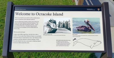
Welcome to Ocracoke Island
| — | Cape Hatteras National Seashore | — |
Photographed by Tom Bosse, September 10, 2024
1. Welcome to Ocracoke Island Marker
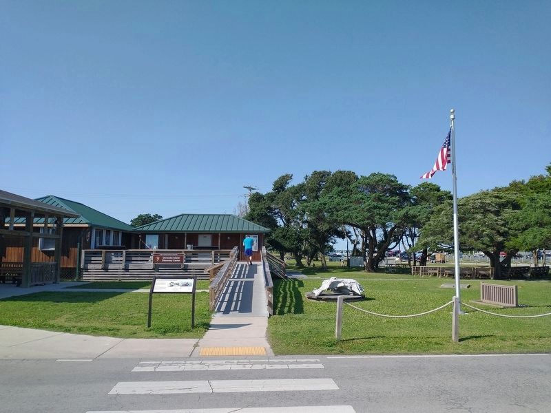
Visit our Discovery Center to learn more about the island and Cape Hatteras National Seashore. The building is open daily during the summer – hours are posted on the door. Trip planning and park information are available on the outside deck 24 hours a day.
Did you arrive by boat?
It takes some effort to get here, but the ferry ride is worth it. If you came from Hatteras Island, you probably noticed the ferry’s round-about route. The Hatteras Inlet is shallow, and the channel is always shifting. In fact, Ocracoke Island was once connected to Hatteras Island. A storm in 1846 created the inlet.
(captions)
Eagerly awaiting the mail! The mailboat Aleta arrives to a crowd at the Ocracoke Island dock.
Brown Pelican You can find hundreds of bird species here, including permanent residents like this talented diver.
North Atlantic right whale skull (on lawn) This segment is all that remains of the 60-foot whale that washed ashore in 1988. Each spring and fall small groups of these endangered plankton-feeding giants migrate past the Outer Banks.
Erected by National
this page online
Topics. This historical marker is listed in this topic list: Notable Places. A significant historical year for this entry is 1846.
Location. 35° 6.966′ N, 75° 59.171′ W. Marker is in Ocracoke, North Carolina, in Hyde County. It is at the intersection of Irvin Garrish Highway (North Carolina Route 12) and Pilot Town Circle, on the right when traveling west on Irvin Garrish Highway. Marker located outside the Ocracoke Island Discovery Center. Touch for map. Marker is at or near this postal address: 38 Irvin Garrish Hwy, Ocracoke NC 27960, United States of America. Touch for directions.

Regionally, this marker is in North Carolina’s Coastal Plain and on the Outer Banks. It is also in the American South, specifically in the Upper South, in the Tidewater, and on the Eastern Seaboard. Globally, it is in the North Atlantic Region, North America, the Western Hemisphere, the Western World, and the Anglosphere. Historically, it finds itself in what was once the territory of the Mississippian Culture, one of the original Thirteen Colonies, one of the Confederate States of America,
Photographed by Tom Bosse, September 10, 2024
2. Ocracoke Island Discovery Center
Other nearby markers. At least 8 other markers are within walking distance of this marker: Harboring Change (within shouting distance of this marker); Lt. Robert Maynard (within shouting distance of this marker); USRC Mercury (about 300 feet away, measured in a direct line); Journey to the original Down East… (about 300 feet away); Welcome to picturesque Ocracoke Island… (about 300 feet away); Welcome to Ocracoke… (about 500 feet away); Late 19th Century Cistern (about 500 feet away); Ship's Rudder (about 500 feet away). Touch for a list and map of all markers in Ocracoke.
Also see . . . Cape Hatteras National Seashore. National Park Service (Submitted on September 12, 2024.)
Credits. This page was last revised on September 12, 2024. It was originally submitted on September 12, 2024, by Tom Bosse of Jefferson City, Tennessee. This page has been viewed 167 times since then and 13 times this year. Photos: 1, 2. submitted on September 12, 2024, by Tom Bosse of Jefferson City, Tennessee. • Bernard Fisher was the editor who published this page.
