
Sherman in Grayson County, Texas — The American South (West South Central)
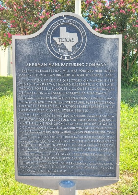
Sherman Manufacturing Company

February 24, 2026
1. Sherman Manufacturing Company Marker
Elected to board of directors on March 18, 1891, were C.A. Andrews, Edward Eastburn, W.C. Eubank, Thomas Forbes, J.F. Jaques, J.C. Jones, Tom Randolph, Z.E. Raney, and J.C. Tassey to serve as chairman.
Elegant cornerstone was shipped from Cromwell, Mass., to go into the original structure. Suffering from financial problems during those early years, the plant operated and closed intermittently.
Acquired in 1906 by Wellington-Sears Company of New York who added buildings and centered production upon single-filling flat duck. Purchased, 1946, by Ely Walker & Company of St. Louis, Missouri; wide sheeting became main product. Merged into Burlington Industries, Inc., 1955.
Cornerstone of original building opened 1956. Disclosed old coins, 1891 newspapers, timetable for trains to Indian Territory (now state of Oklahoma), saloon tokens and menu from Binkley Hotel Coffee Shop.
A portion of the original structure remains as a useful part of this modern plant. Through Burlington's international organization, products made here are sold in market places throughout the world.
Erected 1967 by State Historical Survey Committee. (Marker Number 11536.)
Topics. This historical marker is listed in this topic list: Industry & Commerce. A significant historical date for this entry is March 18, 1891.
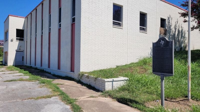
Location. 33° 36.971′ N, 96° 36.544′ W. Marker is in Sherman, Texas, in Grayson County. It is at the intersection of South Sam Rayburn Freeway and West Park Avenue, on the right when traveling north on South Sam Rayburn Freeway. The marker is located at the front of the building. Touch for map. Marker is at or near this postal address: 1815 S Sam Rayburn Fwy, Sherman TX 75090, United States of America. Touch for directions.

Regionally,
this page online
Other nearby markers. At least 8 other markers are within 2 miles of this marker, measured as the crow flies: City of Sherman (approx. 0.3 miles away); Pool Manufacturing Company (approx. half a mile away); St. Mary's Catholic Church (approx. 0.9 miles away); Site of Captain LeTellier's School (approx. 0.9 miles away); Metz House (approx. 1.1 miles away); Lee Simmons (approx. 1.1 miles away); The Rev. J.M. Binkley (approx. 1.1 miles away); Judge C.C. Binkley (approx. 1.1 miles away). Touch for a list and map of all markers in Sherman.
Photographed by James Hulse, September 10, 2024
2. Sherman Manufacturing Company Marker
Photographed by James Hulse, September 10, 2024
3. Sherman Manufacturing Company building and Marker

Photographed by James Hulse, September 10, 2024
4. The view of the Sherman Manufacturing Company building and Marker from the driveway
Credits. This page was last revised on February 28, 2026. It was originally submitted on September 12, 2024, by James Hulse of Medina, Texas. This page has been viewed 656 times since then and 101 times this year. Photos: 1. submitted on February 24, 2026. 2, 3, 4. submitted on September 13, 2024, by James Hulse of Medina, Texas.
