Latham in Albany County, New York — The American Northeast (Mid-Atlantic)
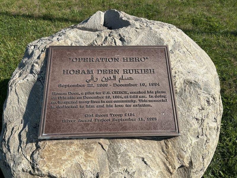
Operation Hero
Hosam Deen Rukieh
| — | September 22, 1969 - December 10, 1994 | — |
Photographed by Steve Stoessel, September 14, 2024
1. Operation Hero Marker
Hosam Deen, pilot for U.S. CHECK, crashed his plane on this site on December 10, 1994, at 2:28 am. In doing so, he spared many lives in our community. This memorial is dedicated to him and his love for aviation.
Erected 1995 by Girl Scout Troop (184).
Topics. This historical marker is listed in these topic lists: Air & Space • Disasters. A significant historical date for this entry is December 10, 1984.
Location. 42° 44.345′ N, 73° 44.017′ W. Marker is in Latham, New York, in Albany County. It is on Troy-Schenectady Road (New York State Route 2) near Semons Avenue, on the left when traveling east. Touch for map. Marker is at or near this postal address: 193 Troy-Schenectady Road, Latham NY 12110, United States of America. Touch for directions.

Regionally, this marker is in Upstate New York, in the Capital District, and in the Albany Metropolitan Area. It is also in the American Northeast and in the Mid-Atlantic. Globally, it is in North America, the Western Hemisphere, the Western World, and the Anglosphere. Historically, it finds itself in what was once New Netherland and also one of the original Thirteen Colonies.
this page online
Other nearby markers. At least 8 other markers are within 2 miles of this marker, measured as the crow flies: Gen. Henry Knox Trail (approx. 1.4 miles away); Latham (approx. 1½ miles away); Newtonville (approx. 1.6 miles away); Maplewood Historic Park (approx. 1.7 miles away); The Weighlock Building (approx. 1.7 miles away); Erie Canal (approx. 1.7 miles away); Peter J. Dalessandro (approx. 1.8 miles away); U.S. Army 3 Inch M5 Antitank Gun (approx. 1.8 miles away). Touch for a list and map of all markers in Latham.
Another marker is no longer nearby. Historic Newtonville (was approx. 1.6 miles away but has been replaced with another marker now near it).
Also see . . . Hosam “Sam” Rukieh. Find A Grave website entry (Submitted on February 20, 2026, by Larry Gertner of New York, New York.)

Photographed by Steve Stoessel, September 14, 2024
2. Operation Hero Marker
Credits. This page was last revised on February 20, 2026. It was originally submitted on September 14, 2024, by Steve Stoessel of Niskayuna, New York. This page has been viewed 233 times since then and 27 times this year. Photos: 1, 2. submitted on September 14, 2024, by Steve Stoessel of Niskayuna, New York.
