Oakville in Halton Region, Ontario — Central Canada (North America)
Lyon’s Log Cabin
Photographed by Tim Boyd, September 8, 2024
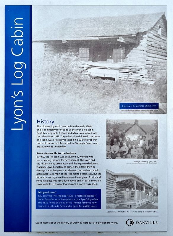
1. Lyon’s Log Cabin Marker
History
The pioneer log cabin was built in the early 1800s and is commonly referred to as the Lyon's log cabin. English immigrants George and Mary Lyon moved into the cabin about 1879. They raised nine children in the home. The cabin was originally located on a 50-acre property, north of the current Town Hall on Trafalgar Road, in an area known as Vernerville.
From Vernerville to the harbour
In 1973, the log cabin was discovered by workers who were clearing the land for development. The town had the historic home taken apart and the logs were hidden at Trafalgar Lawn Cemetery to protect them from theft or damage. Later that year, the cabin was restored and rebuilt at Shipyard Park. Most of the logs had to be replaced, but the form, size, and style are the same as the original. A brick and stone fireplace was also added at one end. In 2014, the cabin was moved to its current location and a porch was added.
Topics. This historical marker is listed in these topic lists: Architecture • Settlements & Settlers. A significant historical year for this entry is 1879.
Location. 43° 26.528′ N, 79° 40.254′ W. Marker is in
this page online

Regionally, this marker is in Greater Toronto, specifically on the Golden Horseshoe, in the Hamilton-Halton-Brant Area, and specifically in the Toronto Metropolitan Area. It is also in Central Canada. Globally, it is in North America, on the Great Lakes, in the Western Hemisphere, in the Western World, and in the Anglosphere. Historically, it finds itself in what was once a British colony, the Viceroyalty of New France, the Haudenosaunee (Iroquois) Confederacy, and Rupert’s Land.
Other nearby markers. At least 8 other markers are within walking distance of this marker: Oakville: Resort Town on Lake Ontario (within shouting distance of this marker); The Young Port Matures (within shouting distance of this marker); Days of Sail and Steam (within shouting distance of this marker); Oakville’s Yachting Heritage (within shouting distance of this marker);

Photographed by Tim Boyd, September 1, 2024
2. Lyon’s Log Cabin Marker

3. Lyon’s Log Cabin marker photo detail

4. Lyon’s Log Cabin marker photos detail

Photographed by Tim Boyd, September 1, 2024
5. Lyon’s Log Cabin
Credits. This page was last revised on September 15, 2024. It was originally submitted on September 14, 2024, by Tim Boyd of Hamilton, Ontario. This page has been viewed 157 times since then and 37 times this year. Photos: 1, 2, 3, 4, 5. submitted on September 14, 2024, by Tim Boyd of Hamilton, Ontario. • Andrew Ruppenstein was the editor who published this page.
