Warrendale in Multnomah County, Oregon — The American West (Northwest)
Warrendale
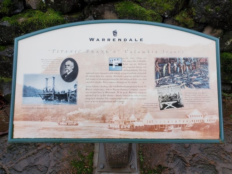
“Titanic Frank’s” Columbia legacy
Photographed by Douglass Halvorsen, November 26, 2021
1. Warrendale Marker
At the industry’s leading edge Portland entrepreneur Frank M. Warren (1848-1912), whose Warren Packing Company cannery was located here at Warrendale. At its peak, Warren’s company operated up to 14 fish wheels—about a thrid of the total number along the Columbia. The cannery employed as many as 150 people, most of them Scandinavians and Chinese.
Captions
[inset photo 1]: After many years of harvesting on the Columbia, Warren realized the need to bolster salmon production. He was an early proponent of hatcheries to augment salmon runs.
[inset photo 2]: Fish wheel near Warren Packing Company cannery.
[inset photo 3]: Frank Warren's productive and influential life was cut short in 1912, when he drowned after helping others onto lifeboats during the sinking of the RMS Titanic. After Warren's death, his children managed the Warren Packing Company until it closed in the 1930s.
[inset photo 4]: The many buildings of the Warren Packing Company cannery are long gone. All that remains are rotting timber piling along "blood beach" - so named for the red sand, stained by the rusting scraps of millions of salmon cans.
[inset photo 5]: Immigrants provided much of the labor in the Columbia River canneries.
Erected by Columbia
this page online
Topics. This historical marker is listed in these topic lists: Industry & Commerce • Settlements & Settlers. A significant historical year for this entry is 1912.
Location. 45° 36.74′ N, 122° 0.238′ W. Marker is in Warrendale, Oregon, in Multnomah County. It is on Historic Columbia River Highway State Trail (U.S. 30), on the right when traveling east. Touch for map. Marker is at or near this postal address: 63645 HCRH State Trail, Cascade Locks OR 97014, United States of America. Touch for directions.

Regionally, this marker is in Oregon’s Columbia River Gorge, in the Willamette Valley, and in Greater Portland Area. It is also on the American Pacific Coast, in the Pacific Northwest, and in the Lewis & Clark Corridor. Globally, it is in North America, on the Ring of Fire, on the Pacific Rim, in the Western Hemisphere, in the Western World, and in the Anglosphere.
Other nearby markers. At least 8 other markers are within 3 miles of this marker, measured as the crow flies: "Remarkable" Rock (approx. 1.2 miles away in Washington); Lewis and Clark National Historic Trail (approx.

Photographed by Douglass Halvorsen, November 26, 2021
2. Warrendale
Credits. This page was last revised on September 20, 2024. It was originally submitted on September 15, 2024, by Douglass Halvorsen of Klamath Falls, Oregon. This page has been viewed 268 times since then and 46 times this year. Photos: 1, 2. submitted on September 15, 2024, by Douglass Halvorsen of Klamath Falls, Oregon. • James Hulse was the editor who published this page.
