
Brockway - Lake Tahoe in Placer County, California — The American West (Pacific Coastal)
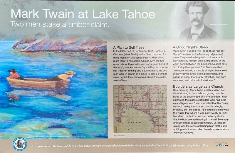
Mark Twain at Lake Tahoe - Two Men Stake a Timber Claim
| — | Mark Twain Timber Claim Adventure Trail | — |
Photographed by David C Antonucci
1. Mark Twain at Lake Tahoe - Two Men Stake a Timber Claim Marker
A Plan to Sell Trees
In the latter part of September 1861, Samuel L. Clemens (Mark Twain) and a friend camped for three nights on this sandy beach. After hiking more than 11 miles from Carson City, the two rowed about three miles across "a deep bend of the lake", now known as Crystal Bay. In order to sell trees for mining and development, the two men were in search of a place to stake a timber claim, which they discovered about three miles west of here.
A Good Night's Sleep
Mark Twain dubbed this location as "Upper Camp" because of the towering ridge above them. They used a flat granite rock as a table to play cards by firelight until falling asleep in the warm sand between the boulders. Despite ants "exploring their persons," as Twain recalled, "We never moved a muscle all night, but waked at early dawn in the original positions, and got up at once, thoroughly refreshed, free from soreness, and brim full of friskiness."
Boulders as Large as a Church
One morning, Mark Twain and his friend set about drifting in the rowboat, gazing over the sides at the submerged offshore boulders. Twain estimated
this page online
Did you know? The two would-be timber barons spent their days working on their timber claim but nearly lost it all when Twain let his campfire escape, setting the forest ablaze.
Erected 2023 by Placer County.
Topics. This historical marker is listed in this topic list: Settlements & Settlers. A significant historical month for this entry is September 1861.
Location. 39° 13.384′ N, 120° 0.518′ W. Marker is in Brockway - Lake Tahoe, California, in Placer County. It can be reached from Lake Street south of Harbor Avenue. Limited parking in the area. Marker is located on the walkway leading to Speedboat Beach. Touch for map. Marker is in this post office area: Kings Beach CA 96143, United States of America. Touch for directions.

Regionally, this marker is in California’s Sacramento Metro, in the Sierra Nevada, and in the Lake Tahoe Basin. It is also in the American Mountain West. Globally, it is in North America, on the Ring of Fire, in the Pacific Rim, in the Western Hemisphere, in the Western World, and in the Anglosphere. Historically, it finds itself in what was once New Spain and also Mexico’s Alta California.
Other nearby markers. At least 8 other markers are within 8 miles of this marker, measured as the crow flies: The Great Incline of the Sierra Nevada (approx. 4.4 miles away in Nevada); Sand Harbor (approx. 4½ miles away in Nevada); The Fairest Picture (approx. 5.2 miles away in Nevada); Tahoe City Begins, 1860 to 1895 (approx. 7.9 miles away); Pioneer Tourism, 1896 to 1926 (approx. 7.9 miles away); Southern Pacific, 1926 to 1945 (approx. 7.9 miles away); Post War, 1946 to 1955 (approx. 7.9 miles away); Olympic Silver, 1956 to 1971 (approx. 7.9 miles away).
More about this marker. Denotes the location of the first night's campsite for Mark Twain and his friend John Kinney as they explored Lake Tahoe.
Also see . . . Mark Twain Timber Claim Adventure Trail (Sierra Nevada Geotourism). Overview:
The Mark Twain Timber Claim Adventure Trail identifies and connects prominent locations visited by Mark Twain as he sought to stake a timber claim at Lake Tahoe. There are six sites where Twain traveled, visited, or camped, and one site provides an elevated overview of the area of his adventure. The trail stretches about 13 miles along Highway 28 in California and Nevada and involves two short but strenuous hikes.(Submitted on September 25, 2024, by David C Antonucci of Homewood, California.)
Credits. This page was last revised on September 25, 2024. It was originally submitted on September 16, 2024, by David C Antonucci of Homewood, California. This page has been viewed 260 times since then and 52 times this year. Photo 1. submitted on September 16, 2024, by David C Antonucci of Homewood, California. • Andrew Ruppenstein was the editor who published this page.
Editor’s want-list for this marker. photo of the marker within its surroundings • Can you help?
