Toboyne Township in New Germantown in Perry County, Pennsylvania — The American Northeast (Mid-Atlantic)
New Germantown
| — | Perry County Bicentennial 1820 - 2020 | — |
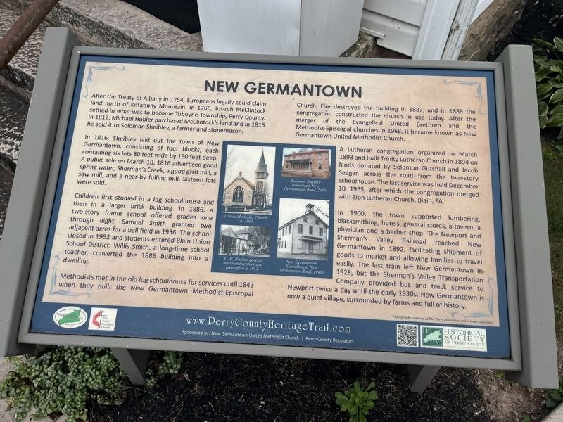
after the Treaty of Albany in 1754, Europeans legally could land north of Kittatinny Mountain. In 1766, Joseph McClintock settled in what was to become Toboyne Township, Perry County. In 1812, Michael Hubler purchased McClintock's land and in 1815 he sold it to Solomon Sheibley, a farmer and stonemason.
In 1816, Sheibley laid out the town of New Germantown, consisting of four blocks, each containing six lots 80 feet wide by 150 feet deep. A public sale on March 18, 1816 advertised good spring water, Sherman's Creek, a good grist mill, a saw mill, and a near-by fulling mill. Sixteen lots were sold.
Children first studied in a log schoolhouse and then a larger brick building. In 1886, a two-story frame school offered grades one through eight. Samuel Smith granted two adjacent acres for a ball field in 1936. The school closed in 1952 and students entered Blain Union School District. Willis Smith, a long-time school teacher, converted the 1886 building into a dwelling.
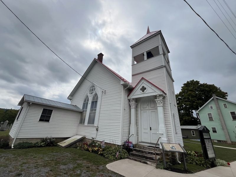
Methodists met in the old log schoolhouse for services until 1843 when they built the New Germantown Methodist-Episcopal Church. Fire destroyed the
this page online
A Lutheran congregation organized in March 1893 and built Trinity Lutheran Church in 1894 on lands donated by Solomon Gushall and Jacob Seager, across the road from the two story schoolhouse. The last service was held December 10, 1965, after which the congregation merged with Zion Lutheran Church, Blain, PA.
In 1900, the town supported lumbering, blacksmithing, hotels, general stores, a tavern, a physician and a barber shop. The Newport and Sherman's Valley Railroad reached New Germantown in 1892, facilitating shipment of goods to market and allowing families to travel easily. The last train left New Germantown in 1928, but the Sherman's Valley Transportation Company provided bus and truck service to Newport twice a day until the early 1930s. New Germantown is now a quiet village, surrounded by farms and full of history.
Erected 2020 by The United Methodist Church; Historical Society
Photographed by Devry Becker Jones (CC0), September 21, 2024
2. New Germantown Marker in front of the Methodist Church
Topics and series. This historical marker is listed in these topic lists: Education • Railroads & Streetcars • Religion & Religious Structures • Settlements & Settlers. In addition, it is included in the Pennsylvania, Perry County Heritage Trail series list. A significant historical date for this entry is March 18, 1816.
Location. 40° 18.495′ N, 77° 34.27′ W. Marker is in New Germantown, Pennsylvania, in Perry County. It is in Toboyne Township. It is at the intersection of Big Spring Road (Pennsylvania Route 274) and Birch Run Lane, on the right when traveling east on Big Spring Road. Touch for map. Marker is at or near this postal address: 3390 Big Spring Road, Blain PA 17006, United States of America. Touch for directions.

Regionally, this marker is in South-Central Pennsylvania, in the Susquehanna Valley, and in Greater Harrisburg. It is also in the American Northeast, in the Mid-Atlantic, in Appalachia, and specifically in Northern Appalachia. Globally, it is in North America, the Western Hemisphere, the Western World, and the Anglosphere. Historically, it finds itself in what was once the Haudenosaunee (Iroquois) Confederacy and also one of the original Thirteen Colonies.
Other nearby markers. At least 8 other markers are within 4 miles of this marker, measured as the crow flies: A different marker also named New Germantown (approx. 0.2 miles away); The Bureau of Forestry (approx. 1.1 miles away); Magdalena Briner Eby (approx. 1½ miles away); Fairview Church (approx. 2.6 miles away); Blain (approx. 3.4 miles away); Blain Planing Mill (approx. 3.7 miles away); Newport & Sherman's Valley Railroad (approx. 3.7 miles away); Blain Fire Company, Inc. (approx. 3.7 miles away). Touch for a list and map of all markers in New Germantown.
Credits. This page was last revised on September 22, 2024. It was originally submitted on September 22, 2024, by Devry Becker Jones of Washington, District of Columbia. This page has been viewed 929 times since then and 120 times this year. Photos: 1, 2. submitted on September 22, 2024, by Devry Becker Jones of Washington, District of Columbia.
