Near Brandy Station in Culpeper County, Virginia — The American South (Mid-Atlantic)
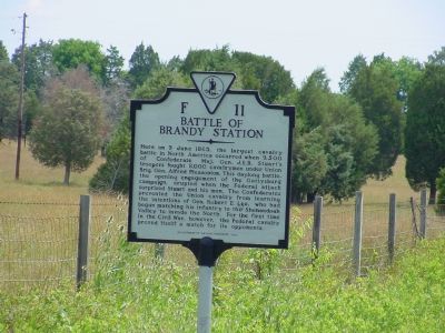
Battle of Brandy Station
Here on 9 June 1863, the largest cavalry battle in North America occurred when 9,500 troopers fought 8,000 cavalrymen under Union Brig. Gen. Alfred Pleasonton. This daylong battle, the opening engagement of the Gettysburg campaign, erupted when the Federal attack surprised Stuart and his men. The Confederates prevented the Union cavalry from learning the intentions of Gen. Robert E. Lee, who had begun marching his infantry to the Shenandoah Valley to invade the North. For the first time in the Civil War, however, the Federal cavalry proved itself a match for its opponents.
Erected 1995 by Department of Historic Resources. (Marker Number F-11.)
Topics and series. This historical marker is listed in this topic list: War, US Civil. In addition, it is included in the Virginia Department of Historic Resources (DHR) series list. A significant historical date for this entry is June 9, 1863.
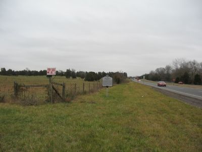
Location. 38° 30.467′ N, 77° 52.383′ W. Marker is near Brandy Station, Virginia, in Culpeper County. Marker is on James Madison Highway (U.S. 15/29) south of Berry Hill Road, on the right when traveling south. Touch for map. Marker is in this post office area: Brandy Station VA 22714, United States of America. Touch for directions.
Other nearby markers. At least 8 other markers are within walking distance of this marker. A different marker also named Battle of Brandy Station (approx. 0.3 miles away); a different marker also named Battle of Brandy Station (approx. 0.3 miles away); a different marker also named Battle of Brandy Station (approx. 0.3 miles away); a different marker also named Battle of Brandy Station (approx. 0.4 miles away); George C. Hupp (approx. 0.4 miles away); a different marker also named Battle of Brandy Station (approx. 0.4 miles away); a different marker also named Battle of Brandy Station (approx. 0.4 miles away); a different marker also named Battle of Brandy Station (approx. 0.4 miles away). Touch for a list and map of all markers in Brandy Station.
More about this marker. This marker replaced two previous markers with the same number and title. The first read, "This was the scene of many cavalry actions. A great cavalry battle took place here, on June 9, 1863, between Stuart, screening Lee's move to Gettysburg, and the cavalry of Hooker's army." The second read, "In this vicinity was fought one of the greatest Cavalry Battles of the Civil War. On June 9, 1863 Union forces under Pleasonton attacked Stuart, who was screening Lee's Northward movement toward Pennsylvania. After heavy fighting Pleasonton withdrew."
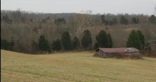
Regarding Battle of Brandy Station. This is one of several markers interpreting the Battle of Brandy Station and the winter encampments of 1863-64 in Culpeper County. See the Battle of Brandy Station Virtual Tour by Markers linked below for additional related markers.
Also see . . .
1. Civil War Battle of Brandy Station June 9, 1863. American Civil War website entry:
Short description illustrated with three period photographs. (Submitted on September 18, 2007.)
2. Prelude to Gettysburg: The Battle of Brandy Station. National Park Service website entry (Submitted on April 29, 2024, by Larry Gertner of New York, New York.)
3. Battle of Brandy Station Virtual Tour by Markers. A set markers that document the Battle of Brandy Station, June 9, 1863, and the Winter Encampment of 1863-64. Note the order of appearance is geographic and not chronologically aligned to the battle. (Submitted on January 1, 2008, by Craig Swain of Leesburg, Virginia.)

Photographed By Craig Swain, December 22, 2007
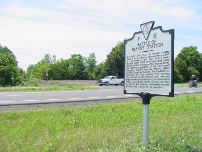
3. Looking northeast at the Marker along the Highway
While there is ample pull off space along the highway to view the marker, visitors should be cautious about stopping and use hazard lights to alter other motorists when stopping. For the most safety, carefully pull off at the farm lane just past (west) of the marker. But this lane is a private entrance, so respect the fence line and property.
Credits. This page was last revised on April 29, 2024. It was originally submitted on September 18, 2007, by J. J. Prats of Powell, Ohio. This page has been viewed 2,359 times since then and 55 times this year. Photos: 1, 2. submitted on September 18, 2007, by J. J. Prats of Powell, Ohio. 3, 4. submitted on December 30, 2007, by Craig Swain of Leesburg, Virginia.


