Durham in Durham County, North Carolina — The American South (South Atlantic)
From Bus Station to Museum
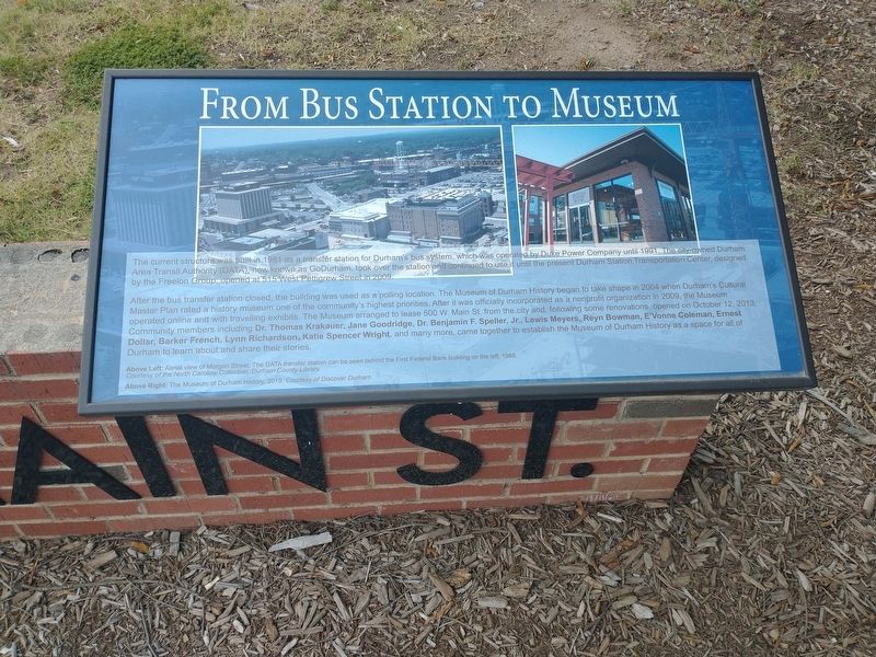
Photographed by Tom Bosse, September 14, 2024
1. From Bus Station to Museum Marker
After the bus transfer station closed, the building was used as a polling location. The Museum of Durham History began to take shape in 2004 when Durham’s Cultural Master Plan rated a history museum one of the community’s highest priorities After it was officially incorporated as a nonprofit organization in 2009, the Museum operated online and with travelling exhibit. The Museum arranged to lease 500 W. Main St. from the city and, following some renovations, opened on October 12, 2013. Community members including Dr. Thomas Krakauer, Jane Goodridge, Dr. Benjamin F. Speller, Jr., Lewis Meyers, Reyn Bowman, E’Vonne Coleman, Ernest Dollar, Barker French, Lynn Richardson, Katie Spencer Wright, and many more, came together to establish
this page online
(captions)
Above Left: Aerial view of Morgan Street. The DATA transfer station can be seen behind the First Federal Bank building on the left, 1988. Courtesy of the North Carolina Collection, Durham County Library.
Above Right: The Museum of Durham History, 2019. Courtesy of Discover Durham.
Erected by Museum of Durham History.
Topics. This historical marker is listed in this topic list: Notable Buildings. A significant historical date for this entry is October 12, 2013.
Location. 35° 59.88′ N, 78° 54.312′ W. Marker is in Durham, North Carolina, in Durham County. It is at the intersection of North Great Jones Street (Downtown Loop) and West Main Street (Business U.S. 70), on the right when traveling west on North Great Jones Street (Downtown Loop). Touch for map. Marker is at or near this postal address: 500 W Main St, Durham NC 27701, United States of America. Touch for directions.

Regionally, this marker is in the Piedmont and in the Research Triangle. It is also in the American South and specifically in the Upper South. Globally,

Photographed by Tom Bosse, September 14, 2024
2. From Bus Station to Museum Marker
Marker is on the right.
Other nearby markers. At least 8 other markers are within walking distance of this marker: Durham’s Urban Renewal (here, next to this marker); The Freight Depot (here, next to this marker); The Globe Warehouse (here, next to this marker); Our Day Out (within shouting distance of this marker); Five Points Loan Company (about 600 feet away, measured in a direct line); Emanuel J. Evans, 1907-1997, and Sara N. Evans, 1905-1986 (approx. 0.2 miles away); Visionary Leadership in the New South (approx. ¼ mile away); John Hope Franklin (approx. 0.3 miles away). Touch for a list and map of all markers in Durham.
Related markers. Click here for a list of markers that are related to this marker. The Story of 500 W. Main Street
Also see . . . Museum of Durham History. (Submitted on September 23, 2024.)

Photographed by Tom Bosse, September 14, 2024
3. The Story of 500 W. Main Street
Credits. This page was last revised on September 23, 2024. It was originally submitted on September 22, 2024, by Tom Bosse of Jefferson City, Tennessee. This page has been viewed 270 times since then and 48 times this year. Photos: 1, 2, 3. submitted on September 22, 2024, by Tom Bosse of Jefferson City, Tennessee. • Bernard Fisher was the editor who published this page.
