Stewartstown in York County, Pennsylvania — The American Northeast (Mid-Atlantic)
POW's in the Stewartstown Community
Photographed by Devry Becker Jones (CC0), September 21, 2024
1. POW's in the Stewartstown Community Marker
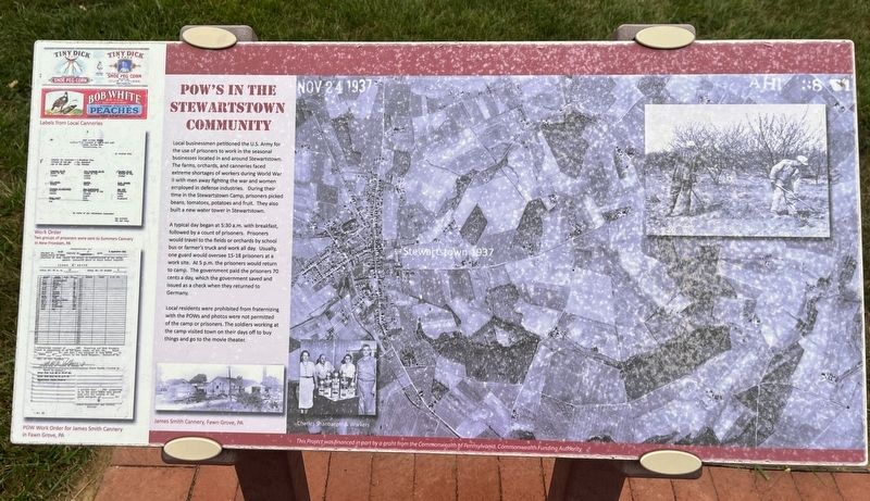
Local businessmen petitioned the U.S. Army for the use of prisoners to work in the seasonal businesses located in and around Stewartstown. The farms, orchards, and canneries faced extreme shortages of workers during World War II with men away fighting the war and women employed in defense industries. During their time in the Stewartstown Camp, prisoners picked beans, tomatoes, potatoes and fruit. They also built a new water tower in Stewartstown.
A typical day began at 5:30 a.m. with breakfast followed by a count of prisoners. Prisoners would travel to the fields or orchards by school bus or farmer's truck and work all day. Usually, one guard would oversee 15-18 prisoners at a work site. At 5 p.m. the prisoners would return to the camp. The government paid the prisoners 70 cents a day, which the government saved and issued as a check when they returned to Germany.
Local residents were prohibited from fraternizing with the POWs and photos were not permitted of the camp or prisoners. The soldiers working at the camp visited town on their days off to buy things and to go to the movie theater.
Topics. This historical
this page online
Location. 39° 45.045′ N, 76° 35.316′ W. Marker is in Stewartstown, Pennsylvania, in York County. It can be reached from College Avenue (Pennsylvania Route 851) 0.3 miles east of South Main Street ( Route 24), on the right when traveling east. Touch for map. Marker is at or near this postal address: 14 College Ave, Stewartstown PA 17363, United States of America. Touch for directions.

Regionally, this marker is in South-Central Pennsylvania, specifically in Pennsylvania Dutch Country, in the Susquehanna Valley, and in Greater Harrisburg. It is also in the American Northeast and in the Mid-Atlantic. Globally, it is in North America, the Western Hemisphere, the Western World, and the Anglosphere. Historically, it finds itself in what was once the Haudenosaunee (Iroquois) Confederacy and also one of the original Thirteen Colonies.
Other nearby markers. At least 8 other markers are within walking distance of this marker: Boy Scout Building (within shouting distance of this marker); Concession Stand
Photographed by Devry Becker Jones (CC0), September 21, 2024
2. POW's in the Stewartstown Community Marker
Credits. This page was last revised on September 22, 2024. It was originally submitted on September 22, 2024, by Devry Becker Jones of Washington, District of Columbia. This page has been viewed 204 times since then and 21 times this year. Photos: 1, 2. submitted on September 22, 2024, by Devry Becker Jones of Washington, District of Columbia.
