Quadrate in Mannheim, Baden-Württemberg, Germany — Central Europe
Erster Schlossbau im 17. Jahrhundert
⎯⎯⎯
First Castle Built in the 17th Century
Photographed by James Hulse, February 20, 2024
1. Erster Schlossbau im 17. Jahrhundert / First castle built in the 17th century Marker

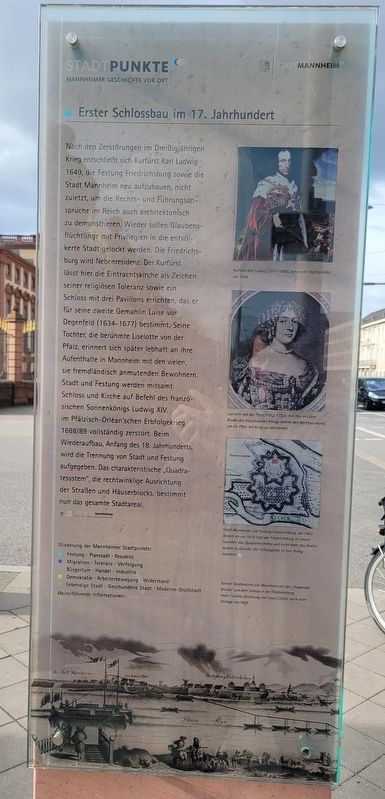
Nach den Zerstörungen im Dreißigjährigen Krieg entschließt sich Kurfürst Karl Ludwig 1649, die Festung Friedrichsburg sowie die Stadt Mannheim neu aufzubauen, nicht zuletzt, um die Rechts- und Führungsansprüche im Reich auch architektonisch zu demonstrieren. Wieder sollen Glaubensflüchtlinge mit Privilegien in die entvölkerte Stadt gelockt werden. Die Friedrichsburg wird Nebenresidenz. Der Kurfürst lässt hier die Eintrachtskirche als Zeichen seiner religiösen Toleranz sowie ein Schloss mit drei Pavillons errichten, das er für seine zweite Gemahlin Luise von Degenfeld (1634-1677) bestimmt. Seine Tochter, die berühmte Liselotte von der Pfalz, erinnert sich später lebhaft an ihre Aufenthalte in Mannheim mit den vielen, sie fremdländisch anmutenden Bewohnern. Stadt und Festung werden mitsamt Schloss und Kirche auf Befehl des französischen Sonnenkönigs Ludwig XIV. im Pfälzisch-Orléan'schen Erbfolgekrieg 1688/89 vollständig zerstört. Beim Wiederaufbau, Anfang des 18. Jahrhunderts, wird die Trennung von Stadt und Festung aufgegeben. Das charakteristische „Quadratesystem", die rechtwinklige Ausrichtung der Straßen und Häuserblocks, bestimmt nun das gesamte Stadtareal. © Stadtarchiv Mannheim Institut Für Stadtgeschichte
Bildunterschriften
(Foto Nr. 1) Kurfürst Karl Ludwig (1617-1880), der zweite Stadtgründer, um 1649.
(Foto Nr. 2) Liselotte von der Pfalz (1652-1722). Ihre Ehe mit dem Bruder des französischen Königs lieferte den Rechtsvorwand, um die Pfalz mit Krieg zu überziehen.
(Foto Nr. 3) Stadt Mannheim und Festung Friedrichsburg, um 1663. Anders als vor 1618 liegt der Friedrichsburg im Innern nunmehr das Quadrateschema und nicht mehr das Radialsystem zu Grunde. Der Schlossplatz ist hier farbig morkiert.
(Foto Nr. 4) Alteste Stadtansicht von Monnhein mit der „Fliegenden Brücke" und dem Schloss in der Friedrichsburg, Feder-Tusche-Zeichnung von Louis Coblitz nach einer Vorlage von 1669.
After
this page online
Photographed by James Hulse, February 20, 2024
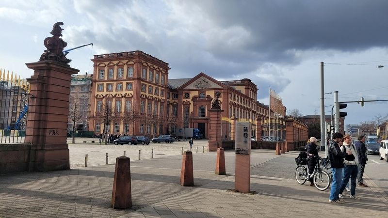
2. The view of the marker in front of the main entrance to the University of Mannheim
Captions
(Photo #1) Elector Karl Ludwig (1617-1880), the second founder of the city, around 1649.
(Photo #2) Liselotte of the Palatinate (1652-1722). Her marriage to the brother of the French king provided the legal pretext for bringing war to the Palatinate.
(Photo #3) City of Mannheim and Friedrichsburg Fortress, around 1663. Unlike before 1618, the interior of the Friedrichsburg is now based on the square scheme and no longer the radial system. The castle square is colorfully mottled here.
(Photo #4) Oldest view of the city of Mannheim with the "Flying Bridge" and the castle in the Friedrichsburg, pen and ink drawing by Louis Coblitz based on a model from 1669.
Erected by Stadtpunkte Mannheimer Geschichte Vor Ort and Stadt Mannheim.
Topics. This historical marker is listed in these topic lists: Forts and Castles • Industry & Commerce. A significant historical year for this entry is 1649.
Location. 49° 29.053′ N, 8° 27.787′ E. Marker is in Mannheim, Baden-Württemberg. It is in Quadrate. It is at the intersection of Bismarckstraße and Kurpflazstraße, on the right when traveling east on Bismarckstraße.

Photographed by James Hulse, September 23, 2024
3. The University of Mannheim

Regionally, it is in Europe, the European Union, Atlantic Europe, Central Europe, the Schengen Area, Western Europe, and the Western World. Historically, it finds itself in what was once the Roman Empire and specifically also the Holy Roman Empire.
Other nearby markers. At least 8 other markers are within walking distance of this marker: Zweiter Schlossbau im 18. Jahrhundert / Second Castle Building in the 18th century (here, next to this marker); Prosper L'Orange (a few steps from this marker); Luftschiff Schütte-Lanz (a few steps from this marker); Ludwig Roebel (a few steps from this marker); Nobelpreis Chemie / Nobel Prize in Chemistry (a few steps from this marker); Nobelpreis für Medizin / Nobel Prize for Medicine (within shouting distance of this marker); Bulldog (within shouting distance of this marker); Otto Feick (within shouting distance of this marker). Touch for a list and map of all markers in Mannheim.
More about this marker. There is a non-related marker separately attached on the other side of the post.
Credits. This page was last revised on September 26, 2024. It was originally submitted on September 23, 2024, by James Hulse of Medina, Texas. This page has been viewed 124 times since then and 23 times this year. Photos: 1, 2, 3. submitted on September 26, 2024, by James Hulse of Medina, Texas.
