Mount Washington in Pittsburgh in Allegheny County, Pennsylvania — The American Northeast (Mid-Atlantic)
Mount Washington
Pittsburgh's Industrial Legacy
| — | Emerald View Park | — |
Photographed by Bradley Owen, September 3, 2024
1. Mount Washington Marker
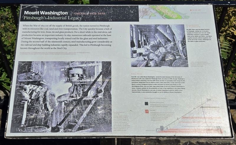
When the War of 1812 cut off the supply of British goods, the nation turned to Pittsburgh with its resources like coal, sand and river transportation. The City quickly became a hub of manufacturing for iron, brass, tin and glass products. For a short while in the mid-1800s, salt production became an important industry. In 1835, numerous railroads operated at the base of Mount Washington, transporting locally mined coal for the glass and steel industries. During the second half of the nineteenth century, steel manufacturing grew considerably as the railroad and ship building industries rapidly expanded. This led to Pittsburgh becoming known throughout the world as the Steel City.
Glassmaking In Pittsburgh
By 1817, there were four glass factories in Pittsburgh, making use of abundant supplies of riverbed sand and coal. Glass production continued to grow steadily, until, by the 1850s and 1860s, local glass suppliers became national suppliers, and, by the end of the century, Pittsburgh led the nation in glass production.
Coal Hill
Coal Hill, now called Mount Washington, earned its name because of its rich seam
this page online
(Captions):
In 1912, it was written that Pittsburgh was regarded as the "cradle of the glass industry in America" because of the city's improvements in the process of making glass.
Bessemer Converter, around 1900
Pittsburgh leaped to the forefront of the steel industry in large part because of Andrew Carnegie. He popularized the Bessemer Process in America, which allowed for inexpensive mass production of steel. By blowing air through molten iron, impurities are removed, which results in a purer, hotter iron for easier conversion into steel.
Elevation Schematic of Mount Washington
The Pittsburgh Coal Seam
The Pittsburgh Coal Seam was the thickest and most extensive coal bed in the Appalachian Mountains.
"Red Beds"
Mount Washington is also comprised of several layers of "red beds," sedimentary rocks that have taken on a rusty color. Red beds are a primary source for material to produce bricks, a major ingredient of building construction in Western Pennsylvania.
Erected by Federal

Photographed by Bradley Owen, September 3, 2024
2. Mount Washington Marker
Topics. This historical marker is listed in these topic lists: Industry & Commerce • Natural Resources. A significant historical year for this entry is 1812.
Location. 40° 25.94′ N, 80° 0.478′ W. Marker is in Pittsburgh, Pennsylvania, in Allegheny County. It is in Mount Washington. It is at the intersection of Grandview Avenue and Maple Terrace, on the right when traveling north on Grandview Avenue. Touch for map. Marker is at or near this postal address: 196 Grandview Avenue, Pittsburgh PA 15211, United States of America. Touch for directions.

Regionally, this marker is in the American Northeast, in the Mid-Atlantic, in the Ohio River Valley, in Appalachia, and specifically in Northern Appalachia. Globally, it is in North America, the Western Hemisphere, the Western World, and the Anglosphere. Historically, it finds itself in what was once the Viceroyalty of New France, the Haudenosaunee (Iroquois) Confederacy, and one of the original Thirteen Colonies.
Other nearby markers. At least 8 other markers are within walking distance of this marker: The Youth of the Leo Club of Grandview (here, next to this marker); a different marker also named Mount Washington (about 500 feet away, measured in a direct line); a different marker also named Mount Washington (about 600 feet away); Monongahela Inclined Plane (about 700 feet away); Carnegie Library of Pittsburgh (approx. 0.2 miles away); Enlightenment (approx. 0.2 miles away); Commerce Court (approx. 0.2 miles away); Grace Episcopal Church (approx. 0.2 miles away). Touch for a list and map of all markers in Pittsburgh.
Credits. This page was last revised on September 24, 2024. It was originally submitted on September 23, 2024, by Bradley Owen of Morgantown, West Virginia. This page has been viewed 210 times since then and 35 times this year. Photos: 1, 2. submitted on September 24, 2024, by Bradley Owen of Morgantown, West Virginia.
