Quadrate in Mannheim, Baden-Württemberg, Germany — Central Europe
Lyceum A 4, 1-2
⎯⎯⎯
Gymnasium-School A 4, 1-2
Photographed by James Hulse, February 20, 2024
1. Lyceum A 4, 1-2 / Gymnasium A 4, 1-2 Marker

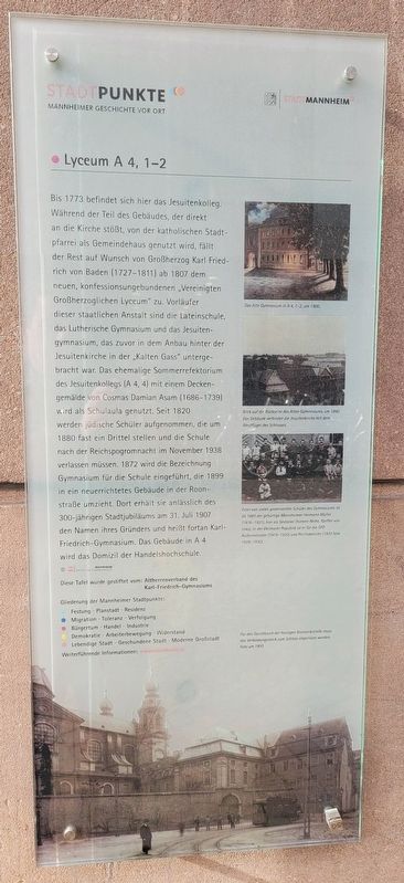
Bis 1773 befindet sich hier das Jesuitenkolleg. Während der Teil des Gebäudes, der direkt an die Kirche stößt, von der katholischen Stadtpfarrei als Gemeindehaus genutzt wird, fällt der Rest auf Wunsch von Großherzog Karl Friedrich von Baden (1727-1811) ab 1807 dem neuen, konfessionsungebundenen „Vereinigten Großherzoglichen Lyceum" zu. Vorläufer dieser staatlichen Anstalt sind die Lateinschule, das Lutherische Gymnasium und das Jesuitengymnasium, das zuvor in dem Anbau hinter der Jesuitenkirche in der „Kalten Gass" untergebracht war. Das ehemalige Sommerrefektorium des Jesuitenkollegs (A 4, 4) mit einem Deckengemälde von Cosmas Damian Asam (1686-1739) wird als Schulaula genutzt. Seit 1820 werden jüdische Schüler aufgenommen, die um 1880 fast ein Drittel stellen und die Schule nach der Reichspogromnacht im November 1938 verlassen müssen. 1872 wird die Bezeichnung Gymnasium für die Schule eingeführt, die 1899 in ein neuerrichtetes Gebäude in der Roonstraße umzieht. Dort erhält sie anlässlich des 300-jährigen Stadtjubiläums am 31. Juli 1907 den Namen ihres Gründers und heißt fortan Karl-Friedrich-Gymnasium. Das Gebäude in A 4 wird das Domizil der Handelshochschule. © Stadtarchiv Mannheim Institut Für Stadtgeschichte
Diese Tafel wurde gestiftet vom: Altherrenverband des Karl-Friedrich-Gymnasiums
Bildunterschriften
(Foto Nr. 1) Das Alte Gymnasium in A 4, 1-2, um 1900.
(Foto Nr. 2) Blick auf die Rückseite des Alten Gymnasiums, um 1890. Das Gebäude verbindet die Jesuitenkirche mit dem Westflügel des Schlosses.
(Foto Nr. 3) Einer von vielen prominenten Schüler des Gymnasiums ist ab 1885 der gebürtige Mannheimer Hermann Müller (1876-1931), hier als Sextoner (hintere Reite, fünfter von links). In der Weimarer Republik ist er für die SPD Außenminister (1919-1920) und Reichskanzler (1920 bzw. 1928-1930).
(Foto Nr. 4) Für den Durchbruch der heutigen Bismarckstraße muss das Verbindungsstück zum Schloss abgerissen werden. Foto um 1910.
The
this page online
Photographed by James Hulse, February 20, 2024
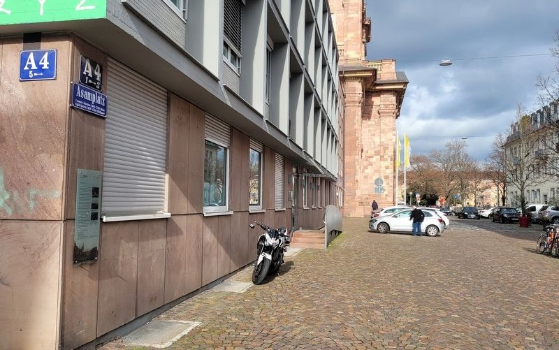
2. The view of the marker along the street
This plaque was donated by: Old Boys' Association of the Karl-Friedrich-Gymnasium
Captions
(Photo #1) The Old Gymnasium in A 4, 1-2, around 1900.
(Photo #2) View of the back of the Old Gymnasium, around 1890. The building connects the Jesuit church with the west wing of the castle.
(Photo #3) One of the many prominent students of the Gymnasium from 1885 onwards is Hermann Müller (1876-1931), born in Mannheim, here as a Sextoner (back row, fifth from the left). In the Weimar Republic he was Foreign Minister (1919-1920) and Chancellor (1920 and 1928-1930) for the SPD.
(Photo #4) To make way for today's Bismarck Street, the connecting section to the castle had to be demolished. Photo taken around 1910.
Erected by Stadtpunkte Mannheimer Geschichte Vor Ort and Stadt Mannheim.
Topics. This historical marker is listed in these topic lists: Education • Sports. A significant historical date for this entry is July 31, 1907.
Location. 49° 29.137′ N, 8° 27.642′ E. Marker is in Mannheim, Baden-Württemberg. It is in Quadrate. It is at the intersection of Bismarckstraße and A4, on the right when traveling west on Bismarckstraße.
Photographed by James Hulse, February 20, 2024
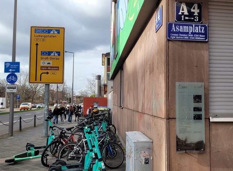
3. The view of the marker at the corner of the street

Regionally, this marker is on the German Upper Rhine. Globally, it is in Europe, the European Union, Atlantic Europe, Central Europe, the Schengen Area, Western Europe, and the Western World. Historically, it finds itself in what was once the Roman Empire, the Holy Roman Empire, and the former West Germany.
Other nearby markers. At least 8 other markers are within walking distance of this marker: Wolfgang Amadeus Mozart (within shouting distance of this marker); Schloss, Sondergericht / Castle, Special Court (within shouting distance of this marker); Wohnhaus von Heinrich und Julia Lanz / Home of Heinrich and Julia Lanz (about 90 meters away, measured in a direct line); Wohnhäuser der Familie Lanz A 2, 6 + 7 / Residences of the Lanz Family, A 2, 6 + 7 (about 90 meters away); Geschäftsstelle der DVP C 3, 21-22 / Office of German People's Party C 3, 21-22 (about 90 meters away); Jesuitenkirche A 4, 1 / Jesuit Church A 4, 1 (about 90 meters away); Wohnhaus von August von Kotzebue, A 2, 5 / Residence of August von Kotzebue, A 2, 5 (about 120 meters away); Nationaltheater B 3 (about 120 meters away). Touch for a list and map of all markers in Mannheim.
Also see . . . Lyceum. Wikipedia
The lyceum is a category of educational institution defined within the education system of many countries, mainly in Europe. The definition varies among countries; usually it is a type of secondary school. Basic science and some introduction to specific professions are generally taught.(Submitted on September 26, 2024, by James Hulse of Medina, Texas.)
Credits. This page was last revised on September 26, 2024. It was originally submitted on September 25, 2024, by James Hulse of Medina, Texas. This page has been viewed 96 times since then and 14 times this year. Photos: 1, 2, 3. submitted on September 26, 2024, by James Hulse of Medina, Texas.
