Darwin City in Darwin Municipality, Northern Territory, Australia — Oceania
Ocean Views Hide History
Our War Heritage
Photographed by Kevin W., September 9, 2024
1. Ocean Views Hide History Marker
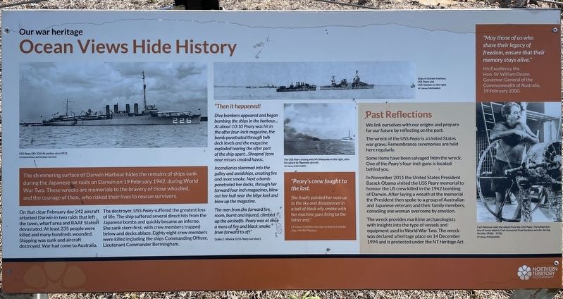
On that clear February day 242 aircraft attacked Darwin in two raids that left the town, wharf area and RAAF Station devastated. At least 235 people were killed and many hundreds wounded. Shipping was sunk and aircraft destroyed. War had come to Australia.
The destroyer, USS Peary suffered the greatest loss of life. The ship suffered several direct hits from the Japanese bombs and quickly became an inferno. She sank stern first, with crew members trapped below and decks ablaze. Eighty eight crew members were killed including the ships Commanding Officer, Lieutenant Commander Bermingham.
"Then it happened!
Dive bombers appeared and began bombing the ships in the harbour… At about 10:10 Peary was hit in the after four-inch magazine, the bomb penetrated through two deck levels and the magazine exploded tearing the after part of the
this page online
Incendiaries slammed into the galley and amidships, creating fire and more smoke. Next a bomb penetrated her decks, through her forward four inch magazines, blew out her hull near the bilge keel and blew up the magazine.
The men from the forward fire room, burnt and injured, climbed up the airshafts. Peary was at once a mass of fire and black smoke" from forward to aft"
Dallis E. Widick (USS Peary survivor).
"Peary's crew fought to the last.
She finally pointed her nose up to the sky and disappeared in a ball of black oily smoke with her machine guns firing to the bitter end."
LT. Owen Griffiths who was onboard a nearby ship, HMAS Platypus.
Past Reflections
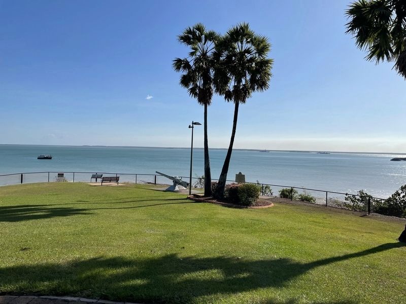
We link ourselves with our origins and prepare for our future by reflecting on the past. The wreck of the USS Peary is a United States war grave. Remembrance ceremonies are held here regularly Some items have been salvaged from the wreck. One of the Peary's four-inch guns is located behind you.
In November 2011 the United States President Barack Obama visited the USS Peary memorial to honour the US crew killed
Photographed by Kevin W., September 9, 2024
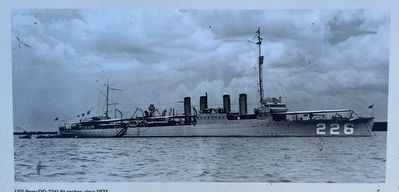
2. USS Peary (DD-226) at anchor, circa 1921
Photo on the marker is provided courtesy of the U.S. Naval History and Heritage Command
The wreck provides maritime archaeologists with insights into the type of vessels and equipment used in World War Two. The wreck was declared a heritage place on 14 December 1994 and is protected under the NT Heritage Act.
"May those of us who share their legacy of freedom, ensure that their memory stays alive."
His Excellency the Hon Sir William Deane Governor-General of the Commonwealth of Australia, 19 February 2000.
Erected by Northern Territory Government.
Topics. This historical marker is listed in this topic list: War, World II. A significant historical date for this entry is February 19, 1942.
Location. 12° 27.733′ S, 130° 50.083′ E. Marker is in Darwin City, Northern Territory, in Darwin Municipality. It is on Parker Walk 0.2 kilometers south of Esplanade, on the right when traveling south. Touch for map. Marker is at or near this postal address: 130 Esplanade, Darwin City NT 0800, Australia. Touch for directions.

Regionally,
Photographed by Kevin W., September 9, 2024
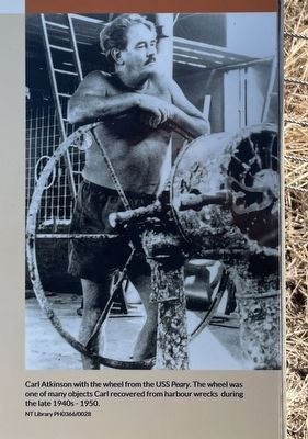
3. Carl Atkinson with the wheel from the USS Peary.
The wheel was one of many objects Carl recovered from harbour wrecks during the late 1940s - 1950s.
NT Library PH0366/0028
NT Library PH0366/0028
Other nearby markers. At least 7 other markers are within walking distance of this marker: USS Peary DD 226 (a few steps from this marker); A Story of Sacrifice (a few steps from this marker); 2nd Lt. Robert J. Buel, USAAF (a few steps from this marker); Friedrich Wilhelm Ludwig Leichhardt (about 150 meters away, measured in a direct line); Friendship through Gardens (about 180 meters away); mirragma gunugurr-wa (approx. 0.3 kilometers away); Mandjabu Fish Trap (approx. 0.3 kilometers away).
More about this marker. In the top center of this marker are two photographs taken of ships in Darwin Harbour during the early days of World War II.
The topmost photo is captioned, "Ships in Darwin Harbour. USS Peary and USS Houston on the right. NT Library PH0296/0033"
The photo in the middle center of the marker is captioned, "The USS Peary sinking with MV Manunda on the right, after the attack by Japanese aircraft. NT Library
Photographed by Kevin W., September 9, 2024
4. Ocean Views Hide History Marker
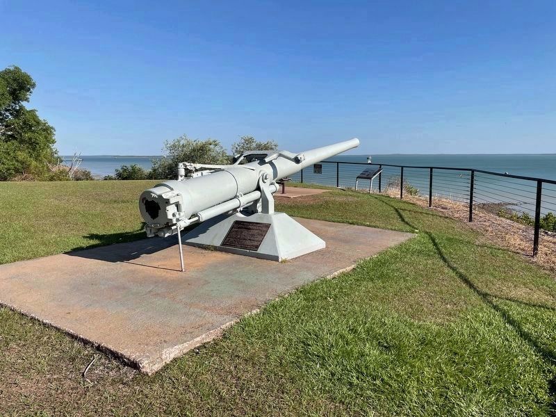
This is the 4-inch gun, salvaged from the USS Peary, mentioned on the marker.
Salvaged from the Peary in the 1950's, it was restored by the Royal Australian Navy and placed dedicated here in January 1992.
Photographed by Kevin W., September 9, 2024
5. Ocean Views Hide History Marker
Four World War II related historical markers, including this one, are within view of this photograph.
Credits. This page was last revised on August 22, 2026. It was originally submitted on September 25, 2024, by Kevin W. of Stafford, Virginia. This page has been viewed 199 times since then and 28 times this year. Photos: 1, 2, 3. submitted on September 25, 2024, by Kevin W. of Stafford, Virginia. 4, 5. submitted on September 24, 2024, by Kevin W. of Stafford, Virginia.
