Erin Mills in Mississauga in Peel Region, Ontario — Central Canada (North America)
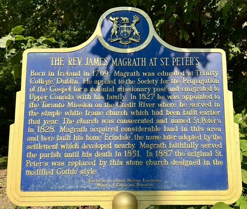
The Rev. James Magrath at St. Peter’s
Photographed by Tim Boyd, September 14, 2024
1. The Rev. James Magrath at St. Peter’s Marker
Erected by the Ontario Heritage Foundation, Ministry of Culture and Recreation
Erected by Ontario Heritage Foundation.
Topics and series. This historical marker is listed in these topic lists: Religion & Religious Structures • Settlements & Settlers. In addition, it is included in the Canada, Ontario Heritage Trust series list. A significant historical year for this entry is 1827.
Location. 43° 32.618′ N,
this page online

Regionally, this marker is in Greater Toronto, specifically on the Golden Horseshoe, and in the Toronto Metropolitan Area. It is also in Central Canada. Globally, it is in North America, on the Great Lakes, in the Western Hemisphere, in the Western World, and in the Anglosphere. Historically, it finds itself in what was once a British colony, the Viceroyalty of New France, the Haudenosaunee (Iroquois) Confederacy, and Rupert’s Land.
Other nearby markers. At least 8 other markers are within 3 kilometers of this marker, measured as the crow flies: Charlotte Schreiber 1834-1922 (approx. one kilometer away); Benares Historic House (approx. 2.6 kilometers away); Mazo de la Roche (approx. 2.6 kilometers away); We Were Here (approx. 2.9 kilometers away); Chi-twaa Tigaanes/ Sacred Garden

Photographed by Tim Boyd, September 14, 2024
2. The Rev. James Magrath at St. Peter’s Marker
Also see . . . A History of St. Peter’s Church Erindale. Church website entry:
At first, services were held twice a year by Bishop Stewart, and it was here that plans were made to build a church on the present hilltop site. Construction began in 1826 to build a white frame church 52 ft long and 32 ft wide, with three windows on each side, a gallery in the back, and with a steeple and spire. The land was purchased for 10 shillings by parishioners, namely Colonel Peter Adamson, Dr. Joseph Adamson, William Thompson, Frederick Starr Jarvis of Toronto Township, Alexander Proudfoot, and Henry Carpenter of Trafalgar Township.(Submitted on September 27, 2024, by Tim Boyd of Hamilton, Ontario.)
Photographed by Tim Boyd, September 14, 2024
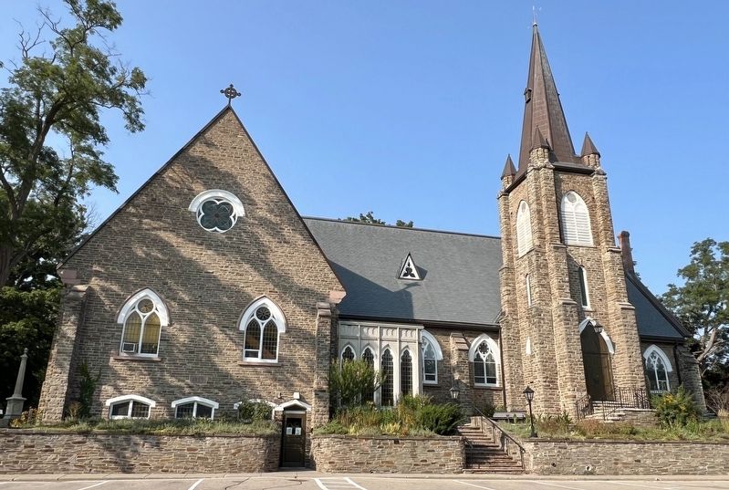
3. The present St. Peter’s Anglican Church
Credits. This page was last revised on August 5, 2025. It was originally submitted on September 27, 2024, by Tim Boyd of Hamilton, Ontario. This page has been viewed 142 times since then and 28 times this year. Photos: 1, 2, 3. submitted on September 27, 2024, by Tim Boyd of Hamilton, Ontario. • Andrew Ruppenstein was the editor who published this page.
