Quadrate in Mannheim, Baden-Württemberg, Germany — Central Europe
Kirchenunion von 1821
⎯⎯⎯
Church Union of 1821
Photographed by James Hulse, February 20, 2024
1. Kirchenunion von 1821 / Church Union of 1821 Marker

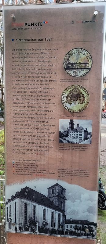
Die größte religiöse Gruppe Mannheims bilden bis zur Stadtzerstörung von 1689 neben reformierten Deutschen calvinistische Franzosen und reformierte Wallonen. Daneben gibt es auch lutherische und katholische Minderheiten. Im 18. Jahrhundert verlieren dann die Protestanten in der Stadt zusehends an Bedeutung. Neben der stärkeren Förderung der Katholiken durch die seit 1685 regierenden katholischen Kurfürsten aus dem Haus Pfalz-Neuburg trägt auch die Zersplitterung in drei Gemeinden - deutsch-reformiert, französisch-reformiert und lutherisch - dazu bei. Nach der Zerstörung der reformierten Doppelkirche 1795 bieten die Lutheraner den beiden anderen Konfessionen für einige Jahre Unterschlupf in der Trinitatiskirche. Diese Erfahrung macht die Mannheimer Gemeinden zu Schrittmachern der badischen Kirchenunion. 1817 unterschreiben 307 lutherische und 287 reformierte Mannheimer Familienväter auch im Namen ihrer Angehörigen eine Resolution, in welcher der Wunsch nach der Vereinigung der beiden Kirchen geäußert wird, eine Initiative, die auf andere badische Städte überspringt. Aus dem Zusammenschluss geht schließlich 1821 die Vereinigte evangelisch-protestantische Kirche in Baden hervor. © Stadtarchiv Mannheim Institut Für Stadtgeschichte
Bildunterschriften
(Foto Nr. 1) Medallie auf den Bau des Schulhauses der Vereinigten Evangelischen Gemeinde Mannhelm, 1823.
(Foto Nr. 2) Mannheimer Medaille auf die Kirchenunion von 1821.
(Foto Nr. 3) Erst 1914 wird die ursprüngliche Doppelanlage architektonisch wiederhergestellt. In dem an den Barockstil angelehnten Schulgebäude ist heute die Mozartschule beheimater.
(Foto Nr. 4) Durch die Kirchenunion ist eine reformierte Doppelkirche nicht mehr notwendig. Der selt 1795 zerstörte, im nördlichen Teil von R 2 gelegene ehemals wallonische Teil wird deshalb abgetragen und an seiner Stelle ein evangelisches Schulhaus errichtet, das quer zur Kirche steht.
Until
this page online
Captions
(Photo #1) Medal for the construction of the schoolhouse of the United Evangelical Community of Mannhelm, 1823.
(Photo #2) Mannheim medal for the Church Union of 1821.
(Photo #3) It was not until 1914 that the original double building was architecturally restored; the school building, which was inspired by the Baroque style, is now home to the Mozart School.
(Photo #4) Due to the Church Union, a reformed double church is no longer necessary. The former Walloon part, which was destroyed in 1795 and is located in the northern part of R 2, is therefore demolished and a Protestant schoolhouse is built in its place, which stands perpendicular to the church.
Erected by Stadtpunkte
Photographed by James Hulse, February 20, 2024
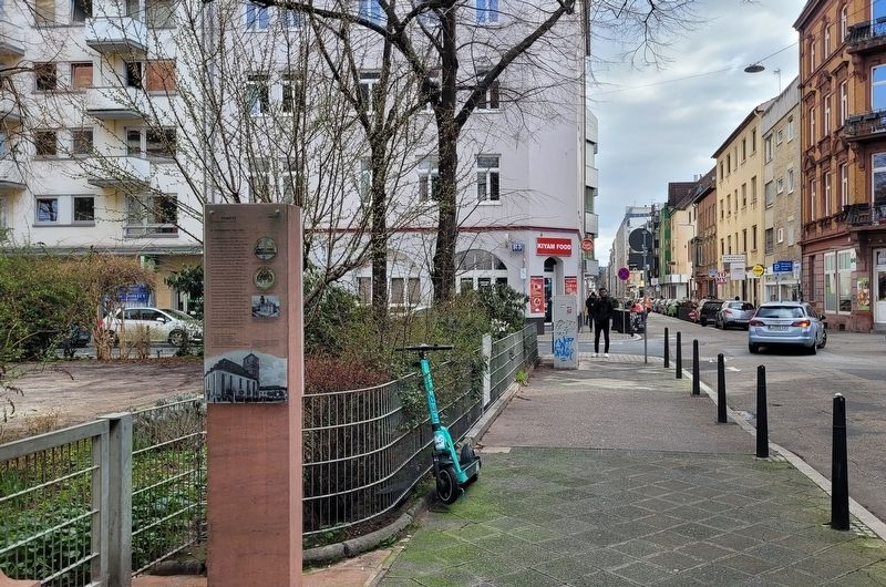
2. The marker is located along the street
Topics. This historical marker is listed in this topic list: Religion & Religious Structures. A significant historical year for this entry is 1689.
Location. 49° 29.317′ N, 8° 28.135′ E. Marker is in Mannheim, Baden-Württemberg. It is in Quadrate. It is at the intersection of R2 and Q2, on the left when traveling east on R2. The marker is located along the street near the church. Touch for map. Marker is at or near this postal address: R2 1-2, Mannheim BW 68159, Germany. Touch for directions.

Regionally, this marker is on the German Upper Rhine. Globally, it is in Europe, the European Union, Atlantic Europe, Central Europe, the Schengen Area, Western Europe, and the Western World. Historically, it finds itself in what was once the Roman Empire, the Holy Roman Empire, and the former West Germany.
Other nearby markers. At least 8 other markers are within walking distance of this marker: Konkordienkirche R 2 / Concordia Church R 2 (here, next to this marker); Altes Rathaus und Untere Pfarrkirche F 1 / Old Town Hall and Lower Parish Church F 1 (about 120 meters away, measured
Photographed by James Hulse, February 20, 2024
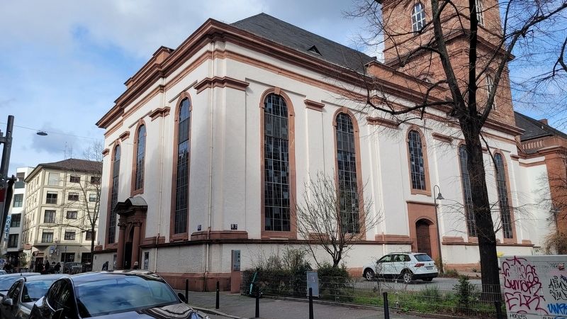
3. The Concordia Church
More about this marker. There is a separately attached marker on the other side of the post.
Photographed by James Hulse, February 20, 2024
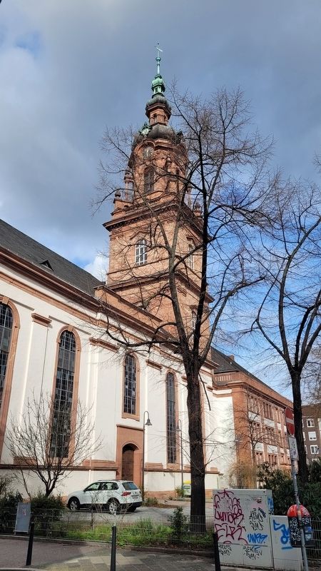
4. The Concordia Church
Credits. This page was last revised on October 1, 2024. It was originally submitted on September 29, 2024, by James Hulse of Medina, Texas. This page has been viewed 121 times since then and 14 times this year. Photos: 1, 2, 3, 4. submitted on September 30, 2024, by James Hulse of Medina, Texas.
