Near Prospect Ferry in Waldo County, Maine — The American Northeast (New England)
By the Numbers
Photographed by Steve Stoessel, September 28, 2024
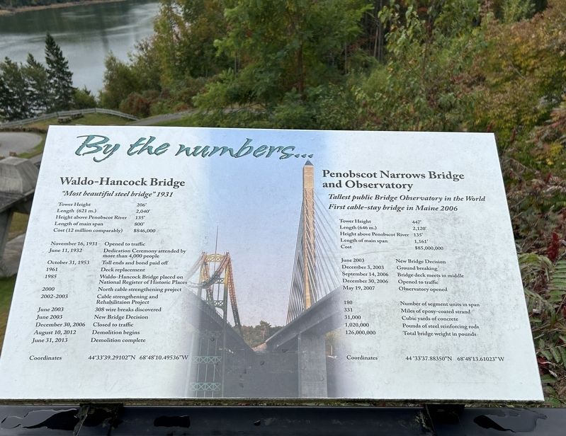
1. By the Numbers Marker
Waldo-Hancock Bridge
"Most beautiful steel bridge" 1931
Tower Height - 206'
Length (621 m.) - 2,040'
Height above Penobscot River - 135'
Length of main span - 800'
Cost (12 million comparably) — $846,000
November 16, 1931 - Opened to traffic
June 11, 1932 - Dedication Ceremony attended by more than 4,000 people
October 31, 1953 - Toll ends and bond paid off
1961 - Deck replacement
1985 - Waldo-Hancock Bridge placed on National Register of Historic Places
2000 - North cable strengthening project
2002-2003 - Cable strengthening and Rehabilitaion Project
June 2003 - 308 wire breaks discovered
June 2003 - New Bridge Decision
December 30, 2006 - Closed to traffic
August 10, 2012 - Demolition begins
June 31, 2013 - Demolition complete
Coordinates - 44°33'39.29102"N 68°48'10.49536"W
Penobscot Narrows Bridge and Observatory
Tallest public Bridge Observatory in the World
First cable-stay bridge in Maine 2006
Tower Height - 447'
Length (646 m.) - 2,120’
Height above Penobscot River - 135'
Length of main span - 1,161'
Cost - $85,000,000
June 2003. - New Bridge Decision December 3, 2003 - Ground breaking September
this page online
December 30, 2006 - Opened to traffic
May 19, 2007 - Observatory opened
Number of segment units in span - 180
Miles of epoxy-coated strand - 331
Cubic yards of concrete - 31,000
Pounds of steel reinforcing rods - 1,020,000
Total bridge weight in pounds: - 126,000,000
Coordinates - 44°33'37.88350"N 68°48'13.61023" W
Topics. This historical marker is listed in this topic list: Bridges & Viaducts. A significant historical date for this entry is June 11, 1932.
Location. 44° 33.691′ N, 68° 48.295′ W. Marker is near Prospect Ferry, Maine, in Waldo County. It is on Fort Knox Road (Maine Route 179) east of U.S. 1, on the left when traveling east. Touch for map. Marker is in this post office area: Stockton Springs ME 04981, United States of America. Touch for directions.

Regionally, this marker is in Midcoast Maine and on Penobscot Bay. It is also in the American Northeast, in New England, and on the Eastern Seaboard. Globally, it is in the North Atlantic Region, North America, the Western Hemisphere, the Western World, and the Anglosphere.
Other nearby markers. At least 8 other markers are
Photographed by Steve Stoessel, September 28, 2024
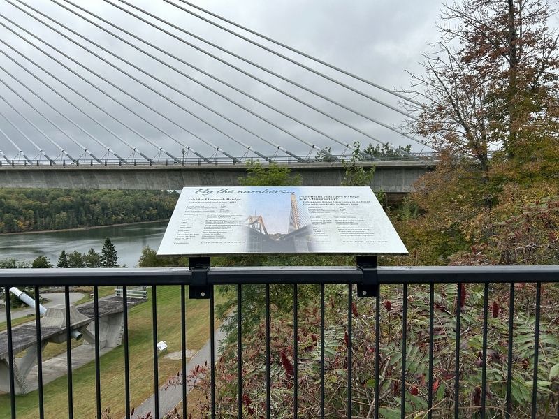
2. By the Numbers Marker
More about this marker. If you going to walk to some of the “nearby” markers, watch that first step! It’s a lulu! Those markers are in Fort Knox State Park, and 90’ below you.
Also see . . .
1. Waldo - Hancock Bridge (Wikipedia). (Submitted on September 29, 2024, by Steve Stoessel of Niskayuna, New York.)
2. Penobscot Narrows Bridge (Wikipedia). (Submitted on September 29, 2024, by Steve Stoessel of Niskayuna, New York.)
Photographed by Steve Stoessel, September 28, 2024
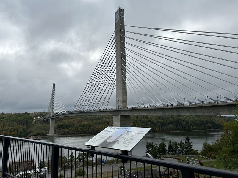
3. By the Numbers Marker
Overlooking the new bridge from old bridge approaches.
Photographed by Steve Stoessel, September 28, 2024
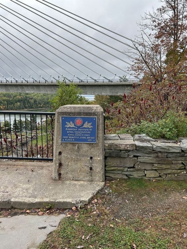
4. Award for the former bridge.
These markers are on the approaches to the former bridge, and next to the current markers.
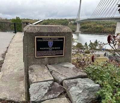
Photographed by Steve Stoessel, September 28, 2024
5. Award for former Waldo - Hancock Bridge.
These markers are next to current markers on the approaches of the former bridge.
Credits. This page was last revised on September 29, 2024. It was originally submitted on September 29, 2024, by Steve Stoessel of Niskayuna, New York. This page has been viewed 129 times since then and 14 times this year. Photos: 1, 2, 3, 4, 5. submitted on September 29, 2024, by Steve Stoessel of Niskayuna, New York.
