Käfertal in Mannheim, Baden-Württemberg, Germany — Central Europe
Käfertal - Geschichte und Gegenwart
⎯⎯⎯
Käfertal - History and Present
Photographed by James Hulse, September 22, 2024
1. Käfertal - Geschichte und Gegenwart / Käfertal - History and Present Marker

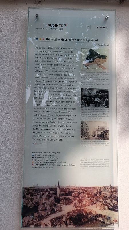
Das Käfertaler Ortsbild wird heute von Gebauden der Nachkriegszeit und des 19. Jahrhunderts dominiert. Aber das Dorf Cheverndal („Tal der Kiefern"), das erstmals im Jahr 1227 urkundlich erwähnt wird, ist sehr viel älter. Bereits vor dem 13. Jahrhundert bestehen auf der heutigen Gemarkung verschiedene Siedlungen. Der Ort wird im Pfälzischen Erbfolgekrieg 1688 zerstört. Beim Wiederaufbau bleiben Teile des alten Straßenrasters erhalten. Die jahrhundertelangen Gemarkungsstreitigkeiten mit Mannheim werden 1882 mit einem Vergleich beigelegt. Im Norden befindet sich der Käfertaler Wald, ein Landschaftsschutz- und Naherholungsgebiet. Dort wird bereits im Jahr 1886 der Grundstein zum Bau des Wasserwerks der Stadt Mannheim gelegt. Nun keimt auch der Gedanke der Eingemeindung nach Mannheim auf. Die Verhandlungen ziehen sich mit Unterbrechungen von 1892 bis 1896 hin. Am 1. Januar 1897 tritt der Vertrag über die Eingemeindung in Kraft. In den 1920er und 1930er Jahren entstehen rings um das alte Dorf die Reiherplatz-, Bäcker- weg-, Kuhbuckel- und Speckwegsiedlung. Im Nordosten wird nach dem 2. Weltkrieg das Benjamin-Franklin-Village für Angehörige der US-Armee errichtet. Im Südosten entsteht seit 1993 die Siedlung „Im Rott". © Stadtarchiv Mannheim Institut Für Stadtgeschichte
Bildunterschriften
(Foto Nr. 1) Durch die Industrialisierung im 19. Jahrhundert wandelt sich das früher bäuerlich geprägte Dorf zum rasch wachsenden Arbeitervorort. Das zur Käfertaler Gemarkung zählende Waldhofgebiet entwickelt sich aufgrund seiner Lage am Altrhein zu einem wichtigen Industriestandort und bietet neuen Wohnraum. Bereits Ende des 19. Jahrhunderts leben mehr Menschen auf dem Waldhof als im ursprünglichen Käfertal. Die Karte von 1886 zeigt die Zweiteilung in Bauerndorf und industrielles Zentrum.
(Foto Nr. 2) Stadt trifft auf Land: Auf dem Bauernhof der Familie Friedrich Dick (Ecke Mannheimer/Ladenburger Straße) haben sich während des 1. Weltkriegs von Links versammelt: Zwei Logisherren (wohl bei BBC angestellt), ein russischer Kriegsgefangener im Arbeitseinsatz, Frau Dick, die Magd und der Knecht des Hofes sowie die Kinder der Familie.
(Foto Nr. 3) Im 19. Jahrhundert befindet sich am nordöstlichen Ortsrand eine Malz- und Braufabrik. Nach dem Abriss um 1980 erinnern daran nur noch die Straßennamen wie Hopfen-, Gersten-, Malz- und Braustraße.
(Foto Nr. 4) Auf der Postkarte ist das 1818/19 von Friedrich Dyckerhoff erbaute Rathaus im Zentrum gut zu erkennen, ebenso die 1816-1818 errichtete evangelische Unionskirche (links) und die 1834/35 umgebaute katholische Laurentiuskirche (rechts). Im Hintergrund rauchen die Schornsteine der Industriebetriebe.
The
this page online
Photographed by James Hulse, September 22, 2024
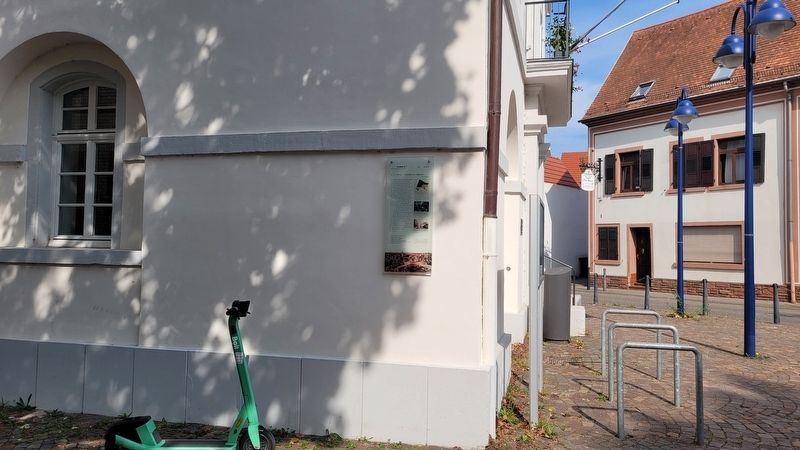
2. The marker is located on the corner of the building
Captions
(Photo #1) Due to industrialization in the 19th century, the formerly rural village was transformed into a rapidly growing working-class suburb. The Waldhof area, which is part of the Käfertal district, developed into an important industrial location due to its location on the Old Rhine and offered new living space. By the end of the 19th century, more people were already living on the Waldhof than in the original Käfertal. The map from 1886 shows the division into a farming village and an industrial center.
(Photo #2) City meets country: On the Friedrich Dick family farm (corner of Mannheimer/Ladenburger Strasse) during the First World War, the following people gathered from left to right: two lodgers (probably employed by the BBC), a Russian prisoner of war on duty, Mrs. Dick, the maid and farmhand, and the family's children.
(Photo #3) In the 19th century, a malt and brewery factory was located on the northeastern edge of the village. After the demolition around 1980, only the street names such as Hopfenstrasse, Gerstenstrasse, Malzstrasse and Braustrasse are still a reminder of this.
(Photo #4) On the postcard, the town hall in the centre, built in 1818/19 by Friedrich Dyckerhoff, is clearly visible, as is the Protestant Union Church (left) built in 1816-1818 and the Catholic Laurentius Church (right), rebuilt in 1834/35. In the background, the chimneys of the industrial plants are smoking.
Erected by Stadtpunkte
Photographed by James Hulse, September 22, 2024
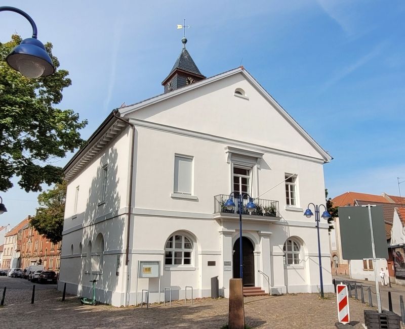
3. Käfertal Rathaus
Topics. This historical marker is listed in this topic list: Notable Buildings. A significant historical date for this entry is January 1, 1897.
Location. 49° 30.75′ N, 8° 31.066′ E. Marker is in Mannheim, Baden-Württemberg. It is in Käfertal. It is at the intersection of Wormser Straße and Ladenburger, on the left when traveling north on Wormser Straße. The marker is located on the southeast corner of the Käfertal Rathaus. Touch for map. Marker is at or near this postal address: Wormser Str 1, Mannheim BW 68309, Germany. Touch for directions.

Regionally, this marker is on the German Upper Rhine. Globally, it is in Europe, the European Union, Atlantic Europe, Central Europe, the Schengen Area, Western Europe, and the Western World. Historically, it finds itself in what was once the Roman Empire, the Holy Roman Empire, and the former West Germany.
Other nearby markers. At least 8 other markers are within 5 kilometers of this marker, measured as the crow flies: Johann Benedict Lemaistre (here, next to this marker); Käfertal Memorial (about 150 meters away, measured in a direct line); Chronik des Friedhofs Käfertal / Chronicle of the Käfertal Cemetery (approx. half a kilometer away); Otto Siffling (approx. half a kilometer away); Für Baden’s Ehre / For Baden's Honor (approx. 0.6 kilometers away); Neckarstadt Ost, Alte Brauerei / Neckar City East, Old Brewery (approx. 2.9 kilometers away); Hochbunker Neckarvorlandstraße / Neckarvorlandstraße Air-Raid Bunker (approx. 4 kilometers away); Neckarkran der Firma Mohr & Federhaff / Neckar Crane of the Mohr & Federhaff Company (approx. 4 kilometers away). Touch for a list and map of all markers in Mannheim.
Credits. This page was last revised on October 3, 2024. It was originally submitted on October 3, 2024, by James Hulse of Medina, Texas. This page has been viewed 373 times since then and 114 times this year. Photos: 1, 2, 3. submitted on October 3, 2024, by James Hulse of Medina, Texas.
