Near Proctor in Marshall County, West Virginia — The American South (Appalachia)
George Rogers Clark
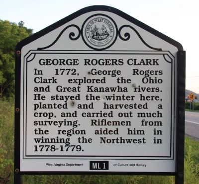
Photographed by Dale K. Benington, July 15, 2011
1. George Rogers Clark Marker
Close-up view of the text on the historic marker.
Erected by West Virginia Department of Culture and History. (Marker Number ML 1.)
Topics and series. This historical marker is listed in these topic lists: Exploration • War, US Revolutionary. In addition, it is included in the West Virginia Archives and History series list. A significant historical year for this entry is 1772.
Location. 39° 48.171′ N, 80° 49.09′ W. Marker is near Proctor, West Virginia, in Marshall County. It is on Energy Highway (West Virginia Route 2) 1.1 miles south of Fish Creek Road (County Road 7/4), on the left when traveling south. This historical marker is located along the side of the highway, opposite the Ohio River, a short distance south of where the highway crosses Fish Creek. This particular historic marker is facing north. Touch for map. Marker is at or near this postal address: 33 Hickory Ave, Moundsville WV 26041, United States of America. Touch for directions.

Regionally,
this page online
Other nearby markers. At least 8 other markers are within 5 miles of this marker, measured as the crow flies: Zachary Taylor (here, next to this marker); Baker's Station (a few steps from this marker); Cedar Curve Cemetery / Funerals in the Early 1800s (approx. 3.6 miles away); The Inez Wright Bridge (approx. 4.1 miles away in Ohio); Powhatan Point (approx. 4.1 miles away in Ohio); Veterans Memorial (approx. 4.1 miles away in Ohio); George Washington (approx. 4.1 miles away in Ohio); The Coal Industry at Powhatan Point / Powhatan Disaster, 1944 (approx. 4.3 miles away in Ohio). Touch for a list and map of all markers in Proctor.
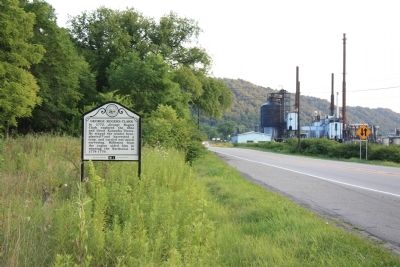
Photographed by Dale K. Benington, July 15, 2011
2. George Rogers Clark Marker
View of the historic marker looking south along state route 2.
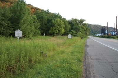
Photographed by Dale K. Benington, July 15, 2011
3. George Rogers Clark Marker
A more distant view of the historic marker looking south along state route 2.
Credits. This page was last revised on October 4, 2024. It was originally submitted on April 24, 2012. This page has been viewed 1,298 times since then and 54 times this year. Last updated on October 3, 2024. Photos: 1, 2, 3. submitted on April 24, 2012, by Dale K. Benington of Toledo, Ohio. • Devry Becker Jones was the editor who published this page.
