
Riverview in Saint Paul in Ramsey County, Minnesota — The American Midwest (Upper Plains)
Smith Avenue High Bridge
Photographed by McGhiever, May 30, 2024
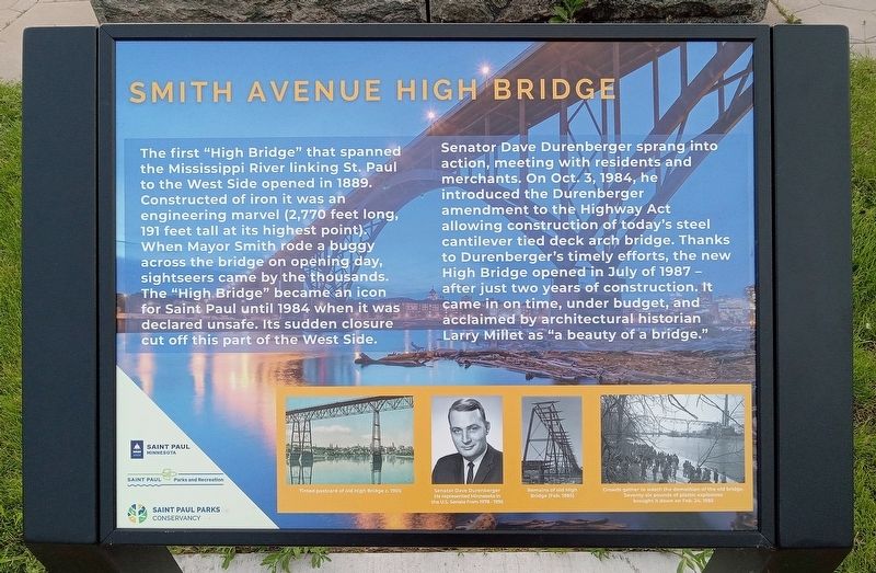
1. Smith Avenue High Bridge Marker
The first "High Bridge" that spanned the Mississippi River linking St. Paul to the West Side opened in 1889. Constructed of iron it was an engineering marvel (2,770 feet long, 191 feet tall at its highest point). When Mayor Smith rode a buggy across the bridge on opening day, sightseers came by the thousands. The "High Bridge" became an icon for Saint Paul until 1984 when it was declared unsafe. Its sudden closure cut off this part of the West Side.
Senator Dave Durenberger sprang into action, meeting with residents and merchants. On Oct 3, 1984, he introduced the Durenberger amendment to the Highway Act allowing construction of today's steel cantilever tied deck arch bridge. Thanks to Durenberger's timely efforts, the new High Bridge opened in July of 1987 – after just two years of construction. It came in on time, under budget, and acclaimed by architectural historian Larry Millet as "a beauty of a bridge."
Tinted postcard of old High Bridge c. 1905
Senator Dave Durenberger
He represented Minnesota in the U.S. Senate from 1978 - 1995
Remains of old High Bridge (Feb 1985)
Crowds gather to watch the demolition of the old bridge. Seventy-six pounds of plastic explosives brought it down on Feb 24, 1985
Erected by City
this page online
Topics. This historical marker is listed in these topic lists: Bridges & Viaducts • Government & Politics. A significant historical year for this entry is 1889.
Location. 44° 55.857′ N, 93° 6.11′ W. Marker is in Saint Paul, Minnesota, in Ramsey County. It is in Riverview. It is at the intersection of Cherokee Avenue and Smith Avenue S., on the left when traveling east on Cherokee Avenue. Touch for map. Marker is at or near this postal address: 365 Cherokee Avenue, Saint Paul MN 55107, United States of America. Touch for directions.

Regionally, this marker is in the Twin Cities Metropolitan Area. It is also in the American Midwest, in the Corn Belt, and in the Great River Road Region. Globally, it is in North America, the Western Hemisphere, the Western World, and the Anglosphere. Historically, it finds itself in what was once Rupert’s Land, the territory of the Mississippian Culture, and the Louisiana Purchase.
Other nearby markers. At least 8 other markers are within walking distance of this marker: River Commerce and the Upper Landing

Photographed by McGhiever, May 30, 2024
2. Smith Avenue High Bridge Marker at the High Bridge Overlook
Photographed by McGhiever, October 21, 2014
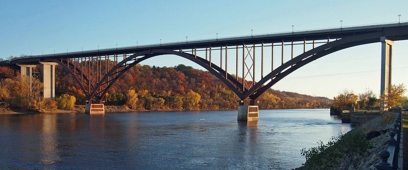
3. The Smith Avenue High Bridge from the opposite side of the Mississippi River
Credits. This page was last revised on October 9, 2024. It was originally submitted on October 9, 2024, by McGhiever of Minneapolis, Minnesota. This page has been viewed 251 times since then and 49 times this year. Photos: 1, 2, 3. submitted on October 9, 2024, by McGhiever of Minneapolis, Minnesota.
