West Loop in Chicago in Cook County, Illinois — The American Midwest (Great Lakes)
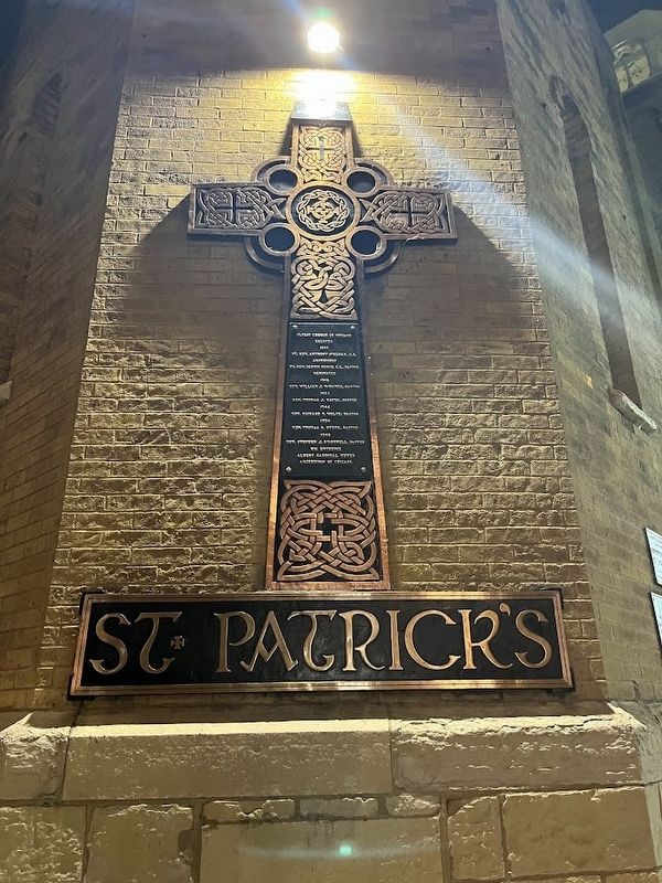
St. Patrick's
Photographed by Sean P. Flynn, October 13, 2024
1. St. Patrick's Marker
Erected
1856
Rt. Rev. Anthony O'Regan D.D.
Archbishop
Rt. Rev. Dennis Dunne, D.D. Pastor
Renovated
1912
Rev. William J. McNamee, Pastor
1933
Rev. Thomas J. Hayes, Pastor
1946
Rev. Richard F. Wolfe, Pastor
1954
Rev. Thomas P. Byrne, Pastor
1960
Rev. Stephen J. O'Donnell, Pastor
His Eminence
Albert Cardinal Meyer
Archbishop of Chicago
Topics and series. This historical marker is listed in this topic list: Religion & Religious Structures. In addition, it is included in the Chicago's Surviving Pre-Fire Structures, and the National Register of Historic Places (NRHP) series lists. A significant historical year for this entry is 1856.
Location. 41° 52.764′ N, 87° 38.653′ W. Marker is in Chicago, Illinois, in Cook County. It is in West Loop. It is at the intersection of West Adams Street and Des Plaines Street, on the right when traveling west on West Adams Street. The marker is on the bottom part of the cross affixed to the church's corner at Adams and Des Plaines. Touch for map. Marker is at or near this postal address: 700 West Adams Street, Chicago IL 60661, United States of America.
this page online

Regionally, this marker is on Chicago’s West Side. It is also in the American Midwest. Globally, it is in North America, on the Great Lakes, in the Western Hemisphere, in the Western World, and in the Anglosphere. Historically, it finds itself in what was once the Viceroyalty of New France, the territory of the Mississippian Culture, and the Northwest Territory.
Other nearby markers. At least 8 other markers are within walking distance of this marker: St. Patrick's Church (here, next to this marker); Gráinne Sculpture/Gráinne Garden (within shouting distance of this marker); Haberdasher Square Lofts: A Landmark of Chicago's Industrial Past (about 500 feet away, measured in a direct line); Charles R. Walgreen Sr. (approx. 0.2 miles away); Walgreens 3000th Drugstore (approx. 0.2 miles away); Batcolumn (approx. 0.2 miles away); Former Site of the Armed Forces Examining and Entrance Station (approx. 0.2 miles away); The Milwaukee Road (approx. 0.2 miles away). Touch for a list and map of all markers in Chicago.
Another marker is no longer nearby. Lou Mitchell's Restaurant & Bakery, Chicago, Illinois
Photographed by Sean P. Flynn, February 28, 2025
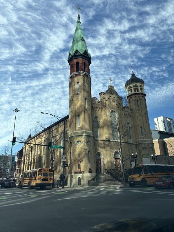
2. Old St. Pat's
More about this marker. This cross was likely erected between 1960 and 1965. Cardinal Meyer, listed at the bottom of the plaque, was the Archbishop of Chicago from 1958 until his death in 1965 following surgery for a malignant brain tumor.
Two other markers are right next to this cross, one about the building's placement on the National Register of Historic Places in 1977, and below that one about its 1964 designation by the Chicago City Council as a historical landmark.
Adams Street is part of historic Route 66; it begins about a mile east of here at Michigan Avenue, and continues west for about 1¼ miles until Ogden Avenue, where it begins its southwest jog.
Regarding St. Patrick's. Old St. Pat's, as the church is known, was founded in 1846 as the first English-speaking Catholic parish in Chicago, and 10 years later the congregation moved into this Romanesque-style church. The church survived the Great Chicago Fire (whose burn zone extended to about two blocks east of here) as well as numerous stages of turnover in the West Loop. In particular, in the post-war

Photographed by Sean P. Flynn, October 27, 2017
3. Old St. Pat's
Also see . . . History of Old St. Pat's. (Submitted on October 15, 2024, by Sean P. Flynn of Oak Park, Illinois.)
Chicago Daily News Collection, Chicago History Museum, October 12, 1914
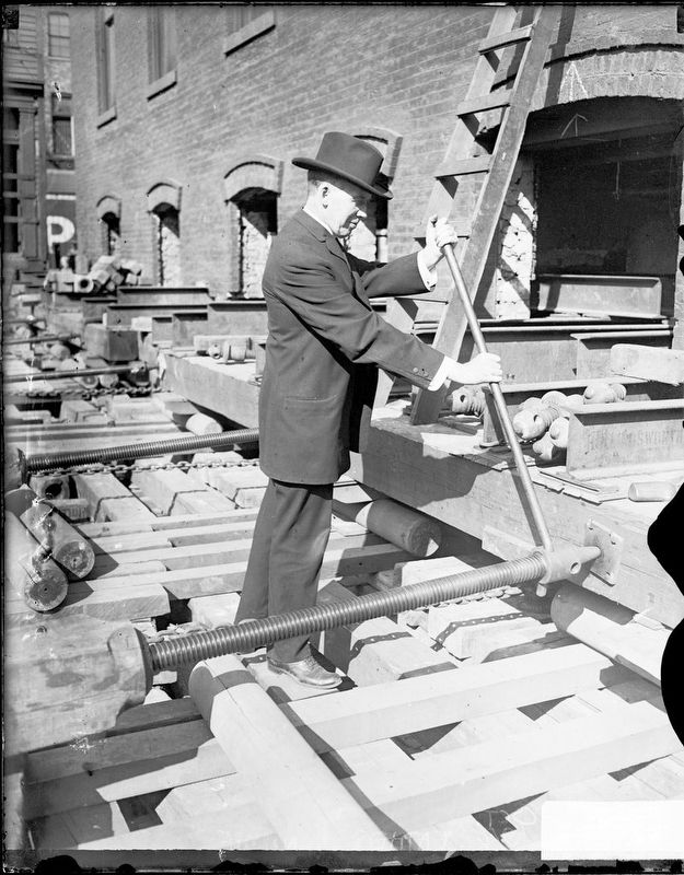
4. Father William McNamee
Fr. McNamee, whose name appears on this cross, is shown here in 1914 at the construction site for two new schools being built adjacent to St. Patrick's Church.

Photographed by Allen C. Browne, November 16, 2016
5. Nearby St. Patrick's Church markers
Two other markers are nearby, one about the church's inclusion on the National Register of Historic Places and another about its designation as a historic landmark by the City of Chicago.
Credits. This page was last revised on May 18, 2025. It was originally submitted on October 15, 2024, by Sean P. Flynn of Oak Park, Illinois. This page has been viewed 314 times since then and 72 times this year. Photos: 1. submitted on October 15, 2024, by Sean P. Flynn of Oak Park, Illinois. 2. submitted on February 28, 2025, by Sean P. Flynn of Oak Park, Illinois. 3, 4. submitted on October 15, 2024, by Sean P. Flynn of Oak Park, Illinois. 5. submitted on November 19, 2016, by Allen C. Browne of Silver Spring, Maryland.
