Bristol in Sullivan County, Tennessee — The American South (East South Central)
Edward Washington King House
The Bristol Historical Association
| — | 1902 | — |
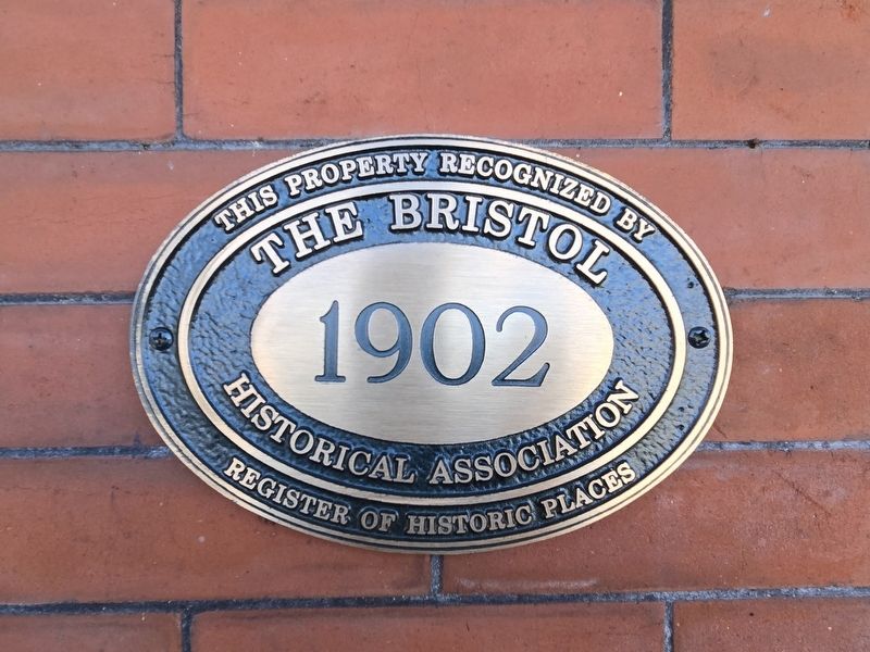
Photographed by Mark Parker, October 17, 2024
1. Edward Washington King House Marker
Register of Historic Places
The Bristol Historical Association
1902
Erected by The Bristol Historical Association.
Topics. This historical marker is listed in these topic lists: Architecture • Notable Buildings. A significant historical year for this entry is 1902.
Location. 36° 35.513′ N, 82° 11.13′ W. Marker is in Bristol, Tennessee, in Sullivan County. It can be reached from the intersection of Anderson Street and 7th Street, on the right when traveling east. The marker is at the left of the front entrance on the northeast corner of the house. Touch for map. Marker is at or near this postal address: 704 Anderson St, Bristol TN 37620, United States of America. Touch for directions.

Regionally, this marker is in East Tennessee and in the Tri-Cities Area. It is also in the American South, specifically in the Upper South, in Appalachia, and specifically in Southern Appalachia. Globally, it is in North America, the Western Hemisphere, the Western World, and the Anglosphere. Historically, it finds itself in what was once the original Cherokee Nation, the territory of
this page online
Other nearby markers. At least 8 other markers are within walking distance of this marker: Shelby's Fort (a few steps from this marker); Gammon Mansion (about 600 feet away, measured in a direct line); The E.W. King Building (about 700 feet away); Evan Shelby's Fort (about 700 feet away); Bristol Tennessee Post Office & Custom House (about 700 feet away); Isaac Shelby (1750-1826) (about 700 feet away); 614-618 State Street (approx. ¼ mile away); Ernest V. "Pop" Stoneman (approx. ¼ mile away in Virginia). Touch for a list and map of all markers in Bristol.
Another marker is no longer nearby. Historic Bristol (was approx. ¼ mile away in Virginia but has been replaced with another marker now near it).
Regarding Edward Washington King House. Excerpts from the Edward Washington King House Nomination Form (pg. 9-10):
The Edward Washington King House is significant...as an important example of the domestic architecture of early twentieth-century Bristol. The residence served as the principal home of one
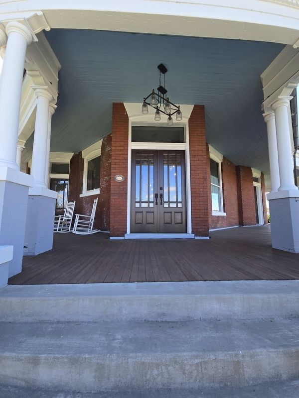
Photographed by Mark Parker, October 17, 2024
2. Front entrance Edward Washington King House. Marker is to the left.
The house served to confirm the position of its owner, who filled a popular role of respected leader in the city's political and social contexts. Edward Washington King was regarded with respect as one of the city's most successful and philanthropic citizens, and was praised for his effective support of education and other social causes throughout his life...
The site of the Edward Washington King House is a small lot on the corner of Seventh and Anderson streets, overlooking downtown Bristol. The choice tract on which Bristol stands was surveyed for John Buchanan in 1749 and was part of a vast grant to Col. James Patton by the Colonial Virginia government to facilitate settlement of the region. This 1,946-acre tract called
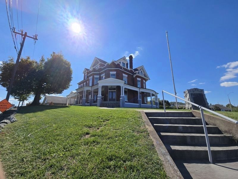
Photographed by Mark Parker, October 17, 2024
3. Full view of Edward Washington King House
Marker for Evan Shelby's Fort is to the right. The house sits on land previously used for the fort.
Related markers. Click here for a list of markers that are related to this marker.
Also see . . .
1. Edward Washington King Nomination Form (pdf). Prepared by Gibson Worsham, architect, 1999 (Submitted on October 18, 2024, by Mark Parker of Hickory, North Carolina.)
2. E.W. King House. A history of the house and the land upon which Shelby's fort was built by The Bristol Historical Society (copied excerpts not permitted). (Submitted on October 18, 2024, by Mark Parker of Hickory, North Carolina.)

Photographed by Mark Parker, October 17, 2024
4. Shelby's Fort Marker on the lot of the King House
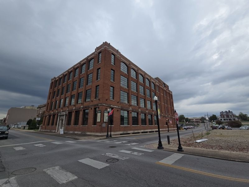
Photographed by Mark Parker, October 4, 2024
5. E.W. King Manufacturing Building
Located a block north of the King House, it was built in 1920. The King House is in the distance on the right
Credits. This page was last revised on October 21, 2024. It was originally submitted on October 18, 2024, by Mark Parker of Hickory, North Carolina. This page has been viewed 490 times since then and 67 times this year. Photos: 1, 2, 3, 4, 5. submitted on October 18, 2024, by Mark Parker of Hickory, North Carolina. • James Hulse was the editor who published this page.
